

Lower Dolpo Trek
The Lower Dolpo Trek crosses the trans-Himalayan district made famous by Peter Matthiessen's The Snow Leopard and Eric V
Porter
$539 $490/porter
No payment required yet
Trip Overview
The Lower Dolpo Trek crosses the trans-Himalayan district made famous by Peter Matthiessen's The Snow Leopard and Eric Valli's film Himalaya. Two flights bring you to Juphal, from where the trail follows the Bheri and Tarap rivers into a landscape that belongs more to the Tibetan plateau than to Nepal — bare ochre hillsides, walled villages, and Bon and Buddhist monasteries at the head of long dry valleys.
The route climbs to the high settlement of Dho Tarap (4,090 m), crosses the Numa La Pass (5,190 m), and descends to Phoksundo Lake (3,612 m), whose extraordinary deep blue water and encircling cliffs make it one of the most photographed places in the Nepali Himalaya. With restricted-area status, an acclimatization day at Dho Tarap, and a full exploration day at the lake, this 17-day journey is among the finest wilderness treks in the country.
Trip Highlights
Phoksundo Lake (3,612 m): Spend a full day at Nepal's deepest lake, an astonishing blue basin ringed by cliffs and Bon monasteries.
Cross the Numa La Pass (5,190 m): Take the trek's high point between the Tarap valley and Phoksundo, with the Dhaulagiri range in view.
Dho Tarap (4,090 m): Reach one of the highest permanently inhabited valleys on earth, with Bon and Buddhist communities side by side.
The Land of the Snow Leopard: Trek the trans-Himalayan district made famous by Peter Matthiessen and the film Himalaya.
A Restricted Wilderness Region: Walk a permit-controlled area that receives a small fraction of the visitors of Nepal's main trekking regions.
Itinerary
A 17-day restricted-area trek through the Tarap valley to Dho Tarap (4,090 m), over the Numa La Pass (5,190 m), and down to Phoksundo Lake with a full exploration day.
1Day 1Arrival in Kathmandu (1,400 m)
Arrival in Kathmandu (1,400 m)
You arrive at Tribhuvan International Airport in Kathmandu (1,400 m) and are met by our representative for the transfer to your hotel.
Your guide runs the pre-trek briefing. Lower Dolpo lies in the far west of Nepal, in the rain shadow behind the Dhaulagiri massif, and it is one of the most culturally intact Tibetan Buddhist regions left in the Himalaya. The route crosses two passes above 5,000 m — the Numa La (5,190 m) and Baga La (5,070 m) — and finishes at Phoksundo Lake, the deepest in Nepal.
This is a restricted area requiring a special permit, a registered agency and a minimum group size. It is also a camping trek: there are no teahouses on the high sections, so a full crew carries tents, food and kitchen.
Your guide checks your equipment — a four-season sleeping bag and proper cold-weather layers are essential at these altitudes. The rest of the day is free. Overnight in Kathmandu.
2Day 2Fly from Kathmandu (1,400 m) to Nepalgunj (150 m)
Fly from Kathmandu (1,400 m) to Nepalgunj (150 m)
A short flight west to the Terai, positioning you for the mountain flight into Dolpo tomorrow.
The hour-long flight leaves the Kathmandu valley, crosses the middle hills and descends over the flat agricultural plain of the Terai. On a clear day the Himalaya runs along the northern horizon for the whole journey — Ganesh Himal, Manaslu, Annapurna and finally Dhaulagiri, behind which Dolpo lies.
Nepalgunj (150 m) is a busy city close to the Indian border, and the contrast with Kathmandu is immediate: hot, humid, flat and low-lying, with a distinctly Indian character to the bazaar and the food.
It is the aviation hub for all of western Nepal and the only practical connection into Dolpo. The afternoon is free — the Bageshwori Temple is worth a visit if the heat allows.
Flights to Jhupal leave at first light, so it is an early night. Overnight in Nepalgunj.
3Day 3Fly from Nepalgunj (150 m) to Jhupal (2,320 m) and Trek to Dunai (2,140 m)
Fly from Nepalgunj (150 m) to Jhupal (2,320 m) and Trek to Dunai (2,140 m)
A spectacular mountain flight, then the first short walk of the trek.
The early flight to Jhupal (2,320 m) takes around 45 minutes in a small aircraft, climbing from the plains over ridge after ridge of the western hills with the Dhaulagiri massif filling the view ahead. The airstrip is a short shelf cut into a hillside. Flights go early because the wind rises later in the day, and delays are common.
The crew meets you at Jhupal and the walking begins with an easy descent.
The trail drops through terraced fields and pine to the Thuli Bheri river, then follows it upstream. This is the gentlest walking of the whole trek and a useful way to start.
Dunai (2,140 m) is the administrative headquarters of Dolpa district, a small town strung along the riverbank with a checkpoint, shops and a hospital. Around 2–3 hours. Overnight camping at Dunai.
4Day 4Trek from Dunai (2,140 m) to Tarakot (2,543 m)
Trek from Dunai (2,140 m) to Tarakot (2,543 m)
An easy day following the Thuli Bheri upstream through the lower valley.
The trail runs east along the river on a well-used path, gaining around 400 m over the course of the day but undulating rather than climbing steadily. It crosses the river on suspension bridges and traverses hillsides above the water, with pine forest on the slopes and terraced barley and buckwheat wherever the ground allows.
This lower part of Dolpo is culturally mixed, with Hindu villages of Nepali-speaking families alongside the Buddhist settlements further up — the transition to a fully Tibetan culture happens over the next few days as you climb.
Tarakot (2,543 m) was historically the fortified capital of this region, and the old fort site — known locally as Dzong — sits on a hill above the village. There is a gompa nearby and the village has an obvious sense of its own history.
Around 4–5 hours. Overnight camping at Tarakot.
5Day 5Trek from Tarakot (2,543 m) to Laini (3,160 m)
Trek from Tarakot (2,543 m) to Laini (3,160 m)
A climb of around 620 m as the valley narrows into gorge country.
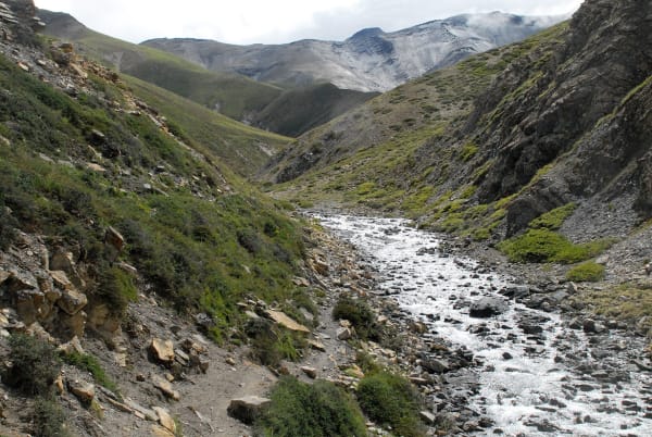
The trail leaves the Thuli Bheri and turns north up the Tarap Khola, and the character of the walking changes immediately. The valley closes into a steep-sided gorge, and the path is cut into the rock wall high above the river, crossing and recrossing on bridges.
This is dramatic and occasionally exposed walking. There are sections where the trail is narrow with a substantial drop, and it requires steady footing rather than any technical skill. The rock walls rise sheer on both sides and the river runs fast and loud below.
The vegetation thins as you climb — pine and juniper on the slopes, with the last of the terraced cultivation left behind.
Laini (3,160 m), also written Laina Odar, is a camping ground in the gorge rather than a village. Around 5–6 hours. Overnight camping at Laini.
6Day 6Trek from Laini (3,160 m) to Nawar Pani (3,545 m)
Trek from Laini (3,160 m) to Nawar Pani (3,545 m)
Another day in the Tarap gorge, climbing around 385 m on rough and occasionally exposed trail.
The route continues north up the Tarap Khola, still enclosed by steep rock walls. The trail crosses the river repeatedly on wooden and suspension bridges, and in places has been cut or built out from the cliff face — this is old trading-route engineering, maintained by the villages upstream.
Progress is slower than the distance suggests because of the terrain, and there are several stiff climbs and descents around spurs. Care is needed on the narrower sections.
The gorge is spectacular precisely because it is so confined: for much of the day you see only rock, river and a strip of sky. Blue sheep are sometimes visible on the crags above.
Nawar Pani (3,545 m) is another campsite rather than a settlement, on a flat area beside the river. Around 5–6 hours. Overnight camping at Nawar Pani.
7Day 7Trek from Nawar Pani (3,545 m) to Dho Tarap (4,090 m)
Trek from Nawar Pani (3,545 m) to Dho Tarap (4,090 m)
The day the gorge finally opens and you enter the Tarap valley proper.
The trail continues climbing through the upper gorge before, quite suddenly, the walls fall back and the country opens into a broad, flat-bottomed valley. The change is striking after two days enclosed in rock.
Above the gorge the landscape is unmistakably Tibetan: dry, treeless, wide and brown, with barley fields irrigated by channels, yaks grazing, and chortens and mani walls along the trail. The rain shadow behind Dhaulagiri means very little precipitation reaches here.
Dho Tarap (4,090 m) is one of the highest permanently inhabited valleys in the world. The village is a cluster of flat-roofed mud and stone houses, and the community practises both Tibetan Buddhism and the older Bön religion — there are gompas of both traditions nearby.
Around 6 hours. Overnight camping at Dho Tarap.
8Day 8Acclimatization Day in Dho Tarap (4,090 m)
Acclimatization Day in Dho Tarap (4,090 m)
An essential rest day at 4,090 m before the two 5,000 m passes ahead.
The recommended approach is a gentle hike of a few hundred metres above the valley and back rather than complete rest — the body adjusts better with light activity. The hillsides above the village give wide views along the Tarap valley.
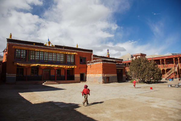
The real interest of the day is cultural. Dho Tarap is one of the few places where Bön, the pre-Buddhist religion of Tibet, is still practised alongside Tibetan Buddhism, and there are monasteries of both traditions within walking distance — including the Bön gompa at Shipchhok and the Buddhist Ribo Bhumpa. Bön practitioners circumambulate anticlockwise, the opposite of Buddhist custom, which is easy to spot at the chortens.
The villagers here are largely of Tibetan origin, herding yaks and growing barley at an altitude where little else will grow.
Overnight camping at Dho Tarap.
9Day 9Trek from Dho Tarap (4,090 m) to Numa La Base Camp (4,440 m)
Trek from Dho Tarap (4,090 m) to Numa La Base Camp (4,440 m)
A short day gaining around 350 m, positioning you beneath the first of the high passes.
The trail leaves Dho Tarap and follows the valley west, climbing gently across open, dry, treeless country. The walking is straightforward and the day deliberately short — the point is to sleep close to the pass without over-exerting at altitude.
You leave the last permanent settlements behind on this stage. From here until the descent to Ringmo there are no villages, no lodges and no resupply; everything is carried by the crew and the pack animals.
The landscape is broad and empty, with grazing yaks, the occasional herder's shelter, and snow peaks around the head of the valley. This is excellent blue sheep country, and the region is within the range of the snow leopard, though sightings are exceptionally rare.
Numa La Base Camp (4,440 m) is an exposed camp with no shelter. Around 4 hours. Overnight camping at Numa La Base Camp.
10Day 10Trek from Numa La Base Camp (4,440 m) over Numa La Pass (5,190 m) to Pelung Tang (4,465 m)
Trek from Numa La Base Camp (4,440 m) over Numa La Pass (5,190 m) to Pelung Tang (4,465 m)
The first of the two big passes: a climb of 750 m to the Numa La (5,190 m), the highest point of the trek.
You start early. The trail climbs steadily over bare scree and rock with no vegetation and no shelter, and at this altitude the pace is necessarily slow — expect three to four hours to the top with frequent short stops.
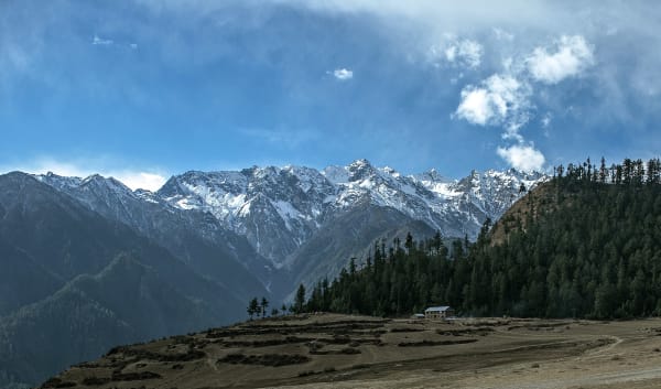
The Numa La is marked by cairns and prayer flags, and the view is the finest of the trek. To the south the entire Dhaulagiri massif fills the horizon; north and west lie the brown, folded ranges of Dolpo running toward Tibet. On a clear day the panorama extends for a hundred kilometres.
It is cold and usually windy at the top, so time there is short. The descent is long and rough, dropping over scree and boulder into the next valley.
Pelung Tang (4,465 m) is a bare camping ground. A hard 7–8 hours. Overnight camping at Pelung Tang.
11Day 11Trek from Pelung Tang (4,465 m) to Dajok Tang (4,080 m)
Trek from Pelung Tang (4,465 m) to Dajok Tang (4,080 m)
The second high pass — the Baga La (5,070 m) — followed by a descent of nearly 1,000 m.
Another early start. The trail climbs around 600 m from camp over the same kind of barren scree and rock as yesterday. Coming a day after the Numa La, this is hard work, but you are well acclimatised by now and the climb is slightly shorter.
From the Baga La the views are again exceptional, with Dhaulagiri and Kanjirowa visible and the whole tangle of Dolpo ridges laid out around you. The pass is marked with cairns and prayer flags.
The descent is long and steep on loose ground, losing height quickly into a valley that begins, for the first time in days, to show some vegetation — juniper and scrub appear as you drop.
Dajok Tang (4,080 m) is a camping ground in the upper valley. Another demanding 7–8 hours. Overnight camping at Dajok Tang.
12Day 12Trek from Dajok Tang (4,080 m) to Ringmo (3,600 m)
Trek from Dajok Tang (4,080 m) to Ringmo (3,600 m)
A descent of around 480 m to the village beside Phoksundo Lake — the goal of the trek.
The trail drops steadily through a widening valley, and the return of vegetation is welcome after the barren pass country. Juniper and scrub give way to birch and pine as you lose height, and there is running water and greenery again.
The approach to the lake is the highlight. Phoksundo Lake appears below you, and its colour is genuinely startling — an intense turquoise created by glacial rock flour suspended in the water. The lake holds no fish and almost no aquatic vegetation.
Ringmo (3,600 m) is a beautiful traditional village on the shore, with flat-roofed stone houses, chortens and mani walls, and an ancient Bön monastery, Thashung Gompa, nearby. Parts of the film Himalaya (Caravan) were shot here.
Around 5 hours. Overnight camping at Ringmo.
13Day 13Explore Phoksundo Lake (3,612 m)
Explore Phoksundo Lake (3,612 m)
A full day at Phoksundo Lake (3,612 m), the deepest lake in Nepal at around 145 m.
After nine days of walking, this is a genuine rest day in an extraordinary setting. The lake sits in a steep bowl within Shey Phoksundo National Park, ringed by cliffs and blue pine, and its turquoise water is unlike anything else in the country.
There are several ways to spend the day. The trail along the western shore climbs to a viewpoint over the whole lake and is well worth the couple of hours. Below the lake is a 167 m waterfall, the highest in Nepal, where the outflow drops into the gorge. And Thashung Gompa, the Bön monastery near the village, is around 900 years old and can be visited.
The national park protects snow leopard, blue sheep and Himalayan black bear, though the first is almost never seen.
It is also a chance to wash, dry kit and rest properly. Overnight camping at Ringmo.
14Day 14Trek from Phoksundo Lake (3,612 m) to Shyanta (2,520 m)
Trek from Phoksundo Lake (3,612 m) to Shyanta (2,520 m)
A long descent of nearly 1,100 m out of the lake basin and back into forest.
The day begins with the steep drop beside the Phoksundo waterfall — at 167 m the highest in Nepal — on a trail that switchbacks down the gorge wall. This section is steep and requires care, but the views back up to the falls and the lake outflow are excellent.
Below the falls the trail follows the Phoksundo Khola downstream through increasingly wooded country. The change over the day is substantial: from the treeless high basin to proper forest of blue pine, birch and walnut, with the air noticeably warmer and thicker.
The route passes through Chhepka and other small settlements, and there is cultivation again on the terraces. After more than a week above 3,500 m, the descent feels easy.
Shyanta (2,520 m) is a small village in the lower valley. Around 6 hours. Overnight camping at Shyanta.
15Day 15Trek from Shyanta (2,520 m) to Jhupal (2,320 m)
Trek from Shyanta (2,520 m) to Jhupal (2,320 m)
The final walking day, an easy stage back to the airstrip.
The trail continues down the valley and rejoins the Thuli Bheri, following it back toward Dunai and then climbing gently to Jhupal. The net height change is small and the walking is straightforward — a relaxed way to finish.
The country here is green and farmed, with terraced fields, walnut and apricot trees, and villages along the route. Passing back through it after the high passes and Phoksundo makes the contrast between lower and upper Dolpo very clear: this is Nepali-speaking, partly Hindu hill country, while the Tarap valley was culturally Tibetan.
Jhupal (2,320 m) is where the trek ends. This is the point to settle up with the camping crew and the animal handlers, who will be returning to their villages from here.
Given that flights out are entirely weather-dependent, an early night is sensible. Around 4–5 hours. Overnight in Jhupal.
16Day 16Fly from Jhupal (2,320 m) to Nepalgunj (150 m) and Fly from Nepalgunj (150 m) to Kathmandu (1,400 m)
Fly from Jhupal (2,320 m) to Nepalgunj (150 m) and Fly from Nepalgunj (150 m) to Kathmandu (1,400 m)
Two flights in one day, returning from Dolpo to the capital.
The morning flight from Jhupal leaves early, before the wind gets up, and gives a final aerial view of the Dolpo ranges and the Dhaulagiri massif — a chance to see the geography of the whole trek at once, including the pass country you crossed.
It is worth restating that this flight is weather-dependent, and delays of a day or more are a normal part of travel in Dolpo. A buffer day at the end of any trip here is sensible.
At Nepalgunj (150 m) you connect to the onward flight to Kathmandu, dropping into the heat of the Terai before climbing back to the valley.
You arrive in Kathmandu (1,400 m) and transfer to your hotel. After more than two weeks of camping, the shower is memorable. The evening is free. Overnight in Kathmandu.
17Day 17Departure from Kathmandu (1,400 m)
Departure from Kathmandu (1,400 m)
The last day of the Lower Dolpo Trek.
Depending on your flight time there may be free hours in the morning. Thamel is the obvious place for last-minute shopping, and if you have half a day the Buddhist sites of Boudhanath and Swayambhunath connect directly to what you have just walked through — though the Bön monasteries of Tarap and Ringmo belong to an older tradition still.
Our representative collects you from your hotel and transfers you to Tribhuvan International Airport around three hours before departure.
You leave having crossed the Numa La (5,190 m) and Baga La (5,070 m), camped in one of the highest inhabited valleys on earth at Dho Tarap, and spent a day at Phoksundo Lake — a journey through a restricted region where Tibetan Buddhist and Bön traditions have continued largely undisturbed.
Inclusions & Exclusions
All domestic flights, Kathmandu and Nepalgunj accommodation, village and tented lodging, all trekking meals, restricted area and national park permits, a licensed guide, camp crew, trekking map, first aid, and government taxes are included, while international flights, visa, insurance, personal gear, porter service, city meals, personal expenses, and tips are excluded.
What's Included
Airport pickup and drop-off services in Kathmandu.
Domestic flights from Kathmandu to Nepalgunj, Nepalgunj to Juphal, Juphal to Nepalgunj, and Nepalgunj to Kathmandu.
Accommodation in Kathmandu with breakfast.
Accommodation in Nepalgunj with breakfast.
Accommodation in local teahouses during the trek.
Lower Dolpo Restricted Area Permit and Shey Phoksundo National Park Entry Permit.
Professional English-speaking licensed trekking guide.
Three meals a day (breakfast, lunch, and dinner) during the trek.
Group trekking map for route guidance.
First aid kit carried by the guide.
Tented accommodation and a full camp and kitchen crew for the sections without permanent shelter.
All government taxes, permit fees, and service charges.
What's Excluded
International flight tickets to and from Nepal.
Nepal entry visa fees.
Travel insurance, including emergency helicopter evacuation coverage.
Personal trekking equipment and clothing.
Porter services (available at an additional cost).
Lunch and dinner in Kathmandu and Nepalgunj.
Snacks, bottled water, hot showers, Wi-Fi, charging fees, and alcoholic or soft drinks.
Personal expenses such as laundry, phone calls, and souvenirs.
Tips for guides, drivers, and support staff.
Any additional accommodation, transportation, or expenses caused by domestic flight delays, bad weather, or other unforeseen circumstances beyond the itinerary.
Route Map
Explore the terrain map showing the trek route.
Loading map...
Altitude Profile
Pricing
Transparent per-person pricing based on group size, covering the services listed in the itinerary with no hidden charges.
Add-ons
Customize your trek with optional services such as porter support and other personalized arrangements at an additional cost.
Best Time to Trek
Dolpo sits in the Himalayan rain shadow, which gives it an unusual season. May to early October is the workable window, and this includes the monsoon months, when Dolpo stays comparatively dry while the rest of Nepal is under rain. June to September is in fact one of the more reliable periods for Numa La.
Spring before May often finds the passes still snow-bound, and from late October the high sections begin to close for the winter, with Dho Tarap increasingly cut off and flights to Juphal unreliable. November to April is not feasible for the full circuit, though the Phoksundo Lake section alone can sometimes be walked in the autumn shoulder.
For a month-by-month look at weather and trail conditions, see our guide to the best time to trek in Nepal.
Permits & Regulations
Lower Dolpo is a restricted area. You need the Lower Dolpo Restricted Area Permit, issued only through a registered trekking agency at USD 20 per person per week, together with the Shey Phoksundo National Park entry permit and standard trekking registration. Permits are non-transferable and are checked at Dunai and again at the park entrance.
A licensed guide is mandatory and solo trekking is not permitted. Our team handles the entire application, but we need clear passport copies, passport-sized photographs, and your Nepal visa details in advance. Note that Upper Dolpo, north of the Tarap valley toward Shey Gompa, is a separate and far more expensive restricted zone; this itinerary covers the lower region only.
The fees and conditions for every restricted area are set out in our guide to restricted area permits in Nepal.
Travel Insurance
Travel insurance covering trekking to at least 5,500 m is mandatory, giving a margin over the Numa La Pass at 5,190 m. Standard holiday policies almost never extend this high and frequently exclude remote-area travel outright, so you will usually need a specialist adventure policy. Read both the altitude clause and any remoteness exclusions before purchasing.
Emergency helicopter evacuation and repatriation cover is essential. There is no road anywhere on this route, no hospital in the district, and from the Tarap valley or the passes the flying distance to Nepalgunj is long and the cost correspondingly high — operators dispatch only against a guarantee of payment. Also ensure cover for delayed or cancelled domestic flights, since the Nepalgunj-Juphal sector is frequently grounded. Send us your policy number and the insurer's 24-hour emergency line well before departure.
Our guide to travel insurance for trekking in Nepal explains the altitude limits, evacuation terms and common exclusions to check before you buy.
Altitude & Acclimatization
The itinerary includes an acclimatization day at Dho Tarap (4,090 m), which is essential preparation for Numa La, and builds height gradually from Dunai through Tarakot, Laini, and Nawar Pani over several days. The night at Numa La Base Camp (4,440 m) is a further step before the crossing itself at 5,190 m.
Your guide monitors the group each evening for headache, disturbed sleep, appetite loss, and breathlessness at rest, and will add a day at Dho Tarap if anyone needs it. Because there is no quick descent available in this terrain, we plan conservatively and turn back rather than push on when someone is not adapting. Drink three to four litres a day, eat properly even when appetite fades, avoid alcohol above Dunai, and report symptoms the evening they appear.
Prevention, symptoms and treatment are covered in depth in our guide to altitude sickness in Nepal.
Accommodation, Food & Drinking Water
Accommodation alternates between very simple village lodges and homestays at Dunai, Tarakot, Dho Tarap, and Ringmo, and tented camps at Laini, Nawar Pani, Numa La Base Camp, Pelung Tang, and Dajok Tang where there is no permanent shelter. A full camp and kitchen crew supports the tented sections. Conditions are basic throughout — no hot showers, limited washing water, shared or outdoor toilets.
Three meals a day are included on the trek. In the villages you eat what households cook, which in Dolpo means tsampa, barley and buckwheat, potatoes, dal bhat where rice is available, and butter tea. At the camps our kitchen crew cooks from supplies carried in from Juphal. Dietary requirements must be given to us well in advance, since nothing can be purchased en route. Water comes from streams and springs and must be treated with tablets, a filter, or a UV pen throughout.
Frequently Asked Questions
Find quick answers to common questions about the Lower Dolpo Trek.
1How many hours do we walk each day?
Six to eight hours on most days. The Numa La crossing from base camp to Pelung Tang is the longest and hardest at nine to eleven hours, starting before dawn on loose, high ground.
2How reliable are the flights to Juphal?
Not very. The Nepalgunj-Juphal sector uses small aircraft into a mountain airstrip and is regularly cancelled for weather or aircraft availability. Delays of one to three days happen, so spare days at the end of your trip are strongly advised.
3Do we camp or stay in villages?
Both. Dunai, Tarakot, Dho Tarap, and Ringmo have basic lodges or homestays, but the sections between them have no permanent shelter, so the group camps with a full crew for roughly half the nights of the trek.
4Why is Phoksundo Lake so blue?
The lake is fed by glacial meltwater carrying fine rock flour that scatters light, producing an intense turquoise-blue that is striking even by Himalayan standards. It is Nepal's deepest lake and appeared prominently in the film Himalaya.
5What is Bon, and where will we encounter it?
Bon is the pre-Buddhist religious tradition of Tibet, still practised in parts of Dolpo alongside Tibetan Buddhism. The monastery at Ringmo near Phoksundo is a Bon establishment. One visible difference is that Bon practitioners circumambulate anticlockwise, the reverse of Buddhist practice — your guide will explain what to follow where.
6Might we see a snow leopard?
Dolpo is prime snow leopard habitat and the region gave Peter Matthiessen's book its title, but sightings are extraordinarily rare and most researchers spend years without one. Blue sheep, Himalayan wolf, marmot, and lammergeier are seen far more often.
7Is mobile network available?
There is limited coverage at Dunai and Juphal and effectively none for the rest of the route. Expect to be entirely offline for two weeks. Our guides carry a satellite communication device for emergencies.
8Where can I withdraw cash and charge devices?
There are no reliable ATMs in Dolpo. Carry all your Nepalese rupees from Kathmandu or Nepalgunj for the whole trip. Charging is solar and very limited in villages and unavailable at camps, so bring a large power bank and spare batteries.
9How cold does it get at the camps?
Nights at Numa La Base Camp and Pelung Tang typically fall to -10°C or below, colder with wind, and there is no heated shelter. A four-season sleeping bag rated to -20°C and an insulated mat are essential rather than optional.
10Can I leave extra luggage in Kathmandu?
Yes, and you should. Your Kathmandu hotel stores anything you do not need free of charge until you return, which matters given the strict baggage limits on the Juphal flight.
Gallery
Explore authentic moments, landscapes, and mountain views from the Lower Dolpo Trek.
Trekking Guides & Articles
Lower Dolpo Trek: Phoksundo, Dho Tarap, and Two High Passes — A circuit linking Phoksundo Lake with the high Tibetan village of Dho Tarap over two passes above 4,400 m, in a region where the permit costs USD 20 a week.
Shey Phoksundo Lake Trek: Nepal's Deepest and Bluest Lake — A turquoise lake at 3,611 m in Dolpo, the deepest in Nepal, reached by a narrow cliff path above the water.
Upper Dolpo Trek: Shey Gompa and the Crystal Mountain — Four weeks in the most remote inhabited region of Nepal — Shey Gompa beneath the Crystal Mountain, passes above 5,000 m, camping throughout, and a USD 500 permit.
Domestic Flights in Nepal: Lukla, Pokhara, Jomsom, and Delays — Several of Nepal's best treks begin with a short flight into the mountains.
Jomsom to Dolpo Trek: The Complete Guide — The great east-to-west traverse of the Nepali trans-Himalaya: 22 days from the Kali Gandaki across the Dolpo plateau to Phoksundo Lake, over five passes.
Kanjirowa Expedition: The Complete Guide — The highest peak of the Kanjiroba Himal, with successful ascents since 1970 countable on one hand.
Fix Departure
This trek runs every week on the selected day. Choose custom dates for one-off departures.
Showing fixed departures in Oct 2026
Guest Reviews
Book it — you will not regret it
“Lower Dolpo Trek was everything we hoped for and so much more. The teahouses and lodges were clean and welcoming, and the food was far better than I expected at altitude. Every sunset and mountain vie...
Linn Holloway
Get in Touch
Tell us the dates you have in mind and roughly what you want out of the trek — one of our guides will reply, usually within 24 hours.
Email Us
info@greencompasstreks.com
Call Us
+977 9864379436
Office
Lakeside, Pokhara, Nepal
Office Hours
Sunday – Friday, 9:00 AM – 9:00 PM
Similar Treks
You might also like these treks
Porter
$539 $490/porter
No payment required yet