

Ganesh Himal Trek
The Ganesh Himal Trek crosses the wild, sparsely visited country between the Langtang range and the Manaslu region, foll
Porter
$424 $385/porter
No payment required yet
Trip Overview
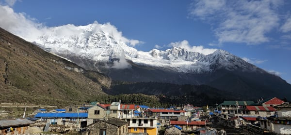
The Ganesh Himal Trek crosses the wild, sparsely visited country between the Langtang range and the Manaslu region, following old trading and grazing routes over two high passes. From Trishuli Bazar the trail climbs through Tamang villages and forest to the herding grounds at Bhaisi Kharka and Kharani Odar before topping out on the Singla Pass (4,600 m), with the Ganesh Himal massif filling the northern skyline.
Beyond the pass the route drops to Pongsang, takes a rest day at the ridge, and continues through the old mining settlement of Somdang to the traditional Tamang village of Gatlang and out at Syabrubesi. This is a genuine wilderness trek within a day's drive of Kathmandu — no permanent teahouse infrastructure for much of the route, few other trekkers, and mountain scenery that would draw crowds anywhere with better trails.
Trip Highlights
Cross the Singla Pass (4,600 m): Reach the high point of the trek with the Ganesh Himal massif spread across the northern horizon.
Almost No Other Trekkers: Walk a route that sees a handful of groups a season despite being a day's drive from Kathmandu.
Tamang Villages and Herding Grounds: Pass through traditional settlements and high yak pastures rarely visited by outsiders.
The Old Mining Settlement of Somdang: Descend past workings historically mined for zinc and crystal in a dramatic high valley.
Finish at Gatlang: Join the Tamang Heritage trail for the last days through one of the best-preserved villages in the Langtang region.
Itinerary
A 13-day wilderness trek from Trishuli Bazar over the Singla Pass (4,600 m) beneath Ganesh Himal, finishing through Somdang and Gatlang at Syabrubesi.
1Day 1Arrival in Kathmandu (1,400 m)
Arrival in Kathmandu (1,400 m)
You arrive at Tribhuvan International Airport in Kathmandu (1,400 m) and are met by our representative for the transfer to your hotel.
Your guide runs the pre-trek briefing. The Ganesh Himal trek is one of the least-visited routes within easy reach of Kathmandu — a genuinely off-the-beaten-path circuit through the range named after the elephant-headed god, between the Langtang and Manaslu regions. There are almost no teahouses on the high sections, so this is largely a camping trek supported by a full crew.
That remoteness is the appeal and the challenge. The route crosses Singla Pass (4,600 m) and spends several days above 3,000 m in country with no lodges, no shops and no road access. Your guide checks your kit carefully — a warm sleeping bag and properly broken-in boots matter here more than usual.
The rest of the day is free to rest or explore Thamel. Overnight in Kathmandu.
2Day 2Drive from Kathmandu (1,400 m) to Trishuli Bazar (1,200 m)
Drive from Kathmandu (1,400 m) to Trishuli Bazar (1,200 m)
A half-day drive north-west out of the Kathmandu valley to the trailhead town.
The road climbs over the valley rim at Kakani — worth the stop on a clear morning for the view north to Ganesh Himal, Langtang and Manaslu laid out along the horizon — before descending steadily through terraced hillsides toward the river.
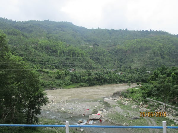
The descent is a long series of switchbacks through farming country: rice and millet terraces cut into every available slope, scattered villages of mud and stone houses, and roadside stalls selling fruit and tea. This is the middle-hill Nepal that most trekkers only see through a bus window.
Trishuli Bazar (1,200 m) is a busy market town on the Trishuli River, serving as the trading hub for the surrounding Nuwakot district and the road junction for Langtang and Ganesh Himal alike.
The afternoon is free to walk around the bazaar while the crew organises loads. Overnight at Trishuli Bazar.
3Day 3Trek from Trishuli Bazar (1,200 m) to Deurali Bhanjyang (1,700 m)
Trek from Trishuli Bazar (1,200 m) to Deurali Bhanjyang (1,700 m)
The first walking day, a steady 500 m climb out of the river valley onto the ridge system the trek will follow north.
The trail leaves the bazaar and begins climbing almost immediately through farmland. This is inhabited country, and the walking is as much cultural as scenic — you pass through Tamang and Brahmin-Chhetri villages, past water mills, along irrigation channels, and through terraces of rice, maize and millet worked entirely by hand.
The path is a working trail rather than a trekking route: locals use it daily to move between villages and down to the bazaar, and you are likely to share it with porters carrying goods and children walking to school.
As you gain height the terraces give way to scrubby forest and the views back over the Trishuli valley open up.
Deurali Bhanjyang (1,700 m) sits on a saddle in the ridge — bhanjyang means exactly that. Around 5 hours. Overnight camping at Deurali Bhanjyang.
4Day 4Trek from Deurali Bhanjyang (1,700 m) to Bhaisi Kharka (2,300 m)
Trek from Deurali Bhanjyang (1,700 m) to Bhaisi Kharka (2,300 m)
A quieter day climbing another 600 m, with the settlements thinning out and forest taking over.
The trail follows the ridge north, rolling over a series of minor saddles before beginning a sustained climb. Below around 2,000 m the country is still farmed, but the villages become smaller and further apart, and above that the trail enters proper forest — oak and rhododendron at first, thick with moss and epiphytes, then increasingly mixed with pine as you climb.
This is good wildlife country precisely because so few people come through. Langur monkeys are common in the canopy, and the birdlife is excellent — pheasants, laughingthrushes and, if you are lucky, the Himalayan monal.
Bhaisi Kharka (2,300 m) is a kharka, a summer grazing pasture — a clearing in the forest used by herders to graze buffalo in the warmer months, and empty for most of the year.
The crew sets up camp in the meadow. Around 5–6 hours. Overnight camping at Bhaisi Kharka.
5Day 5Trek from Bhaisi Kharka (2,300 m) to Kharani Odar (2,800 m)
Trek from Bhaisi Kharka (2,300 m) to Kharani Odar (2,800 m)
A demanding day with several steep sections, climbing 500 m through high forest toward the treeline.
The trail continues north along the ridge, but the gradient is less forgiving than yesterday — the route gains and loses height repeatedly across a series of forested spurs before the final climb. The forest at this altitude is dominated by rhododendron, which in spring turns the whole hillside red and pink, and by autumn is a tangle of dark, twisted trunks and moss.
There are occasional clearings where the trees open onto views north toward the Ganesh Himal peaks, still distant but now clearly the destination rather than a backdrop.
You are unlikely to meet anyone at all today. There are no permanent settlements on this stretch, and the only structures are the occasional herder's shelter.
Kharani Odar (2,800 m) — odar means a rock overhang or cave — is a camp beneath a natural shelter used by herders. Around 6 hours. Overnight camping at Kharani Odar.
6Day 6Trek from Kharani Odar (2,800 m) to Singla Pass (4,600 m)
Trek from Kharani Odar (2,800 m) to Singla Pass (4,600 m)
The hardest and highest day of the trek: an ascent of 1,800 m to the Singla Pass (4,600 m).
This is a very long climb and an early start is essential. The trail leaves camp and climbs steeply through the last of the rhododendron forest, breaking out above the treeline at around 3,500 m into open alpine country — grass, juniper scrub and rock.
Above 4,000 m the vegetation gives out almost entirely and the ground becomes stone and scree. The pace slows markedly with altitude, and the final approach to the pass is a slog on loose ground. This is a serious altitude gain in a single day and your guide will set a deliberately conservative pace, with frequent stops.
The reward at Singla Pass (4,600 m) is a panorama across the Ganesh Himal range, with Ganesh I (7,422 m) and its neighbours filling the view, and Manaslu visible to the west on a clear day.
8–9 hours. Overnight camping near the pass.
7Day 7Trek from Singla Pass (4,600 m) to Pongsang Pass (3,800 m)
Trek from Singla Pass (4,600 m) to Pongsang Pass (3,800 m)
A high traverse losing 800 m, with the best sustained mountain views of the trek.
After the effort of yesterday, today is more forgiving in profile but no less spectacular. The trail descends from Singla across open alpine terrain — bare rock, scree and cropped grass, with no tree cover at all — following ridgelines rather than dropping into valleys, so the views stay open all day.
The Ganesh Himal peaks are close and dominant on this section, and in clear weather the panorama extends west to Manaslu (8,163 m) and east toward the Langtang range. Blue sheep are sometimes seen on the slopes, and the whole area is a corridor between the Langtang and Manaslu conservation zones.
Weather is the main variable up here. Cloud can close in quickly in the afternoon, so the day starts early to make the most of the morning clarity.
Pongsang Pass (3,800 m) — often spelled Pangsang — is a broad, open saddle. Around 6 hours. Overnight camping at Pongsang Pass.
8Day 8Rest and Acclimatization at Pongsang Pass (3,800 m)
Rest and Acclimatization at Pongsang Pass (3,800 m)
A rest day at 3,800 m, both to recover from the crossing of Singla and to let the body settle before the long descent.
After two hard days at altitude this is a genuine break. The recommended approach is gentle activity rather than complete rest — a short walk up one of the ridges above camp gets you a few hundred metres higher and back, which helps acclimatisation more than lying still, while leaving plenty of time to recover.
The Pangsang saddle is one of the great viewpoints of the region, sitting on the divide between the Ganesh and Langtang ranges. From the ridges around camp the panorama takes in Ganesh Himal, Langtang Lirung and, in clear conditions, Manaslu. Sunrise and sunset are both worth setting an alarm for.
It is also a good day for photography, for washing and drying kit, and for the crew to reorganise supplies before the descent.
Avoid anything strenuous, drink plenty, and eat well. Overnight camping at Pongsang Pass.
9Day 9Trek from Pongsang Pass (3,800 m) to Somdang Phedi (3,300 m)
Trek from Pongsang Pass (3,800 m) to Somdang Phedi (3,300 m)
A shorter, easier day dropping 500 m off the high ridges toward the valley.
The trail descends from the Pangsang saddle on open ground before entering the upper limit of the treeline, where juniper and stunted rhododendron begin to appear again after several days of bare alpine country. The change is welcome — there is shelter from the wind, and the walking underfoot becomes softer.
The route follows the valley of the Somdang Khola down. This area was historically mined for zinc and lead, and there are remnants of the old workings and access tracks visible along the way, an unexpected piece of industrial history in an otherwise empty landscape.
The descent is steady rather than steep, and after the exertion of the pass days this feels like an easy stage. Views back up to the Ganesh Himal peaks remain open for much of the morning.
Somdang Phedi (3,300 m) sits at the foot of the descent. Around 4–5 hours. Overnight camping at Somdang Phedi.
10Day 10Trek from Somdang Phedi (3,300 m) to Gotlang (1,800 m)
Trek from Somdang Phedi (3,300 m) to Gotlang (1,800 m)
A long descent of 1,500 m that brings you back into inhabited, farmed country.
The trail drops steadily through thickening forest — rhododendron and oak giving way to mixed broadleaf as you lose height — before emerging onto terraced hillsides. The temperature climbs noticeably through the day and the air thickens after a week at altitude.
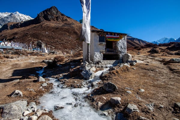
Gatlang (1,800 m), usually spelled Gatlang, is one of the most attractive Tamang villages in the region: a tight cluster of stone houses with carved wooden windows, set on a terraced hillside, with a small lake and a gompa above the settlement. The Tamang here are of Tibetan origin and the culture is strongly Buddhist — prayer flags, mani walls and chortens throughout the village.
The village is part of the Tamang Heritage Trail, and there is often the chance to see traditional weaving or hear local music in the evening.
Around 6 hours. Overnight in Gatlang.
11Day 11Trek from Gotlang (1,800 m) to Syabrubesi (1,467 m)
Trek from Gotlang (1,800 m) to Syabrubesi (1,467 m)
The final walking day, descending to the roadhead on the Bhote Koshi.
The trail leaves Gatlang and descends through farmland and forest, passing through smaller Tamang settlements and crossing side streams on wooden and suspension bridges. The route drops steadily toward the valley floor, with terraced fields of millet and maize on the slopes and the sound of the river growing as you descend.
This is a gentler day than the recent ones, and a good opportunity to take in the last of the hill country. There are open views back up toward the Ganesh Himal ridges you crossed, which by now look impressively far away.
Syabrubesi (1,467 m) sits at the confluence of the Bhote Koshi and Langtang Khola, and is the roadhead and starting point for the Langtang valley treks. After a week of camping in empty country, arriving in a town with lodges, shops and hot showers is a distinct pleasure.
Around 4–5 hours. Overnight in Syabrubesi.
12Day 12Drive from Syabrubesi (1,467 m) to Kathmandu (1,400 m)
Drive from Syabrubesi (1,467 m) to Kathmandu (1,400 m)
The drive back to Kathmandu, around 120 km but a full day on the road.
The route climbs steeply out of the Bhote Koshi valley to Dhunche, the district headquarters and the checkpoint for Langtang National Park, then continues up and over the ridge system before beginning the long descent toward the Trishuli valley.
This is a spectacular but slow road, cut into steep hillsides with the valley dropping away below, and the surface is rough in sections. In clear weather there are excellent views back toward Langtang and Ganesh Himal from the high points.
Lower down the road passes through Trishuli Bazar, where the trek began nearly two weeks earlier, before joining the highway and climbing over the Kathmandu valley rim.
You arrive in the late afternoon and transfer to your hotel. The evening is free — a hot shower, a good meal, and perhaps a farewell dinner with the crew who carried the camp. Overnight in Kathmandu.
13Day 13Departure from Kathmandu (1,400 m)
Departure from Kathmandu (1,400 m)
The last day of the Ganesh Himal Trek.
Depending on your departure time there may be a few free hours. Thamel is the natural place for last-minute shopping — pashmina, singing bowls, tea, or a copy of the trekking map you have just walked across. If you have longer, Boudhanath and Swayambhunath are both easy half-day visits, and the Buddhist iconography will look familiar after two weeks among Tamang villages and mountain chortens.
Our representative collects you from your hotel and transfers you to Tribhuvan International Airport approximately three hours before your flight.
You leave having completed one of the quietest routes in Nepal — a camping trek across Singla Pass (4,600 m) and Pangsang Pass, through country between Langtang and Manaslu where the trails are used by herders rather than trekkers, and where you can walk for days without meeting another group.
Inclusions & Exclusions
Private transport at both ends, Kathmandu accommodation, homestay and tented lodging, all trekking meals, national park permits, a licensed guide, camp crew, trekking map, first aid, and government taxes are included, while international flights, visa, insurance, personal gear, porter service, city meals, personal expenses, and tips are excluded.
What's Included
Airport pickup and drop-off services in Kathmandu.
Private transportation from Kathmandu to Trishuli Bazar and from Syabrubesi back to Kathmandu as per the itinerary.
Accommodation in Kathmandu with breakfast.
Accommodation in local teahouses during the trek.
Langtang National Park Entry Permit and required trekking permits.
Professional English-speaking licensed trekking guide.
Three meals a day (breakfast, lunch, and dinner) during the trek.
Group trekking map for route guidance.
First aid kit carried by the guide.
Tented accommodation and a full camp and kitchen crew for the high-camp sections of the route.
All government taxes, permit fees, and service charges.
What's Excluded
International flight tickets to and from Nepal.
Nepal entry visa fees.
Travel insurance, including emergency helicopter evacuation coverage.
Personal trekking equipment and clothing.
Porter services (available at an additional cost).
Lunch and dinner in Kathmandu.
Snacks, bottled water, hot showers, Wi-Fi, charging fees, and alcoholic or soft drinks.
Personal expenses such as laundry, phone calls, and souvenirs.
Tips for guides, drivers, and support staff.
Any additional accommodation, transportation, or expenses caused by unforeseen circumstances beyond the itinerary.
Route Map
Explore the terrain map showing the trek route.
Loading map...
Altitude Profile
Pricing
Transparent per-person pricing based on group size, covering the services listed in the itinerary with no hidden charges.
Add-ons
Customize your trek with optional services such as porter support and other personalized arrangements at an additional cost.
Best Time to Trek
April to May and October to November are the two workable seasons, and the Singla Pass decides it. Autumn gives the most settled weather for the crossing and the clearest views of Ganesh Himal from the ridge. Spring is warmer with rhododendron in flower on the lower forest sections, though snow can linger on the pass into April.
Winter snow closes the Singla Pass for months, and the high camps have no shelter, so December to March is not feasible for this route. The monsoon brings leeches through the forest, landslide risk on the approach road, and cloud that removes the mountain views the trek is built around, so June to August is equally unsuitable.
For a month-by-month look at weather and trail conditions, see our guide to the best time to trek in Nepal.
Trek Difficulty & What to Expect
This is a challenging trek, more for its remoteness and lack of infrastructure than for technical difficulty. There is no glacier travel and no equipment to learn, but you cross a 4,600 m pass, walk long days on rough and sometimes indistinct trails, and spend several nights in places with no permanent lodging where the group camps.
You should be comfortable walking six to eight hours a day on uneven ground for nearly two weeks, and prepared for basic conditions — no hot showers, limited washing water, and simple food. Two to three months of preparation including long hill days with a loaded pack is sensible. Navigation on this route genuinely depends on your guide; the trails are not signposted and several sections are grazing paths rather than maintained routes.
To see where this trek sits among Nepal's routes, read our guide to Nepal trek difficulty grades.
Travel Insurance
Travel insurance covering trekking to at least 5,000 m is required, comfortably above the Singla Pass at 4,600 m. Standard policies frequently cap at 3,000 m or 4,000 m and would leave you uninsured for the central section of the trek, so check the altitude clause explicitly before purchasing.
The policy must include emergency helicopter evacuation and repatriation plus medical treatment. This is a genuinely remote route: there are no lodges, no medical posts, and no road access between Trishuli Bazar and Somdang, and evacuation from the pass area means a helicopter, which operators dispatch only against a guarantee of payment. Send us your policy number and the insurer's 24-hour emergency contact well before departure.
Our guide to travel insurance for trekking in Nepal explains the altitude limits, evacuation terms and common exclusions to check before you buy.
Packing List
The pass and the high camps are cold and exposed, and there is no lodge heating to fall back on. Bring waterproof trekking boots, three or four base layers, a fleece, an insulated down jacket, a windproof and waterproof shell jacket and trousers, trekking trousers, a warm hat, sun hat, liner and insulated gloves, and several pairs of wool socks. A four-season sleeping bag rated to -15°C and an insulated sleeping mat are essential for the camping nights.
Also pack a 30-40 litre daypack, trekking poles for the long loose descents, a headlamp with spare batteries, high-SPF sunscreen and lip balm, sunglasses, a reusable bottle with purification tablets or a filter, a thorough personal first aid kit, insect repellent and leech socks for the forest, a quick-dry towel, toiletries, and a large power bank — charging opportunities on this route are minimal.
For the complete kit list, organised by the altitude you will reach, see our Nepal trekking packing list.
Accommodation, Food & Drinking Water
You stay in a tourist-standard hotel in Kathmandu at either end, in simple homestays and village lodges at Trishuli Bazar, Gotlang, and Syabrubesi, and in tented camps through the high sections where no permanent accommodation exists. Camping nights are supported by a full crew who carry, pitch, and cook, so you are not expected to be self-sufficient — but conditions are basic and you should be comfortable with that.
Three meals a day are included on the trek. In the villages you eat what the household cooks — dal bhat, dhido, potatoes, eggs, and chapati — while at the camps our kitchen crew prepares meals for the group. Tell us about vegetarian, vegan, or allergy requirements well in advance, since supplies for the camping section are bought before the trek and cannot be adjusted en route. Water comes from streams and springs and must be treated with tablets, a filter, or a UV pen throughout.
Frequently Asked Questions
Find quick answers to common questions about the Ganesh Himal Trek.
1How many hours do we walk each day?
Six to eight hours on most days. The climb from Kharani Odar to the Singla Pass is the longest and hardest at eight to nine hours, and the descent from Somdang to Gotlang is a long day of over 1,500 m of drop.
2Which permits are required and do you arrange them?
You need the Langtang National Park Entry Permit for the Gatlang and Syabrubesi section and trekking registration. Both are included in your package and arranged by our team from passport copies and photographs sent before departure.
3Do we camp or stay in teahouses?
Both. The lower villages have homestays and simple lodges, but there is no permanent accommodation between Deurali Bhanjyang and Somdang, so the group camps with a full crew for the middle section of the trek.
4How remote is this trek really?
Genuinely remote. You are unlikely to see another trekking group, there are no shops, no ATMs, no medical posts, and no phone signal for several days. The road head is a multi-day walk away from the middle of the route.
5What happens if the Singla Pass is blocked?
If snow or weather make the crossing unsafe, your guide will either wait a day at the camp below or reroute the group back down the valley. Because the trek relies on camping, a reroute has real logistical consequences, so we build flexibility into the schedule.
6Is mobile network available?
There is intermittent coverage around Trishuli Bazar, Gotlang, and Syabrubesi, and effectively none through the middle of the trek. Expect to be entirely offline for four to five days; our guides carry a satellite communication device for emergencies.
7Where can I withdraw cash and charge devices?
There are no ATMs on the route. Carry all your Nepalese rupees from Kathmandu. Charging is limited to solar in the villages and unavailable at the camps, so bring a large power bank and spare batteries.
8How cold does it get at the high camps?
Nights around Singla Pass and Pongsang typically fall to -10°C or below, colder with wind, and there is no heated dining room to warm up in. A -15°C sleeping bag and an insulated mat make a substantial difference.
9How large are the groups and what support is provided?
Groups are kept small and led by a licensed guide who knows this route specifically, supported by a camp and kitchen crew for the tented sections. The staff-to-trekker ratio is much higher than on a teahouse trek.
10Can I leave extra luggage in Kathmandu?
Yes. Your Kathmandu hotel stores anything you do not need on the trail free of charge until you return, which is worth doing given how carefully load weight is managed on a camping trek.
Gallery
Explore authentic moments, landscapes, and mountain views from the Ganesh Himal Trek.
Trekking Guides & Articles
Ganesh Himal Trek: The Complete Guide — A wilderness crossing between the Langtang and Manaslu ranges, over the Singla Pass at 4,600 m, within a day's drive of Kathmandu.
Paldor Peak Climbing: The Complete Guide — One of the first peaks the NMA opened and still one of the least climbed — a classic PD+ snow and ice ridge in the Ganesh Himal.
Lamjung Himal Trek: The Complete Guide — A walked-in ridge route on the eastern edge of the Annapurnas, with high camps instead of teahouses and a summit day to Rambrong West at 4,384 m.
Fix Departure
This trek runs every week on the selected day. Choose custom dates for one-off departures.
Showing fixed departures in Oct 2026
Guest Reviews
Trip of a lifetime
“We picked Ganesh Himal Trek after a lot of research and it did not disappoint. The itinerary was well paced with proper acclimatisation days built in. The whole team looked after us brilliantly — noth...
Alexander Anderson
Get in Touch
Tell us the dates you have in mind and roughly what you want out of the trek — one of our guides will reply, usually within 24 hours.
Email Us
info@greencompasstreks.com
Call Us
+977 9864379436
Office
Lakeside, Pokhara, Nepal
Office Hours
Sunday – Friday, 9:00 AM – 9:00 PM
Similar Treks
You might also like these treks

Porter
$424 $385/porter
No payment required yet