

Langtang Gosaikunda Lake Trek
The Langtang Gosaikunda Lake Trek links the two great objectives of the Langtang region into one continuous 15-day walk,
Porter
$501 $455/porter
No payment required yet
Trip Overview
The Langtang Gosaikunda Lake Trek links the two great objectives of the Langtang region into one continuous 15-day walk, entirely in teahouses and without a single domestic flight. The route first follows the Langtang Khola through forest and yak pasture to Kyanjin Gompa (3,870 m), with an exploration day for the climb to Tsergo Ri or Kyanjin Ri and their panoramas over the Langtang glaciers.
It then descends and turns south, climbing through Thulo Syabru and Shin Gompa to the sacred lakes of Gosaikunda (4,380 m), before crossing the Laurebina Pass (4,610 m) into Helambu and finishing on foot at Sundarijal on the Kathmandu valley rim. Glacier views, a high pass, a pilgrimage site, and Tamang and Hyolmo villages — all within a week's walk of the capital.
Trip Highlights
Kyanjin Gompa and the Langtang Glaciers: Reach the valley head beneath Langtang Lirung with a day to climb Kyanjin Ri or Tsergo Ri (5,033 m).
The Sacred Lakes of Gosaikunda (4,380 m): Walk to a chain of high alpine lakes revered by Hindus and Buddhists in a bare rocky basin.
Cross Laurebina Pass (4,610 m): Link the Gosaikunda basin to Helambu over the trek's high point with views back to the Langtang range.
Finish on Foot at the Valley Rim: Descend through Kutumsang and Chisapani to Sundarijal, walking into the Kathmandu valley rather than driving.
Teahouses All the Way: Cover two major regions and a high pass without camping or needing a domestic flight.
Itinerary
A 15-day teahouse traverse from the Langtang valley and Kyanjin Gompa to the sacred Gosaikunda lakes, crossing Laurebina Pass (4,610 m) into Helambu.
1Day 1Arrival in Kathmandu (1,400 m)
Arrival in Kathmandu (1,400 m)
You arrive at Tribhuvan International Airport in Kathmandu (1,400 m), where our representative meets you and transfers you to your hotel.
Your guide runs the pre-trek briefing. The Langtang and Gosaikunda trek combines three distinct regions in one route: the glaciated Langtang valley beneath Langtang Lirung, the sacred alpine lakes of Gosaikunda (4,380 m), and the Sherpa and Tamang villages of Helambu on the walk out.
It is one of the best-value trekking circuits in Nepal — accessible from Kathmandu by road with no domestic flights required, yet taking in high mountain scenery, a 4,610 m pass and a great deal of cultural interest.
The route crosses the Laurebina La (4,610 m), so proper acclimatisation matters and warm layers are essential. Your guide checks your kit and confirms your Langtang National Park permit and TIMS card. The rest of the day is free. Overnight in Kathmandu.
2Day 2Drive from Kathmandu (1,400 m) to Syabrubesi (1,467 m)
Drive from Kathmandu (1,400 m) to Syabrubesi (1,467 m)
A long drive north, around 120 km taking seven to eight hours on mountain roads.
The route climbs out of the Kathmandu valley over the Kakani ridge — worth a stop on a clear morning for the panorama of Ganesh Himal, Langtang and Manaslu — then descends in switchbacks toward the Trishuli river.
From Trishuli Bazar the road turns north and climbs steadily to Dhunche, the district headquarters, where you register at the Langtang National Park checkpoint. This upper section is dramatic and rough: a narrow road cut into steep hillsides with long drops below and a deteriorating surface.
Beyond Dhunche the road descends to Syabrubesi (1,467 m), a small town at the confluence of the Bhote Koshi and Langtang Khola and the trailhead for the whole region. Overnight in Syabrubesi.
3Day 3Trek from Syabrubesi (1,467 m) to Lama Hotel (2,470 m)
Trek from Syabrubesi (1,467 m) to Lama Hotel (2,470 m)
The first walking day, climbing around 1,000 m through the forested lower Langtang gorge.
The trail crosses the Bhote Koshi and turns east up the Langtang Khola, following the river upstream and crossing it several times on suspension bridges. The valley here is deep and steep-sided, and the path works its way along the wall above the water.
The forest is one of the highlights of the lower valley — oak, bamboo, pine and rhododendron, hung with moss and ferns. Langur monkeys are common overhead, and the birdlife is excellent. The valley is also red panda habitat, though sightings are rare.
The climbing is sustained, with the steepest sections in the afternoon, and the day is a fair introduction to the effort involved.
Lama Hotel (2,470 m) is a cluster of lodges in a forest clearing. Around 5–6 hours. Overnight at Lama Hotel.
4Day 4Trek from Lama Hotel (2,470 m) to Langtang Village (3,450 m)
Trek from Lama Hotel (2,470 m) to Langtang Village (3,450 m)
A climb of around 980 m that takes you out of the forest and into the open upper valley.
The trail continues east beside the river, climbing steadily. The forest thins through the morning, and at around 3,000 m the valley opens out — Langtang Lirung (7,227 m) appears above you and glaciers become visible at the head of the valley.
You pass the army checkpoint at Ghoda Tabela, and from there the country is open pasture and scrub, with yaks grazing and mani walls, chortens and prayer flags marking the strongly Tibetan Buddhist character of the upper valley.
Langtang Village (3,450 m) carries a difficult recent history: the original settlement was destroyed entirely by a landslide during the 2015 earthquake, with heavy loss of life. The village standing today was rebuilt by survivors, and a memorial marks the site.
Around 5–6 hours. Overnight in Langtang Village.
5Day 5Trek from Langtang Village (3,450 m) to Kyanjin Gompa (3,870 m)
Trek from Langtang Village (3,450 m) to Kyanjin Gompa (3,870 m)
A short and gentle day of around 420 m to the highest settlement in the valley.
The day is deliberately easy, putting you at 3,870 m with a full afternoon to rest and acclimatise before going higher.
The trail climbs gradually through open alpine country past yak pastures and some of the longest mani walls in Nepal — stone walls faced with carved prayer stones, traditionally passed on the left. Chortens and prayer flags line the route.
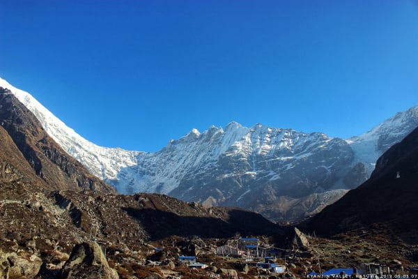
Kyanjin Gompa (3,870 m) sits in a superb position directly beneath Langtang Lirung (7,227 m) at the head of the valley, with the Lirung glacier tumbling off the mountain above. There is an old Buddhist monastery, and a small cheese factory founded with Swiss help in the 1950s, still producing yak cheese.
The afternoon is free for a gentle walk toward the glacier viewpoint. Around 3 hours. Overnight at Kyanjin Gompa.
6Day 6Exploration Day at Kyanjin Gompa (3,870 m) with Hike to Tsergo Ri (5,033 m) or Kyanjin Ri (4,850 m)
Exploration Day at Kyanjin Gompa (3,870 m) with Hike to Tsergo Ri (5,033 m) or Kyanjin Ri (4,850 m)
Today is an important acclimatization and exploration day in Kyanjin Gompa. Depending on your fitness, weather conditions, and preference, you can take an optional hike to either Tsergo Ri or Kyanjin Ri.
Tsergo Ri offers a challenging climb and spectacular panoramic views of Langtang Lirung, Yala Peak, Dorje Lakpa, Ganesh Himal, and surrounding Himalayan peaks. Kyanjin Ri is a shorter but still demanding climb that provides excellent views of the Langtang Valley, glaciers, and surrounding mountains.
After completing the hike, descend carefully back to Kyanjin Gompa and spend the afternoon resting and exploring the village. This acclimatization day also allows your body to adjust to the high altitude before continuing toward Gosaikunda.
7Day 7Trek from Kyanjin Gompa (3,870 m) to Lama Hotel (2,470 m)
Trek from Kyanjin Gompa (3,870 m) to Lama Hotel (2,470 m)
A long descent of 1,400 m, retracing the Langtang valley in a single day.
The route reverses the walk in — down through Langtang Village and Ghoda Tabela, and back below the treeline into the forest. Descending covers ground far faster than climbing did, and what took two days on the way up takes one on the way down.
Walking the valley in the opposite direction gives a genuinely different perspective. On the way up you are looking at the peaks ahead; going down, the view is out over the valley and its forested walls, and the light is usually better in the afternoon.
The physiological effect is welcome too — after several nights above 3,400 m, the thicker air lower down means better sleep and a sharper appetite.
Lama Hotel (2,470 m) is the same forest clearing you stayed in on the way up. Around 5–6 hours. Overnight at Lama Hotel.
8Day 8Trek from Lama Hotel (2,470 m) to Thulo Syabru (2,250 m)
Trek from Lama Hotel (2,470 m) to Thulo Syabru (2,250 m)
A moderate day that leaves the main Langtang route and turns south toward the Gosaikunda trail.
The trail descends briefly along the Langtang Khola before branching away from the valley floor and climbing onto a ridge to the south. There is more up and down than the net height change of around 220 m suggests.
The route runs through mixed forest and open hillside, with views back into the Langtang valley and across to the Ganesh Himal range on clear days. The lower altitude brings warmer air and denser vegetation.
Thulo Syabru (2,250 m) is a substantial Tamang village strung out along a steep ridge, with houses stacked in a line down the spine of the hill. The Tamang here are of Tibetan origin, and there are gompas, chortens and prayer flags through the village.
It is a pleasant place to spend an evening, with open views in both directions. Around 5 hours. Overnight in Thulo Syabru.
9Day 9Trek from Thulo Syabru (2,250 m) to Shin Gompa (3,330 m)
Trek from Thulo Syabru (2,250 m) to Shin Gompa (3,330 m)
A steady climb of around 1,080 m through beautiful forest onto the Gosaikunda ridge.
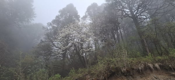
The trail climbs almost continuously from the village, gaining height through excellent forest — rhododendron, oak, pine and hemlock, thick and shaded. In spring the rhododendron flowers right through this section, and the walking is superb throughout the year.
There are occasional clearings with views back toward Langtang and, further up, north to the Tibetan border peaks. It is a substantial ascent, but a rewarding one.
Shin Gompa (3,330 m), also known as Chandanbari, is a small settlement around an old Buddhist monastery. It is best known for its yak cheese factory, one of the oldest in Nepal, and the cheese is worth trying.
The forest around Shin Gompa is protected red panda habitat, and the area is quiet and heavily wooded. Around 5–6 hours. Overnight at Shin Gompa.
10Day 10Trek from Shin Gompa (3,330 m) to Gosaikunda (4,380 m)
Trek from Shin Gompa (3,330 m) to Gosaikunda (4,380 m)
A demanding climb of over 1,000 m to the sacred lakes — the highest sleeping point of the trek.
The trail climbs steadily out of the forest, and within a couple of hours the trees give way to open alpine terrain of rock, grass and low scrub. The route follows an exposed ridge with the ground falling away on both sides, and the views widen continuously — Langtang Lirung and the Ganesh Himal range behind you, and on very clear days Manaslu and even Annapurna II far to the west.
The route passes Lauribina (3,900 m) and then a series of smaller high-altitude lakes — Saraswati Kunda and Bhairav Kunda — before reaching the main lake.
Gosaikunda (4,380 m) is one of Nepal's most important pilgrimage sites. Hindus hold that the lake was created by Shiva, and thousands of pilgrims come here during the Janai Purnima festival in August.
Around 6 hours. Overnight at Gosaikunda.
11Day 11Trek from Gosaikunda (4,380 m) to Ghopte (3,430 m) via Laurebina Pass (4,610 m)
Trek from Gosaikunda (4,380 m) to Ghopte (3,430 m) via Laurebina Pass (4,610 m)
The hardest day of the trek: the crossing of the Laurebina La (4,610 m) followed by a long, rough descent.
You start early. The trail climbs around 230 m from the lake over bare rock and scree to the pass, passing several more of the Gosaikunda lakes on the way. The ascent is not long but the altitude makes it slow work.
From the Laurebina La, marked with cairns and prayer flags, the panorama is extensive — back over the lake basin toward Langtang, and south over the ranges of Helambu. In poor weather or fresh snow the crossing is serious, and it is entirely weather-dependent.
The descent is the harder half of the day. The trail drops steeply and persistently over loose rock and boulder fields, losing more than 1,100 m, and the footing is poor for long stretches. Poles are strongly recommended.
Ghopte (3,430 m) is a small huddle of lodges among boulders and scrub. A long 7–8 hours. Overnight at Ghopte.
12Day 12Trek from Ghopte (3,430 m) to Kutumsang (2,470 m) via Thadepati (3,690 m)
Trek from Ghopte (3,430 m) to Kutumsang (2,470 m) via Thadepati (3,690 m)
A day of two halves — a climb to the Thadepati ridge, then a long descent into Helambu proper.
The morning climbs from Ghopte through rhododendron and pine forest, undulating across a series of gullies before the final pull to Thadepati (3,690 m). This is the high point of the day and a fine viewpoint: the ridge looks north to the Langtang range and the Gosaikunda peaks, and south over the Helambu valleys toward the Kathmandu valley rim.
From Thadepati the trail turns south and descends along the ridge system, dropping steadily through forest. The vegetation thickens as you lose height and the temperature climbs.
The route passes through Mangengoth and small settlements before reaching cultivated land again — terraced fields, livestock and houses after several days of high country.
Kutumsang (2,470 m) is a Tamang and Sherpa village on a saddle. Around 6–7 hours. Overnight in Kutumsang.
13Day 13Trek from Kutumsang (2,470 m) to Chisapani (2,165 m)
Trek from Kutumsang (2,470 m) to Chisapani (2,165 m)
A pleasant ridge day with a modest net descent of around 300 m but plenty of undulation.
The trail follows the ridge south, rising and falling across a series of tops rather than descending steadily, so the day involves more climbing than the numbers suggest. The walking is through rhododendron and pine forest interspersed with open sections and terraced farmland.
The route passes through Gul Bhanjyang and Chipling, small Tamang villages on the ridge, and this section gives a good sense of ordinary hill life — schools, small shops, farms and paths busy with local traffic.
On clear days the views are excellent in both directions, north to the Langtang and Ganesh Himal ranges and, further on, south over the Kathmandu valley.
Chisapani (2,165 m) sits on the ridge at the edge of Shivapuri Nagarjun National Park, and is well known for its sunrise views over the Himalaya. Around 5–6 hours. Overnight in Chisapani.
14Day 14Trek from Chisapani (2,165 m) to Sundarijal (1,460 m) and Drive to Kathmandu (1,400 m)
Trek from Chisapani (2,165 m) to Sundarijal (1,460 m) and Drive to Kathmandu (1,400 m)
The final walking day, a descent through national park forest to the roadhead just outside Kathmandu.
It is worth being up for sunrise from Chisapani — on a clear morning the view along the Himalayan chain, from Langtang east toward Everest, is the last of the trek.
The trail then enters Shivapuri Nagarjun National Park and descends through dense broadleaf forest on stone steps, following streams and passing through Mulkharka, a Tamang village on the hillside. The forest is protected and rich in birdlife, and the walking is shaded and pleasant.
The final section drops beside the Bagmati headwaters to Sundarijal (1,460 m), where the reservoir supplying part of Kathmandu's water sits at the roadhead.
From there it is a drive of around an hour into the city. You arrive in Kathmandu (1,400 m) in the afternoon. The evening is free for a farewell dinner. Overnight in Kathmandu.
15Day 15Final Departure from Kathmandu (1,400 m)
Final Departure from Kathmandu (1,400 m)
The last day of the Langtang and Gosaikunda Trek.
Depending on your flight time there may be free hours in the morning. Thamel is the obvious place for last-minute shopping, and Boudhanath or Pashupatinath both connect directly to what you have just walked through — the Tibetan Buddhist gompas of Langtang on one hand, and the Hindu pilgrimage tradition of Gosaikunda on the other.
Our representative collects you from your hotel and transfers you to Tribhuvan International Airport around three hours before departure.
You leave having completed a circuit that took in the glaciers below Langtang Lirung, the sacred lakes at Gosaikunda (4,380 m), the crossing of the Laurebina La (4,610 m), and the Tamang and Sherpa villages of Helambu — all without a single domestic flight.
Inclusions & Exclusions
Private transport at both ends, Kathmandu accommodation, teahouse lodging, all trekking meals, national park permits, a licensed guide, trekking map, first aid, and government taxes are included, while international flights, visa, insurance, personal gear, porter service, city meals, personal expenses, and tips are excluded.
What's Included
Airport pickup and drop-off services in Kathmandu.
Private transportation from Kathmandu to Syabrubesi and from Sundarijal back to Kathmandu as per the itinerary.
Accommodation in Kathmandu with breakfast.
Accommodation in local teahouses during the trek.
Langtang National Park and Shivapuri Nagarjun National Park entry permits and required trekking permits.
Professional English-speaking licensed trekking guide.
Three meals a day (breakfast, lunch, and dinner) during the trek.
Group trekking map for route guidance.
First aid kit carried by the guide.
All government taxes, permit fees, and service charges.
What's Excluded
International flight tickets to and from Nepal.
Nepal entry visa fees.
Travel insurance, including emergency helicopter evacuation coverage.
Personal trekking equipment and clothing.
Porter services (available at an additional cost).
Lunch and dinner in Kathmandu.
Snacks, bottled water, hot showers, Wi-Fi, charging fees, and alcoholic or soft drinks.
Personal expenses such as laundry, phone calls, and souvenirs.
Tips for guides, drivers, and support staff.
Any additional accommodation, transportation, or expenses caused by unforeseen circumstances beyond the itinerary.
Route Map
Explore the terrain map showing the trek route.
Loading map...
Altitude Profile
Pricing
Transparent per-person pricing based on group size, covering the services listed in the itinerary with no hidden charges.
Add-ons
Customize your trek with optional services such as porter support and other personalized arrangements at an additional cost.
Best Time to Trek
March to May and October to November are the seasons to aim for. Autumn gives the clearest views of the Langtang glaciers and the most settled conditions on Laurebina Pass, which is the section that determines whether the full traverse is possible. Spring brings rhododendron through the lower forests and warmer nights.
Winter closes Laurebina Pass with snow for extended periods and the Gosaikunda lodges thin out considerably, so December to February usually means walking the Langtang valley and returning the way you came. The monsoon brings landslide risk on the Syabrubesi road, leeches in the forest, and cloud over the pass, so it is not recommended.
For a month-by-month look at weather and trail conditions, see our guide to the best time to trek in Nepal.
Trek Difficulty & Fitness
This is a moderate to challenging trek. There is no technical ground and every night is spent in a lodge, but the route covers a great deal of ascent and descent over fifteen days, with the crossing of Laurebina Pass at 4,610 m as its most demanding section — a long day on rough, often snow-patched ground with a steep descent to Ghopte on the far side.
You should be comfortable walking five to seven hours a day for two weeks with substantial daily height gain and loss. Two months of preparation including regular hill walking with a loaded daypack is sensible. The Helambu section at the end, which rides up and over successive ridges, is more tiring than it looks on a map. Trekking poles are strongly recommended.
To build that fitness step by step, follow our 12-week training plan for a Nepal trek.
Travel Insurance
Travel insurance covering trekking to at least 5,500 m is required, giving a safe margin over the Laurebina Pass at 4,610 m and the optional Tsergo Ri climb at 5,033 m. Standard policies frequently cap at 3,000 m or 4,000 m and would leave you uninsured for the most committing parts of the route, so verify the altitude clause before purchasing.
The policy must include emergency helicopter evacuation and medical treatment. Neither the Gosaikunda basin nor the pass has road access, and the section between Gosaikunda and Kutumsang is remote enough that a serious problem means a helicopter, which operators dispatch only against a guarantee of payment. Send us your policy number and the insurer's 24-hour emergency contact before departure.
Our guide to travel insurance for trekking in Nepal explains the altitude limits, evacuation terms and common exclusions to check before you buy.
Altitude & Acclimatization
The itinerary is well shaped for adaptation. You climb gradually up the Langtang valley over three days, take an exploration day at Kyanjin Gompa (3,870 m) with an optional climb to Kyanjin Ri or Tsergo Ri, then descend substantially before the second ascent to Gosaikunda. That descent and re-ascent is genuinely helpful — you arrive at the lakes already adapted rather than climbing to 4,380 m cold.
Laurebina Pass follows the night at Gosaikunda, so the crossing is made from an altitude your body has already had a night to work with. Your guide checks the group each evening for headache, poor sleep, and appetite loss, and can add a night at Shin Gompa or Gosaikunda if needed. Drink three to four litres a day, avoid alcohol above Thulo Syabru, and report symptoms early rather than the next morning.
Prevention, symptoms and treatment are covered in depth in our guide to altitude sickness in Nepal.
Accommodation, Food & Drinking Water
Every night on the trek is spent in a teahouse. The Langtang valley lodges were largely rebuilt after 2015 and are comfortable, with twin rooms, blankets, and warm dining rooms; Kyanjin Gompa has the widest choice. Gosaikunda and Ghopte are the most basic stops — simple rooms, shared toilets, no heating outside the dining room — while the Helambu villages at the end have pleasant family-run lodges.
Three meals a day are included on the trek. Menus cover dal bhat with free refills, noodle soup, fried rice, momos, eggs, chapati, potatoes, and porridge, with the well-known yak cheese from the Kyanjin and Sing Gompa factories appearing throughout. Refill your bottle at lodges and treat it with tablets, a filter, or a UV pen. At Gosaikunda, note that the lake water is sacred and should not be used for washing, drinking, or bathing.
What the lodges are really like, from rooms and meals to showers and charging, is covered in our guide to teahouse trekking in Nepal.
Frequently Asked Questions
Find quick answers to common questions about the Langtang Gosaikunda Lake Trek.
1How many hours do we walk each day?
Five to seven hours on most days. The Laurebina Pass crossing from Gosaikunda to Ghopte is the longest at seven to nine hours, and the Ghopte to Kutumsang day is a similar length over repeated ridges.
2Which permits are required and do you arrange them?
You need the Langtang National Park Entry Permit, the Shivapuri Nagarjun National Park permit for the final descent to Sundarijal, and trekking registration. All are included and arranged by our team from passport copies and photographs sent in advance.
3What happens if Laurebina Pass is closed by snow?
If the pass is unsafe the group returns from Gosaikunda to Dhunche and travels to Kathmandu by road, ending the trek there. This is most likely between December and March. Your guide makes the call based on conditions and how the group is travelling.
4Can I bathe in the Gosaikunda lakes?
No. Gosaikunda is an active pilgrimage site and the water is treated as sacred. Ritual bathing is done by pilgrims, particularly during the August Janai Purnima festival. Trekkers should not swim or wash there, and your guide will show where washing water can be drawn.
5How difficult is the Tsergo Ri climb?
It is the hardest optional day on the trek — about 1,200 m of ascent from Kyanjin Gompa to 5,033 m on steep, rocky ground, taking four to five hours up. Kyanjin Ri at 4,850 m is a shorter alternative with a comparable view.
6Is mobile network and Wi-Fi available?
Coverage is good in the Langtang valley and in Helambu, and patchy around Gosaikunda and Ghopte. Many lodges sell Wi-Fi at slow speeds. Expect a dead zone through the forest near Lama Hotel and over the pass.
7Can I charge devices and where can I get cash?
Lodges offer charging for a small fee, from micro-hydro or solar power depending on the village. There are no reliable ATMs on the route — the one in Dhunche often has no cash — so carry all your Nepalese rupees from Kathmandu.
8How cold does it get at night?
Gosaikunda typically falls to between -5°C and -15°C in the main seasons, and Kyanjin Gompa is similar. The lower Helambu villages are much milder. A sleeping bag rated to -10°C plus a liner is the right specification for this route.
9How large are the groups and who leads the trek?
Groups are capped at twelve trekkers and led by a licensed English-speaking guide who knows both the Langtang valley and the Laurebina crossing. We add an assistant guide for larger groups so the party can split by pace on the pass day.
10Can I leave extra luggage in Kathmandu?
Yes. Your Kathmandu hotel stores anything you do not need on the trail free of charge until you return.
Gallery
Explore authentic moments, landscapes, and mountain views from the Langtang Gosaikunda Lake Trek.
Trekking Guides & Articles
Ama Yangri Trek: A Sacred Ridge Five Days from Kathmandu — Five days from Kathmandu to a prayer-flagged summit above the Hyolmo Sherpa villages of Helambu, with Langtang Lirung, Dorje Lakpa and the Jugal Himal on the skyline.
Gosaikunda Lake Trek: Sacred Lakes at 4,380 m — A chain of glacial lakes at 4,380 m, sacred to Hindus and Buddhists and the destination of a mass August pilgrimage.
Langtang Valley Trek: The Complete Guide — The closest big Himalayan valley to Kathmandu — no flight, no restricted permit, and a glacier-head village at 3,870 m with a 4,773 m viewpoint above it.
Langtang Ganja La Pass Trek: The Complete Guide — The Langtang valley followed by a genuinely committing crossing: the Ganja La at 5,130 m, often snow-covered.
Langtang After the 2015 Earthquake: What Happened and Why Go Now — The 2015 earthquake destroyed Langtang village and much of the valley's trekking economy.
Tamang Heritage Trail: Villages, Hot Springs, and a Tibet Border View — A cultural trek through Tamang villages west of Langtang, with homestays, natural hot springs at Tatopani, and a ridge view into Tibet from Nagthali.
Fix Departure
This trek runs every week on the selected day. Choose custom dates for one-off departures.
Showing fixed departures in Oct 2026
Guest Reviews
A pilgrimage to remember
“We joined Langtang Gosaikunda Lake Trek as pilgrims and came away feeling we had done something truly special. Our guide explained the significance of every temple and shrine with real knowledge and w...
Anthony Richardson
Get in Touch
Tell us the dates you have in mind and roughly what you want out of the trek — one of our guides will reply, usually within 24 hours.
Email Us
info@greencompasstreks.com
Call Us
+977 9864379436
Office
Lakeside, Pokhara, Nepal
Office Hours
Sunday – Friday, 9:00 AM – 9:00 PM
Similar Treks
You might also like these treks
Porter
$501 $455/porter
No payment required yet