

Kanchenjunga South Base Camp Trek
The Kanchenjunga South Base Camp Trek is the shortest way into the Kanchenjunga massif, reaching the Oktang viewpoint (4
Porter
$347 $315/porter
No payment required yet
Trip Overview
The Kanchenjunga South Base Camp Trek is the shortest way into the Kanchenjunga massif, reaching the Oktang viewpoint (4,730 m) above the Yalung Glacier with a view of the south face of the world's third-highest mountain. Flying to Bhadrapur and driving through the tea country to Taplejung and Helok, the trail climbs the Simbua Khola valley through dense forest into high pasture.
The base for the final days is Cheram (3,870 m), with a full acclimatization day and then an early-morning walk up the glacier moraine to Oktang, where Kanchenjunga, Kabru, Rathong, and Talung form a wall across the head of the valley. At eleven days this is much the most accessible of the Kanchenjunga itineraries, and it remains a restricted region that sees very few trekkers.
Trip Highlights
The Oktang Viewpoint (4,730 m): Walk the Yalung Glacier moraine to a viewpoint facing the south face of Kanchenjunga (8,586 m).
Eleven Days to an 8,000 m Face: The shortest route into the Kanchenjunga massif, with no pass to cross and no camping required.
A Full Acclimatization Day at Cheram: Rest at 3,870 m before the high moraine walk, giving a well-judged ascent profile.
The Simbua Khola Forest: Climb through some of eastern Nepal's finest rhododendron and mixed forest, prime red panda habitat.
Restricted Country, Very Few Trekkers: Walk a permit-controlled region that receives a small fraction of the visitors of the main trekking areas.
Itinerary
An 11-day restricted-area trek up the Simbua Khola to Cheram (3,870 m), with an acclimatization day and a moraine walk to the Oktang viewpoint at 4,730 m.
1Day 1Arrival in Kathmandu (1,400 m)
Arrival in Kathmandu (1,400 m)
You arrive at Tribhuvan International Airport in Kathmandu (1,400 m) and are met by our representative for the drive to your hotel in Thamel.
Your guide runs the pre-trek briefing. The Kanchenjunga South Base Camp trek approaches the mountain from the Simbua Khola valley, reaching the Oktang viewpoint (4,730 m) on the moraine of the Yalung Glacier, beneath the south face of Kanchenjunga (8,586 m). It is a restricted area, so a special permit, a licensed guide and a minimum group size are all required.
This is a shorter and slightly gentler route than the northern approach, but it is no less remote — the lodges are simple, the valley is thinly populated, and help is a long way off. Your guide checks your kit: warm layers, a four-season bag and boots with good grip are all needed. Overnight in Kathmandu.
2Day 2Fly from Kathmandu (1,400 m) to Bhadrapur (91 m) and Drive to Taplejung (1,820 m)
Fly from Kathmandu (1,400 m) to Bhadrapur (91 m) and Drive to Taplejung (1,820 m)
An early flight east to Bhadrapur (91 m), close to the Indian border in the far south-east of the country. The flight takes around 45 minutes, and on a clear morning the whole eastern Himalaya lines the northern horizon — Everest, Makalu and Kanchenjunga all in view at once.
Bhadrapur sits at 91 m on the Terai plain: flat, hot and humid. From the airstrip we drive north and the road begins to climb almost immediately into the hills of the Ilam district, famous for its tea. Whole hillsides are terraced in bright green tea bushes, and the road winds between them for hours.
The journey up to Taplejung (1,820 m) takes eight to ten hours on narrow, winding mountain road. It is a long day, but the change from tropical plain to hill town in a single afternoon is remarkable. Overnight in a lodge.
3Day 3Drive from Taplejung (1,820 m) to Helok (1,270 m) and Trek to Yarsang (1,700 m)
Drive from Taplejung (1,820 m) to Helok (1,270 m) and Trek to Yarsang (1,700 m)
A rough jeep transfer from Taplejung down to Helok (1,270 m), taking two to three hours on a track that deteriorates steadily as it descends into the valley.
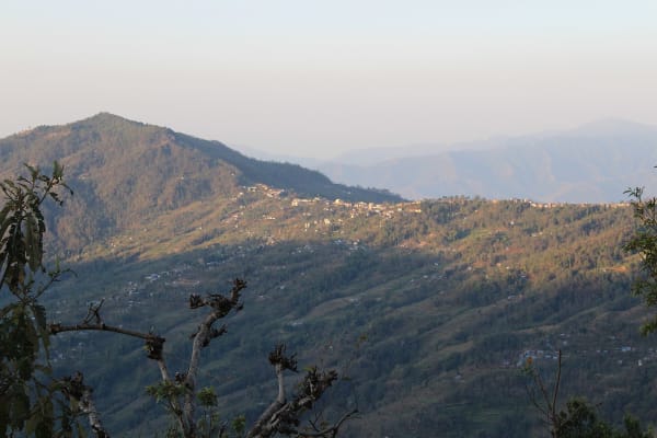
The walking starts here. The trail follows the Simbua Khola upstream, and this lower section is subtropical and humid — dense forest of bamboo, ferns and cardamom, with the river running loud below and butterflies everywhere. Cardamom is the main cash crop in this valley, and you will pass drying sheds and plantations along the way.
The path crosses the river on suspension bridges and climbs steadily through Limbu villages, the dominant ethnic group in this part of eastern Nepal, whose culture and language differ markedly from the Tibetan-influenced communities higher up. Yarsang (1,700 m) is a small settlement with basic lodges. Overnight in a teahouse.
4Day 4Trek from Yarsang (1,700 m) to Tortong (2,995 m)
Trek from Yarsang (1,700 m) to Tortong (2,995 m)
A serious climbing day — nearly 1,300 m of ascent, and the biggest single gain of the trek.
The trail continues up the Simbua Khola into an increasingly narrow and forested valley. The climb is steady and relentless, and the vegetation changes noticeably as you gain height: the bamboo and cardamom of the lower valley give way to oak, then to rhododendron and fir, hung with moss and old man's beard.
This is genuinely wild forest with very few settlements, and it is among the best wildlife habitat on any trekking route in Nepal — red panda live in this valley, along with Himalayan black bear and a rich variety of birds. Sightings of the first two are rare, but the forest itself is impressive.
Tortong (2,995 m) is a small clearing with a couple of very basic lodges beside the river. Facilities are minimal. Overnight in Tortong.
5Day 5Trek from Tortong (2,995 m) to Cheram (3,870 m)
Trek from Tortong (2,995 m) to Cheram (3,870 m)
Another substantial climbing day, and the one where you finally break out of the forest into the high country.
The trail climbs steeply from Tortong through the last of the rhododendron, which thins rapidly as you gain height. Within a couple of hours the trees stop altogether and the valley opens into open alpine terrain — juniper scrub, boulder fields and the first views of the peaks at the head of the valley.
The route passes through the summer yak pastures at Anda Phedi and continues up the widening valley. The Yalung Glacier comes into view ahead, with the ridgeline of Kanchenjunga's outliers rising behind it.
Cheram (3,870 m) — also spelled Tseram — is a small seasonal settlement of stone huts and simple lodges on a flat above the river. It is cold and exposed, and the altitude is now genuinely noticeable. Overnight in Cheram.
6Day 6Acclimatization Day at Cheram (3,870 m)
Acclimatization Day at Cheram (3,870 m)
An acclimatisation day before pushing to 4,730 m tomorrow. Sleeping two nights at 3,870 m with a high walk in between is what makes the Oktang day comfortable rather than punishing.
The usual excursion climbs toward Ramche (4,580 m) up the valley, or up the ridge above the settlement, gaining several hundred metres before returning. From higher ground the view opens onto the Yalung Glacier and the peaks that ring its head, and the scale of the basin becomes clear.
The slopes around Cheram are excellent for wildlife: blue sheep graze in large herds and are often visible from the lodges, and Himalayan griffon vultures and lammergeiers work the thermals along the valley walls. Snow leopards live in this valley too, though seeing one is a matter of extraordinary luck. Rest, drink steadily and eat well. Overnight in Cheram.
7Day 7Early Morning Hike from Cheram (3,870 m) to Oktang Viewpoint (4,730 m) and Return to Cheram (3,870 m)
Early Morning Hike from Cheram (3,870 m) to Oktang Viewpoint (4,730 m) and Return to Cheram (3,870 m)
The summit day of the trek. We set out early for the climb up the valley alongside the Yalung Glacier, gaining around 860 m over four to five hours.
The trail climbs first to Ramche (4,580 m), a grassy basin with a small lake that is one of the most beautiful spots on the route, then continues along the glacier's lateral moraine to the prayer flags and chorten at Oktang (4,730 m).
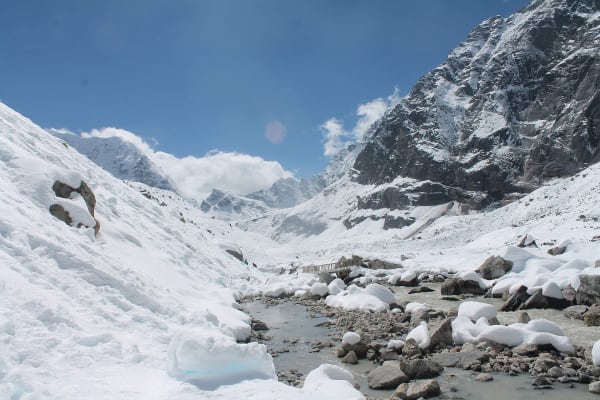
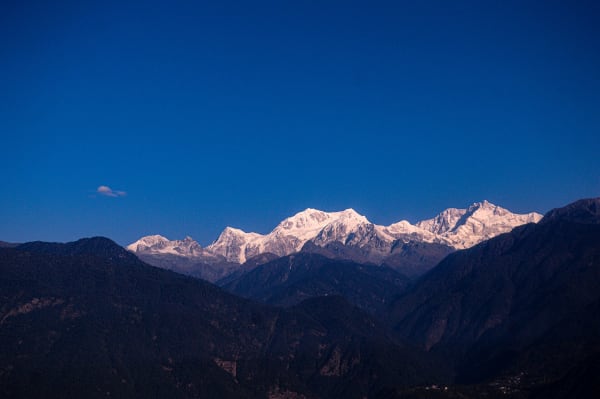
The view is what you came for. The entire south face of Kanchenjunga (8,586 m) fills the head of the valley — the third-highest mountain in the world seen from directly beneath, with Yalung Kang, Kabru, Rathong and Talung along the ridgeline and the glacier stretching away below. It is a very different aspect from the northern side at Pangpema, and for many people the more beautiful of the two.
We descend the same route to Cheram (3,870 m). Overnight in Cheram.
8Day 8Trek from Cheram (3,870 m) to Yarsang (1,700 m)
Trek from Cheram (3,870 m) to Yarsang (1,700 m)
A very long descending day, giving back more than 2,100 m — essentially two days' climb reversed in one.
The trail drops from Cheram through the yak pastures at Anda Phedi and down into the rhododendron and fir forest. Below Tortong (2,995 m), where we usually stop for lunch, the descent continues steeply through the moss-hung woodland of the middle valley.
The change over the course of the day is dramatic: from bare alpine boulder field at breakfast to humid subtropical forest by mid-afternoon, with the temperature climbing steadily and the air thickening with every hour. Bamboo and cardamom reappear in the lower valley.
The day finishes at Yarsang (1,700 m). It is a hard day on the knees, so poles are worth using and a steady pace beats speed. Overnight in a teahouse.
9Day 9Trek from Yarsang (1,700 m) to Helok (1,270 m) and Drive to Taplejung (1,820 m)
Trek from Yarsang (1,700 m) to Helok (1,270 m) and Drive to Taplejung (1,820 m)
A short final walking morning down the Simbua Khola through the cardamom plantations and Limbu villages of the lower valley, crossing the river on suspension bridges.
It is a warm, green, gentle few hours — a marked contrast to the high country of the past week — and there is usually time to stop and watch cardamom being sorted and dried, which is the economic backbone of this valley.
The walking ends at Helok (1,270 m), where a jeep meets us for the rough climb back up to Taplejung (1,820 m), two to three hours on the same track you came down. Arriving in the afternoon there is time for a hot shower and a proper meal. Tonight is the farewell dinner with your guide and porters. Overnight in Taplejung.
10Day 10Drive from Taplejung (1,820 m) to Bhadrapur (91 m) and Fly to Kathmandu (1,400 m)
Drive from Taplejung (1,820 m) to Bhadrapur (91 m) and Fly to Kathmandu (1,400 m)
A long travel day, starting early to make the afternoon flight. The drive from Taplejung down to Bhadrapur (91 m) takes eight to ten hours, descending through the Ilam tea gardens and out onto the Terai.
The tea country is the highlight of the journey — hillsides terraced in bright green, pickers working the rows with baskets on their backs, and processing factories where it is sometimes possible to stop and taste. Ilam produces some of the finest tea in Nepal and it makes a good souvenir.
The 45-minute flight west to Kathmandu (1,400 m) follows the line of the Himalaya, and on a clear afternoon you can pick out Kanchenjunga receding behind you. Arriving in the capital you transfer to your hotel, with the evening free. Overnight in Kathmandu.
11Day 11Departure from Kathmandu (1,400 m)
Departure from Kathmandu (1,400 m)
Your last day in Nepal. If your flight is later there is time for one more part of the valley — Boudhanath Stupa, Pashupatinath Temple and Swayambhunath are all a short drive from Thamel.
Our representative will collect you from your hotel and transfer you to Tribhuvan International Airport around three hours before your scheduled departure.
The Kanchenjunga South Base Camp trek takes you into one of the emptiest corners of Nepal — a valley of cardamom plantations and red panda forest that climbs to a chorten at 4,730 m beneath the south face of the world's third-highest mountain. Very few trekkers come here. If you would like to see the northern side as well, the Pangpema route and the full Kanchenjunga Circuit both link the two base camps over the Sele La. Safe travels.
Inclusions & Exclusions
Bhadrapur flights, all ground transport, Kathmandu and Taplejung accommodation, teahouse lodging, all trekking meals, restricted area and conservation permits, a licensed guide, trekking map, first aid, and government taxes are included, while international flights, visa, insurance, personal gear, porter service, city meals, personal expenses, and tips are excluded.
What's Included
Airport pickup and drop-off services in Kathmandu.
Domestic flights from Kathmandu to Bhadrapur and Bhadrapur to Kathmandu.
Ground transportation between Bhadrapur, Taplejung, and Helok as per the itinerary.
Accommodation in Kathmandu with breakfast.
Accommodation in Taplejung with breakfast.
Accommodation in local teahouses during the trek.
Kanchenjunga Restricted Area Permit and Kanchenjunga Conservation Area Permit.
Professional English-speaking licensed trekking guide.
Three meals a day (breakfast, lunch, and dinner) during the trek.
Group trekking map for route guidance.
First aid kit carried by the guide.
All government taxes, permit fees, and service charges.
What's Excluded
International flight tickets to and from Nepal.
Nepal entry visa fees.
Travel insurance, including emergency helicopter evacuation coverage.
Personal trekking equipment and clothing.
Porter services (available at an additional cost).
Lunch and dinner in Kathmandu.
Snacks, bottled water, hot showers, Wi-Fi, charging fees, and alcoholic or soft drinks.
Personal expenses such as laundry, phone calls, and souvenirs.
Tips for guides, drivers, and support staff.
Any additional accommodation, transportation, or expenses caused by domestic flight delays, bad weather, or other unforeseen circumstances beyond the itinerary.
Route Map
Explore the terrain map showing the trek route.
Loading map...
Altitude Profile
Pricing
Transparent per-person pricing based on group size, covering the services listed in the itinerary with no hidden charges.
Add-ons
Customize your trek with optional services such as porter support and other personalized arrangements at an additional cost.
Best Time to Trek
April to May and October to November are the two workable seasons. Autumn brings the most settled weather and the clearest view of the south face from Oktang. Spring is warmer and the rhododendron forest of the Simbua Khola is exceptional in April, among the best displays anywhere in Nepal.
Eastern Nepal receives heavy monsoon rain, so June to September brings leeches through the forest, landslides on the Taplejung road, and cloud that removes the mountain views. Winter closes Cheram and Ramche and the upper lodges shut. This route is not viable outside the two named windows.
For a month-by-month look at weather and trail conditions, see our guide to the best time to trek in Nepal.
Permits & Regulations
Kanchenjunga is a restricted area. You need the Kanchenjunga Restricted Area Permit, issued only through a registered trekking agency at USD 20 per person per week, alongside the Kanchenjunga Conservation Area Permit and trekking registration. Permits are non-transferable and are checked at posts along the route.
Regulations require a minimum of two trekkers travelling together and a licensed guide throughout; solo trekking is not permitted. Our team handles the full application, but we need clear passport copies, passport-sized photographs, and your Nepal visa details in advance. The conservation area is co-managed with local committees, so small additional community fees may be collected at village checkpoints.
The fees and conditions for every restricted area are set out in our guide to restricted area permits in Nepal.
Travel Insurance
Travel insurance covering trekking to at least 5,000 m is mandatory, giving a margin over the Oktang viewpoint at 4,730 m. Standard holiday policies frequently cap at 3,000 m and often exclude remote-area travel, so read both the altitude clause and any remoteness exclusions before purchasing.
Emergency helicopter evacuation and repatriation cover is essential. From Cheram and Ramche the nearest road is two days' walk and evacuation means a helicopter flying from Biratnagar or Kathmandu, which operators dispatch only against a guarantee of payment. Also ensure cover for delayed or cancelled domestic flights on the Bhadrapur sector. Send us your policy number and the insurer's 24-hour emergency contact before departure.
Our guide to travel insurance for trekking in Nepal explains the altitude limits, evacuation terms and common exclusions to check before you buy.
Packing List
The forest sections are warm and humid and the upper valley is cold and exposed, so a full layering range is needed. Bring waterproof trekking boots, three base layers, a fleece, an insulated down jacket, a windproof and waterproof shell jacket and trousers, trekking trousers, a warm hat, sun hat, gloves, and several pairs of wool socks. A sleeping bag rated to -15°C is right for Cheram and Ramche.
Also pack a 30-40 litre daypack, trekking poles for the long descents, a headlamp with spare batteries for the pre-dawn Oktang start, high-SPF sunscreen and lip balm, sunglasses for the glare off the glacier, a reusable bottle with purification tablets or a filter, a thorough personal first aid kit, insect repellent and leech socks for the forest, a quick-dry towel, toiletries, and a large power bank, since charging above Tortong is solar and limited.
For the complete kit list, organised by the altitude you will reach, see our Nepal trekking packing list.
Accommodation, Food & Drinking Water
You stay in a tourist-standard hotel in Kathmandu, a simple hotel in Taplejung, and village teahouses at Yarsang, Tortong, and Cheram. Standards are basic — twin rooms with foam mattresses, shared or outdoor toilets, no hot showers above Tortong, and heating only in the dining room. Cheram has just a handful of lodges, which is why we plan arrivals early in the day.
Three meals a day are included on the trek. Menus are short and repetitive, built around dal bhat with refills, noodle soup, fried rice, potatoes, eggs, chapati, and tea, because supplies above Tortong are carried up on foot. Tell us about vegetarian, vegan, or allergy requirements well in advance, as nothing can be substituted en route. Water comes from streams and lodge taps and must be treated with tablets, a filter, or a UV pen; bottled water is not reliably available on this route.
What the lodges are really like, from rooms and meals to showers and charging, is covered in our guide to teahouse trekking in Nepal.
Frequently Asked Questions
Find quick answers to common questions about the Kanchenjunga South Base Camp Trek.
1How many hours do we walk each day?
Five to seven hours on most days. The Oktang day return from Cheram is the longest at seven to nine hours from a pre-dawn start, on glacial moraine, and the descent from Cheram to Yarsang is a long day dropping over 2,000 m.
2How does this compare with the north base camp trek?
The south route is shorter at eleven days, lower at 4,730 m rather than 5,143 m, and less demanding overall. Pangpema on the north side puts you directly beneath a 3,000 m face and is the more dramatic of the two, but Oktang gives a broader view of the whole south wall for considerably less commitment.
3Can I trek Kanchenjunga alone?
No. Restricted-area regulations require a minimum of two trekkers on a permit and a licensed guide throughout. If you are travelling solo we can pair you with another trekker on a fixed departure or issue a two-person permit at the corresponding cost.
4Do we camp on this trek?
No. Every night is spent in a village lodge or hotel. The lodges above Tortong are basic, but there is permanent accommodation at every stop, which is one of the advantages of the south route over the full circuit.
5How reliable are the flights to Bhadrapur?
Reasonably reliable, as Bhadrapur is a lowland airport served by larger aircraft rather than a mountain strip. Poor visibility causes occasional delays but outright cancellations are less common than on Lukla or Juphal. The drives to and from Taplejung are the less predictable element.
6Is mobile network available?
There is patchy coverage at Taplejung, Helok, and Yarsang and effectively none above Tortong. Expect to be offline for the upper part of the trek. Our guides carry a satellite communication device for emergencies.
7Where can I withdraw cash and charge devices?
Taplejung has the last reliable ATM and there are none beyond it, so carry all your Nepalese rupees from Kathmandu or Bhadrapur. Charging above Tortong is solar and limited, usually for a fee, so bring a large power bank.
8How cold does it get at Cheram?
Nights at Cheram and Ramche typically fall to between -5°C and -15°C in the main seasons, colder with wind off the glacier, and lodge heating is limited to the dining room. A sleeping bag rated to -15°C plus a liner is appropriate.
9What wildlife might we see?
The Simbua Khola forest is prime red panda habitat, though sightings are rare. Himalayan tahr, blue sheep, langur monkeys, and outstanding birdlife including blood pheasant and lammergeier are seen much more regularly, and the conservation area is one of Nepal's richest.
10Can I leave extra luggage in Kathmandu?
Yes. Your Kathmandu hotel stores anything you do not need on the trail free of charge until you return, which helps with the baggage limits on the Bhadrapur flight.
Gallery
Explore authentic moments, landscapes, and mountain views from the Kanchenjunga South Base Camp Trek.
Trekking Guides & Articles
Kanchenjunga South Base Camp Trek: The Complete Guide — The shortest way into the Kanchenjunga massif: eleven days to the Oktang viewpoint at 4,730 m above the Yalung Glacier, where Kanchenjunga, Kabru.
Bokta Peak Climbing: The Complete Guide — One of the least-attempted permitted peaks in Nepal, on the southern rim of the Kanchenjunga massif.
Kanchenjunga Circuit Trek: Nepal's Remotest Major Trek — Three weeks in far-eastern Nepal to both base camps of the world's third-highest mountain, over a 4,792 m pass.
Kanchenjunga North Base Camp Trek: The Complete Guide — The direct route to Pangpema at 5,143 m, beneath a north face that rises more than 3,000 m in front of you.
Fix Departure
This trek runs every week on the selected day. Choose custom dates for one-off departures.
Showing fixed departures in Oct 2026
Guest Reviews
Book it — you will not regret it
“We picked Kanchenjunga South Base Camp Trek after a lot of research and it did not disappoint. The whole team looked after us brilliantly — nothing was ever too much trouble. The teahouses and lodges ...
Amelia Castro
Get in Touch
Tell us the dates you have in mind and roughly what you want out of the trek — one of our guides will reply, usually within 24 hours.
Email Us
info@greencompasstreks.com
Call Us
+977 9864379436
Office
Lakeside, Pokhara, Nepal
Office Hours
Sunday – Friday, 9:00 AM – 9:00 PM
Similar Treks
You might also like these treks

Porter
$347 $315/porter
No payment required yet