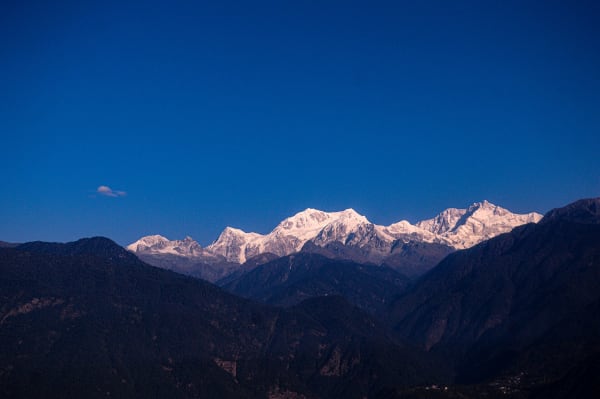
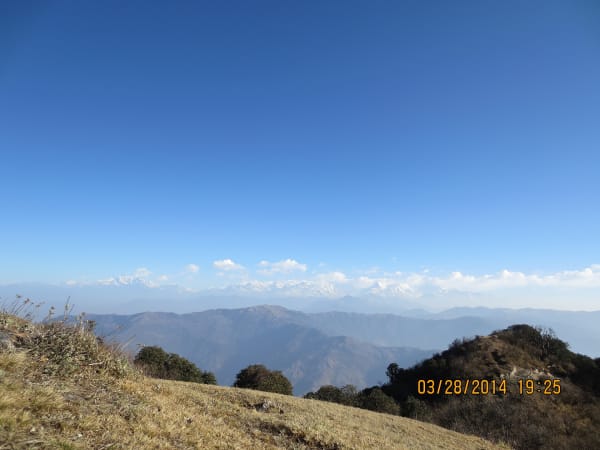
Kanchenjunga (8,586 m) is the third-highest mountain on earth and sits in the far north-east corner of Nepal on the Sikkim border. The circuit visits both of its base camps — Pangpema on the north side and Oktang on the south — linked over the Mirgin La, and it is the remotest major trek in the country.
Three weeks, a flight to Bhadrapur and a long drive to Taplejung, basic lodges and some camping, and a restricted permit that costs USD 20 per week. For trekkers who have done the classics and want somewhere that still feels genuinely unvisited, this is the answer.
The Trek at a Glance
| Duration | 21 days from Kathmandu |
| Highest point | About 4,792 m on the Mirgin La, with base camps at 5,143 m and 4,730 m |
| Key places | Pangpema (north base camp), Oktang (south base camp), Ghunsa, Tseram |
| Difficulty | Moderate to difficult — very remote, long stages, basic lodges |
| Permit | Kanchenjunga restricted permit (USD 20 per week) plus conservation area fee |
| Minimum group | Two trekkers with a registered agency and licensed guide |
| Access | Flight to Bhadrapur or Biratnagar, then a long drive to Taplejung |
| Best seasons | April to May, October to November |
We run the full 21-day circuit, and shorter routes to each base camp separately: the 14-day north base camp trek and the 11-day south base camp trek.
The Route
Getting there
A flight to Bhadrapur in the far-eastern Terai, then a long drive north through the tea gardens of Ilam to Taplejung at around 1,820 m. It is a full day on the road, and it is the reason Kanchenjunga sees so few trekkers — the approach alone takes two days from Kathmandu.
North to Ghunsa and Pangpema
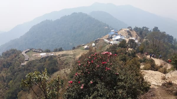
Up the Tamor valley through Chirwa and Sekathum, then into the Ghunsa Khola — a long, forested, steep-sided valley that narrows dramatically. Ghunsa at 3,475 m is a Tibetan-Buddhist village and the staging point for the north side. Above it the valley opens through Khambachen and Lhonak to Pangpema at about 5,143 m, a moraine shelf directly beneath the 3,000 m north face of Kanchenjunga. It is one of the great views in the Himalaya and almost nobody sees it.
Over the Mirgin La to the south side
Back down to Ghunsa and over the Mirgin La at about 4,792 m — actually a series of passes — into the Simbuwa Khola. This is the crux of the circuit, a long committed day with no shelter between Ghunsa and Tseram.
Oktang and the south base camp
Up from Tseram through Ramche to Oktang at about 4,730 m on the Yalung glacier, looking up at Kanchenjunga's south face and the Kumbhakarna (Jannu) massif. Different in character from the north — more glacial, more open — and equally empty.
Out through the Yalung valley
South-west down the Simbuwa Khola through Torongding and Yamphudin to the road, and back to Taplejung and Bhadrapur.
What Makes It Hard
- The approach. Two days from Kathmandu before you start walking, and the same coming back. Allow spare days for the Bhadrapur flight.
- Length. Twenty-one days with very few rest opportunities, and stages of six to eight hours are normal.
- Remoteness. From Ghunsa onward you are days from a road. Helicopter evacuation is possible from some valleys and weather-dependent everywhere.
- Basic lodges and some camping. Teahouses exist in the main valleys and are simple; the high camps at Lhonak, Pangpema, Ramche and over the Mirgin La are minimal or tented.
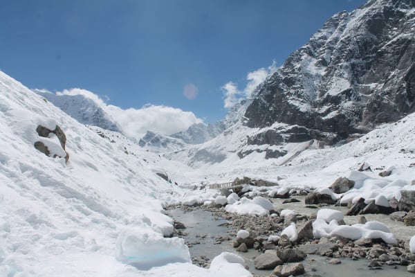
- The Mirgin La day. A long crossing with no shelter, which can hold snow into May and from October.
- Leeches and heat low down in the Tamor valley approach, which is subtropical.
What it does not involve is technical ground or extreme altitude. The highest you sleep is around 4,800 m at the high camps, and there is no rope work. It is a question of endurance and self-sufficiency.
Why Go
- Pangpema. Standing on moraine beneath the north face of the world's third-highest mountain, with Wedge Peak, Tent Peak and the Twins around you, and nobody else there.
- Kumbhakarna (Jannu). From the south side, one of the most striking mountain forms anywhere — a 7,710 m peak with a near-vertical north face that climbers rate among the hardest in the world.
- Biodiversity. The Kanchenjunga Conservation Area runs from subtropical forest to glacier in 40 km, with red panda, snow leopard and over 250 bird species recorded.
- Limbu and Tibetan culture. Limbu and Rai villages low down, Tibetan-Buddhist settlements at Ghunsa and Tseram, with very little tourism infrastructure shaping either.
- The permit cost. USD 20 per week, which makes it one of the cheapest restricted areas in Nepal despite being the remotest.
- Almost nobody else. A few hundred trekkers a year on the full circuit.
Which Version to Book
| Option | Days | Reaches | Best for |
|---|---|---|---|
| Full circuit | 21 | Both base camps via the Mirgin La | The complete trek, for experienced trekkers with three weeks |
| North base camp | 14 | Pangpema, about 5,143 m | The single best view on the trek, in two weeks |
| South base camp | 11 | Oktang, about 4,730 m | The shortest route in, with Kumbhakarna and the Yalung glacier |
| Red Panda Trail | 12 | Ilam and Panchthar hills | The same region at low altitude, with forest and tea gardens |
If you have two weeks rather than three, the north base camp route is the one to take — Pangpema is the highlight of the whole region. The full circuit is worth the extra week for the Mirgin La crossing and the contrast between the two faces.