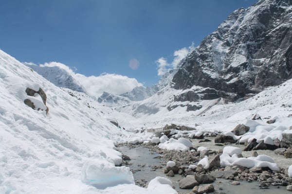
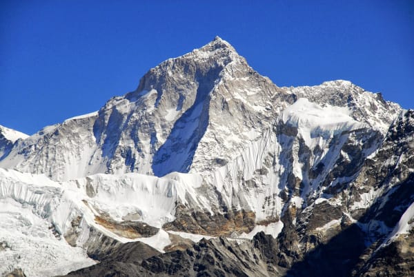
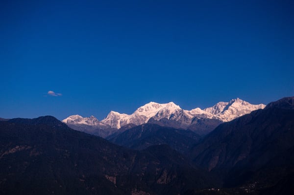
Makalu (8,485 m) is the fifth-highest mountain in the world and stands 19 km from Everest, but almost nobody walks to its base camp. The route goes up the Barun valley — a deep, forested, glacially carved gorge inside Makalu Barun National Park — to a moraine basin at around 4,870 m where Makalu's south-west face rises directly above you.
It is a harder proposition than Everest Base Camp despite being lower, because the valley is genuinely remote: two days from Kathmandu to the trailhead, a week of walking with barely any lodges, and no road within several days at any point above Num.
The Trek at a Glance
| Duration | 17 days from Kathmandu |
| Highest point | Makalu Base Camp area, about 4,870 m |
| Difficulty | Moderate to difficult — remote, basic lodges and camping, two passes on the approach |
| Access | Flight to Tumlingtar, then road to Num or Seduwa |
| Permits | Makalu Barun National Park entry and trekking registration |
| Best seasons | March to May, September to November |
| Accommodation | Basic lodges, homestays, and camping in the upper valley |
We run it as a 17-day Makalu Base Camp trek. The far harder Sherpani Col route crosses from the Barun into the Khumbu over three technical passes, and a 29-day expedition combines that with Mera Peak.
The Route
Tumlingtar to Seduwa (405 m to 1,500 m)
A flight to Tumlingtar in the Arun valley, then a road transfer to Num on a ridge above the Arun river, and a steep descent and climb to Seduwa — the national park entry point. The Arun is one of the great rivers of Nepal, cutting from Tibet through the Himalaya, and the lower valley is subtropical and hot.
Seduwa to Khongma Danda (1,500 m to 3,500 m)
A sustained climb through Tashigaon and into genuine forest — oak, rhododendron, magnolia, bamboo — on one of the steepest trail sections in eastern Nepal. Khongma Danda at around 3,500 m is a ridge camp, and from here the route crosses two passes, the Shipton La and Keke La, both around 4,100 to 4,200 m, into the Barun.
Down into the Barun valley
A descent to Dobato and Yangle Kharka on the Barun river. This is the part of the trek people remember: a glacially carved U-shaped valley with 2,000 m walls, waterfalls coming off both sides, juniper and birch on the floor, and almost no human presence. It is one of the most beautiful valleys in Nepal and it feels prehistoric.
Yangle Kharka to Makalu Base Camp (3,600 m to 4,870 m)
Up the valley through Langmale Kharka and Shershong onto the moraine, and to the base camp area at around 4,870 m. Makalu's south-west face fills the head of the valley, with Baruntse, Chamlang and — from the higher moraine — Everest and Lhotse visible to the west. Spend two nights and walk up the moraine for the full view.
Back out
Retrace the valley and the two passes to Seduwa and Num. There is no alternative exit unless you are on the Sherpani Col route, which crosses into the Khumbu and is a mountaineering undertaking rather than a trek.
Why It Is Harder Than Everest Base Camp
Makalu Base Camp is 500 m lower than Everest Base Camp and a considerably bigger commitment.
| Makalu Base Camp | Everest Base Camp | |
|---|---|---|
| Highest point | About 4,870 m | 5,545 m |
| Lodges | Basic, sparse, camping in the upper valley | Teahouses every 1–3 hours |
| Distance from a road | Up to 5 days | Lukla airstrip is 2–3 days away |
| Other trekkers | Very few | The busiest trail in Nepal |
| Rescue | Helicopter only, weather-dependent | Helicopter, with a short flight to Kathmandu |
| Approach | Flight to Tumlingtar plus road plus two passes | One flight to Lukla |
| Difficulty | Moderate to difficult | Moderate |
Our difficulty grades guide explains why remoteness pushes a route up a grade regardless of altitude. Makalu is the clearest example in Nepal.
The National Park and Its Wildlife
Makalu Barun National Park covers 1,500 km² and runs from 435 m in the Arun valley to the 8,485 m summit of Makalu — one of the greatest altitude ranges of any protected area on earth. The Barun valley itself is a designated strict nature reserve.
- Over 3,000 plant species, including 25 rhododendron species and 47 orchids. The forest between Tashigaon and Khongma Danda in April is exceptional.
- Red panda, snow leopard, Himalayan black bear, and musk deer are all present, with red panda most likely of the four to be seen.
- Over 400 bird species, including spiny babbler, which is endemic to Nepal.
- Very low human density. The upper Barun has no permanent settlement at all.
Because there is so little infrastructure, the practical rules matter: carry out everything, use our crew's treated water rather than streams, and do not leave the trail in the strict reserve section.
Practicalities
- Flights to Tumlingtar are small-aircraft and weather-dependent. Allow two spare days at each end.
- Permits: Makalu Barun National Park entry at NPR 3,000 and trekking registration. No restricted permit, which keeps the cost down.
- Accommodation: basic lodges and homestays as far as Khongma Danda, then increasingly camping. We run the upper valley with a cook and crew.
- Cold: nights at the base camp area run to -10 to -15 °C. A -20 °C bag.
- Altitude: the two passes on the approach give useful acclimatisation before the upper valley, but the climb from Yangle Kharka is sustained. Our itinerary builds in a day at Langmale.
- Insurance: cover to 6,000 m with helicopter evacuation, and read the search-and-rescue clause. This is the kind of valley where that matters.
- Connectivity: effectively none above Tashigaon.