

Langtang Ganja La Pass Trek
The Langtang Ganja La Pass Trek combines the classic Langtang valley with a genuinely demanding high crossing into Helam
Porter
$462 $420/porter
No payment required yet
Trip Overview
The Langtang Ganja La Pass Trek combines the classic Langtang valley with a genuinely demanding high crossing into Helambu. After following the Langtang Khola through forest and yak pasture to Kyanjin Gompa (3,870 m) and taking an exploration day at the valley head, the route turns south over the Ganja La Pass (5,130 m) — a steep, often snow-covered crossing that requires a rope on the descent in poor conditions.
Beyond the pass the trail drops through remote high camps at Keldang and Dhukpa, where there are no permanent lodges and the group camps, before descending into the Hyolmo Buddhist villages of Tarkeghyang and Sermathang. It is one of the few routes in Nepal that pairs a comfortable teahouse valley with a committing wilderness crossing, and it is intended for experienced trekkers rather than as a first Himalayan trip.
Trip Highlights
Cross Ganja La Pass (5,130 m): Take on one of the more serious trekking passes in Nepal, steep and often snow-covered on the Helambu side.
Kyanjin Gompa and the Langtang Glaciers: Spend an exploration day at the valley head beneath Langtang Lirung with optional climbs to Kyanjin Ri or Tsergo Ri.
Camp in True Wilderness: Sleep at Keldang and Dhukpa, high camps beyond the pass where there are no lodges and no other trekkers.
Finish in the Hyolmo Villages: Descend into Tarkeghyang and Sermathang, traditional Buddhist settlements with old monasteries.
Two Regions in One Trek: Link the Langtang valley and Helambu on foot rather than travelling between them by road.
Itinerary
A 14-day trek up the Langtang valley to Kyanjin Gompa, crossing Ganja La Pass (5,130 m) with high camps beyond, and finishing in the Hyolmo villages of Helambu.
1Day 1Arrival in Kathmandu (1,400 m)
Arrival in Kathmandu (1,400 m)
You arrive at Tribhuvan International Airport in Kathmandu (1,400 m), where our representative meets you and transfers you to your hotel.
Your guide runs the pre-trek briefing. The Langtang Ganja La Pass trek is a serious undertaking — it combines the accessible and beautiful Langtang valley with a crossing of the Ganja La (5,122 m), a technical high pass that links Langtang to the Helambu region.
The pass is what sets this route apart. It frequently holds snow and ice, involves steep and exposed ground on both sides, and may require a rope and basic mountaineering equipment. The section beyond it is genuinely remote camping country with no lodges, so the trek is crew-supported from Kyanjin Gompa onward.
Your guide checks your equipment carefully — a four-season sleeping bag, crampons or microspikes, and proper layers are all necessary. The rest of the day is free to rest or walk around Thamel. Overnight in Kathmandu.
2Day 2Drive from Kathmandu (1,400 m) to Syabrubesi (1,467 m)
Drive from Kathmandu (1,400 m) to Syabrubesi (1,467 m)
A long day on the road, around 120 km but taking seven to eight hours.
The route climbs out of the Kathmandu valley and heads north-west, and it is worth stopping at the Kakani ridge on a clear morning for the view of Ganesh Himal, Langtang and Manaslu along the horizon. The road then descends in long switchbacks toward the Trishuli river.
Beyond Trishuli Bazar the road turns north and begins climbing again toward Dhunche, the district headquarters and the checkpoint for Langtang National Park, where permits are registered. This upper section is spectacular and rough — a narrow track cut into steep hillsides with substantial drops, and the surface deteriorates as you climb.
From Dhunche the road descends to Syabrubesi (1,467 m), at the confluence of the Bhote Koshi and Langtang Khola. Overnight in Syabrubesi.
3Day 3Trek from Syabrubesi (1,467 m) to Lama Hotel (2,470 m)
Trek from Syabrubesi (1,467 m) to Lama Hotel (2,470 m)
The first walking day, a climb of around 1,000 m up the Langtang valley through dense forest.
The trail crosses the Bhote Koshi and turns east up the Langtang Khola, following the river upstream. The lower valley is a deep, steep-sided gorge, and the path crosses the river several times on suspension bridges as it works its way up.
The forest here is excellent — oak, bamboo, pine and rhododendron, thick with moss and ferns, with the river loud below. This is good wildlife country: langur monkeys are common in the canopy and the birdlife is varied. Red pandas live in this valley, though sightings are very rare.
The climbing is sustained rather than steep, with several stiff sections in the afternoon.
Lama Hotel (2,470 m) is a cluster of lodges in a forest clearing rather than a village. Around 5–6 hours. Overnight at Lama Hotel.
4Day 4Trek from Lama Hotel (2,470 m) to Langtang Village (3,450 m)
Trek from Lama Hotel (2,470 m) to Langtang Village (3,450 m)
A climb of around 980 m out of the forest and into the open upper valley.
The trail continues east beside the Langtang Khola, climbing steadily. The forest thins through the morning and by around 3,000 m the valley opens out, with Langtang Lirung (7,227 m) appearing above and glaciers visible at the head of the valley.
You pass Ghoda Tabela, an army post and checkpoint, and from there the landscape becomes pasture and scrub, with yaks grazing and the first mani walls, chortens and prayer flags marking the Tibetan Buddhist character of the upper valley.
Langtang Village (3,450 m) should be approached with some awareness of its history: the original village was completely destroyed by a landslide triggered by the 2015 earthquake, with heavy loss of life. What stands today has been rebuilt by the survivors, and there is a memorial to those who died.
Around 5–6 hours. Overnight in Langtang Village.
5Day 5Trek from Langtang Village (3,450 m) to Kyanjin Gompa (3,870 m)
Trek from Langtang Village (3,450 m) to Kyanjin Gompa (3,870 m)
A short, gentle day of around 420 m to the highest permanent settlement in the valley.
The walking is easy by the standards of this trek and the day is deliberately short — it puts you at 3,870 m with a full afternoon to rest and acclimatise.
The trail climbs gradually through open alpine country, past yak pastures and some of the longest mani walls in Nepal — stone walls faced with carved prayer stones, which by custom you pass on the left. Chortens and prayer flags line the route, and the valley walls rise steeply on both sides.
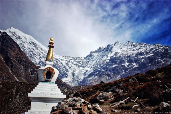
Kyanjin Gompa (3,870 m) sits directly beneath Langtang Lirung (7,227 m) in a spectacular position at the head of the valley. There is an old Buddhist monastery here, a small cheese factory originally established with Swiss assistance, and views of the Lirung glacier tumbling off the mountain.
The afternoon is free to rest or walk gently. Around 3 hours. Overnight at Kyanjin Gompa.
6Day 6Exploration Day at Kyanjin Gompa (3,870 m)
Exploration Day at Kyanjin Gompa (3,870 m)
An essential acclimatisation day before the Ganja La, and one of the best days of the trek in its own right.
The principle is climb high, sleep low, and there are two excellent options. Kyanjin Ri (4,773 m) is the shorter and steeper climb directly above the village, taking three to four hours return, with a panorama of Langtang Lirung, the glaciers and the whole valley. Tserko Ri (4,984 m) is longer and harder — six to seven hours return — but gives an even wider view east toward the Tibetan border peaks.
Either gets you around 1,000 m above sleeping height and back, which is exactly the preparation the pass requires.
Back in the village there is the monastery, the cheese factory and the glacier viewpoint. It is also the last day with lodges, shops and mobile signal.
Spend the evening preparing: the crossing ahead is technical and committing. Overnight at Kyanjin Gompa.
7Day 7Trek from Kyanjin Gompa (3,870 m) to Nyengang Kharka (4,430 m)
Trek from Kyanjin Gompa (3,870 m) to Nyengang Kharka (4,430 m)
The trek leaves the Langtang valley and its lodges behind, climbing 560 m to the first camp beneath the pass.
The trail turns south out of Kyanjin, crosses the Langtang Khola and begins climbing the valley's southern wall. Within an hour the well-trodden main route is behind you and the character of the trip changes completely — from a teahouse trek to a supported camping expedition in empty country.
The climb is steady over open ground, and there is no vegetation to speak of beyond grass and low scrub. Behind you the whole Langtang valley opens out, with Langtang Lirung and its glaciers directly opposite.
This is high pasture where yaks are grazed in summer, and blue sheep are often seen on the slopes above.
Nyengang Kharka (4,430 m) is a herders' grazing ground with no permanent structures — the crew pitches camp. It is cold and exposed. Around 4–5 hours. Overnight camping at Nyengang Kharka.
8Day 8Trek from Nyengang Kharka (4,430 m) to Keldang (4,270 m) via Ganja La Pass (5,130 m)
Trek from Nyengang Kharka (4,430 m) to Keldang (4,270 m) via Ganja La Pass (5,130 m)
Today is the most challenging and adventurous day of the trek as you cross the high Ganja La Pass. Begin early because the route involves steep and rugged terrain, and conditions around the pass can change quickly.
The trail climbs steadily through rocky alpine terrain toward the pass. As you approach Ganja La, the path can become steep and challenging, particularly if snow or ice is present. Reaching the top at 5,130 m is a major achievement and rewards you with spectacular views of the surrounding Himalayan peaks and remote valleys.
After spending some time at the pass, begin the long descent toward Keldang. The trail gradually becomes less steep as you move into the remote Helambu landscape. Arrive at Keldang after a demanding day and rest well.
9Day 9Trek from Keldang (4,270 m) to Dhukpa (4,040 m)
Trek from Keldang (4,270 m) to Dhukpa (4,040 m)
A long day on a high, remote ridge, with less climbing than yesterday but sustained walking at altitude.
After the effort of the pass crossing, today's profile is gentler in net terms — a loss of around 230 m — but the trail undulates persistently along a high ridge system, climbing and dropping across a series of spurs, so the actual work is more than the figures suggest.
This is the most isolated stretch of the trek. There are no settlements, no lodges and no reliable water for long sections, so the crew carries everything. You are unlikely to see another group.
The compensation is the position. The trail follows open ridgelines with views in every direction — north back toward the Langtang peaks, and south over the ranges and valleys of Helambu. Blue sheep and Himalayan griffons are common.
Dhukpa (4,040 m) is another exposed camping ground. Around 6–7 hours. Overnight camping at Dhukpa.
10Day 10Trek from Dhukpa (4,040 m) to Tarkeghyang (2,590 m)
Trek from Dhukpa (4,040 m) to Tarkeghyang (2,590 m)
A long descent of around 1,450 m that brings you off the high ridges and back into inhabited country.
The trail drops steadily south, and the transformation over the course of the day is dramatic. You start on bare alpine ridge with no vegetation, pass through juniper and stunted rhododendron, then into proper rhododendron and oak forest, and finish among terraced fields and houses.
The descent is sustained and hard on the knees — poles are worth using — but the return of oxygen, warmth and greenery after several days above 4,000 m is a considerable relief.
Tarkeghyang (2,590 m) is the largest and most important village in Helambu, and a genuinely interesting place to arrive. It is a Sherpa settlement — the Helambu Sherpa are distinct from those of the Khumbu — with traditional stone houses, an old gompa, mani walls and prayer flags, set on a hillside among apple orchards.
Around 6–7 hours. Overnight in Tarkeghyang.
11Day 11Trek from Tarkeghyang (2,590 m) to Sermathang (2,610 m)
Trek from Tarkeghyang (2,590 m) to Sermathang (2,610 m)
An easy, level day along the Helambu ridge — a genuine rest after the high country.
The net height change is negligible, and the trail contours along the hillside rather than climbing or descending significantly. After the demands of the pass and the ridge camps, this is a pleasant walk rather than a day's work.
The route runs through pine and rhododendron forest, past terraced fields, apple orchards and a string of small Sherpa and Tamang settlements. There are gompas, chortens and mani walls throughout — Helambu is strongly Buddhist and the religious architecture is everywhere along the trail.
On a clear day the views north take in the Langtang range, including the peaks around the pass you crossed, and east toward Dorje Lakpa.
Sermathang (2,610 m) is an attractive village on a broad ridge with an old monastery and wide views over the Melamchi valley. Around 4–5 hours. Overnight in Sermathang.
12Day 12Trek from Sermathang (2,610 m) to Melamchi Pul Bazar (870 m)
Trek from Sermathang (2,610 m) to Melamchi Pul Bazar (870 m)
The final walking day, a long descent of more than 1,700 m to the roadhead.
The trail drops steadily off the Helambu ridge, losing height continuously through the day. The landscape changes accordingly: pine and rhododendron forest gives way to terraced farmland, then to the warm, green, densely cultivated country of the lower valley, with rice paddies and banana palms near the bottom.
The route passes through a series of villages and the walking is on well-used paths, shared with local people going about their day. It is a good final stage for taking in ordinary rural Nepal after two weeks in the mountains.
The heat is noticeable by the afternoon — from a camp at 4,040 m three days ago to under 900 m is a substantial change.
Melamchi Pul Bazar (870 m) is a busy market town on the Melamchi river, and the roadhead where the trek ends. Around 5–6 hours. Overnight in Melamchi Pul Bazar.
13Day 13Drive from Melamchi Pul Bazar (870 m) to Kathmandu (1,400 m)
Drive from Melamchi Pul Bazar (870 m) to Kathmandu (1,400 m)
The drive back to the capital, around 80 km and four to five hours.
The road follows the Melamchi and then the Indrawati river valleys south-west before climbing toward the Kathmandu valley rim. It is a scenic route through terraced farmland, riverside settlements and green hills, and the surface is mixed — rough in sections, sealed closer to the city.
This is also the corridor of the Melamchi Water Supply Project, the long-running scheme that pipes water from this valley to Kathmandu, and you will see elements of the infrastructure along the way.
As you approach the capital the landscape becomes progressively more built up.
You arrive in Kathmandu (1,400 m) and transfer to your hotel. The evening is free — a hot shower after nearly a week of camping, and time for a farewell dinner with the guide and crew. Overnight in Kathmandu.
14Day 14Final Departure from Kathmandu (1,400 m)
Final Departure from Kathmandu (1,400 m)
The last day of the Langtang Ganja La Pass Trek.
Depending on your flight time there may be free hours in the morning. Thamel is the obvious place for last-minute shopping, and Boudhanath — the great stupa at the centre of Kathmandu's Tibetan Buddhist community — connects directly to the gompas and mani walls of Langtang and Helambu.
Our representative collects you from your hotel and transfers you to Tribhuvan International Airport around three hours before departure.
You leave having completed one of the more demanding routes in central Nepal: the full Langtang valley to Kyanjin Gompa, the technical crossing of the Ganja La (5,122 m), several days of remote ridge camping with no lodges or settlements, and a descent into the Sherpa villages of Helambu.
Inclusions & Exclusions
Private transport at both ends, Kathmandu accommodation, teahouse and tented lodging, all trekking meals, national park permits, a licensed guide, group climbing equipment, trekking map, first aid, and government taxes are included, while international flights, visa, insurance, personal gear, porter service, city meals, personal expenses, and tips are excluded.
What's Included
Airport pickup and drop-off services in Kathmandu.
Private transportation from Kathmandu to Syabrubesi and from Melamchi Pul Bazar back to Kathmandu as per the itinerary.
Accommodation in Kathmandu with breakfast.
Accommodation in local teahouses during the trek.
Langtang National Park Entry Permit and required trekking permits.
Professional English-speaking licensed trekking guide.
Three meals a day (breakfast, lunch, and dinner) during the trek.
Group trekking map for route guidance.
First aid kit carried by the guide.
Tented accommodation and a full camp crew for the high-camp sections at Nyengang Kharka, Keldang, and Dhukpa.
Group climbing equipment for the Ganja La Pass crossing, including ropes and fixed line where required.
All government taxes, permit fees, and service charges.
What's Excluded
International flight tickets to and from Nepal.
Nepal entry visa fees.
Travel insurance, including emergency helicopter evacuation coverage.
Personal trekking equipment and clothing.
Porter services (available at an additional cost).
Lunch and dinner in Kathmandu.
Snacks, bottled water, hot showers, Wi-Fi, charging fees, and alcoholic or soft drinks.
Personal expenses such as laundry, phone calls, and souvenirs.
Tips for guides, drivers, and support staff.
Any additional accommodation, transportation, or expenses caused by pass closures, bad weather, or other unforeseen circumstances beyond the itinerary.
Route Map
Explore the terrain map showing the trek route.
Loading map...
Altitude Profile
Pricing
Transparent per-person pricing based on group size, covering the services listed in the itinerary with no hidden charges.
Add-ons
Customize your trek with optional services such as porter support and other personalized arrangements at an additional cost.
Best Time to Trek
The Ganja La crossing decides the season. Late April to May and October to early November are the only windows we recommend, when snow on the pass is consolidated and the weather is settled enough to plan the crossing with reasonable confidence.
Outside those periods the pass is the limiting factor. Winter snow closes Ganja La for months at a time, and monsoon cloud combined with wet rock makes the steep Helambu-side descent hazardous. Even in season, conditions vary considerably year to year, and we build flexibility into the itinerary because a closure means returning down the Langtang valley rather than crossing.
For a month-by-month look at weather and trail conditions, see our guide to the best time to trek in Nepal.
Trek Difficulty & Experience Required
This is a challenging trek and considerably harder than the standard Langtang valley route. Ganja La is a steep pass with a loose, exposed descent on the southern side where a fixed rope is commonly used, and the days beyond it involve long stretches on rough, trackless ground at over 4,000 m with no settlements, no lodges, and no easy escape route.
You should have previous high-altitude trekking experience and be comfortable on steep, loose terrain and with several consecutive nights camping in cold conditions. Build fitness over two to three months with long hill days carrying a pack. If this would be your first Himalayan trek, the Langtang Valley or Langtang Gosaikunda itineraries are far better starting points.
To see where this trek sits among Nepal's routes, read our guide to Nepal trek difficulty grades.
Travel Insurance
Travel insurance covering trekking to at least 6,000 m is mandatory for this itinerary, since Ganja La stands at 5,130 m and the days beyond it stay above 4,000 m. Standard policies almost never extend this high, so you will usually need a specialist adventure add-on — and check that it does not exclude the use of fixed ropes.
Emergency helicopter evacuation and repatriation cover is essential rather than advisable. Between the pass and Tarkeghyang there are no lodges, no road, and no quick way down, and a serious problem at Keldang or Dhukpa is resolved by helicopter, which operators dispatch only against a guarantee of payment. Send us your policy number and the insurer's 24-hour emergency line well before departure.
Our guide to travel insurance for trekking in Nepal explains the altitude limits, evacuation terms and common exclusions to check before you buy.
Altitude, Acclimatization & Safety
The itinerary builds altitude through the Langtang valley and includes an exploration day at Kyanjin Gompa (3,870 m) with optional climbs to Kyanjin Ri or Tsergo Ri, which serve as climb-high, sleep-low acclimatization before the pass. The night at Nyengang Kharka (4,430 m) is a further step up before the crossing itself.
Your guide assesses both the group's condition and the pass conditions before committing to the crossing, and turning back is a genuine possibility rather than a formality. Once past Ganja La there is no quick descent for two days, which is precisely why the decision is made carefully. Drink three to four litres a day, eat properly even when appetite drops, avoid alcohol from Kyanjin Gompa upward, and report symptoms the evening they appear.
Prevention, symptoms and treatment are covered in depth in our guide to altitude sickness in Nepal.
Accommodation, Food & Equipment
Lodging alternates between teahouses and tented camps. Syabrubesi, Lama Hotel, Langtang Village, and Kyanjin Gompa have comfortable rebuilt lodges with twin rooms and warm dining rooms. From Nyengang Kharka through Keldang and Dhukpa there are no permanent lodges at all, so the group camps with a full crew before returning to village teahouses at Tarkeghyang and Sermathang.
All meals are included on the trek. In the valley you eat lodge food — dal bhat, noodle soup, fried rice, momos, eggs, and the well-known Kyanjin yak cheese — while at the high camps our kitchen crew cooks for the group. Group technical equipment for the pass, including rope and fixed line where needed, is provided; personal crampons and an ice axe may be required depending on conditions, and your guide will confirm before departure. Water at the camps comes from streams and snowmelt and must be treated.
What the lodges are really like, from rooms and meals to showers and charging, is covered in our guide to teahouse trekking in Nepal.
Frequently Asked Questions
Find quick answers to common questions about the Langtang Ganja La Pass Trek.
1What happens if Ganja La cannot be crossed?
If your guide judges the pass unsafe, the group returns down the Langtang valley to Syabrubesi and travels to Helambu by road, or ends the trek there. Snow and weather make closures a real possibility in any season, so build flexibility into your onward travel plans.
2Do I need technical climbing skills?
No climbing skills are required, but you must be comfortable descending steep, loose ground on a fixed rope, which your guide sets and briefs. Crampons are sometimes needed on the northern approach depending on snow conditions.
3How many hours do we walk each day?
Six to eight hours on most days. The pass day is the longest at nine to eleven hours from a pre-dawn start, and the days at Keldang and Dhukpa are long stretches on rough, trackless ground with no lodges to stop at.
4Which permits are required and do you arrange them?
You need the Langtang National Park Entry Permit and trekking registration, both included and arranged by our team from passport copies and photographs sent in advance. No restricted-area permit applies to this route.
5How cold does it get at the high camps?
Nights at Nyengang Kharka, Keldang, and Dhukpa regularly fall to -15°C or below, colder with wind. A four-season sleeping bag rated to -20°C and an insulated sleeping mat are essential rather than optional on this trek.
6Is there mobile network beyond the pass?
Coverage reaches most of the Langtang valley and returns in Helambu, but there is effectively no signal between Kyanjin Gompa and Tarkeghyang. Expect to be entirely offline for three to four days, and our guides carry a satellite communication device for emergencies.
7Where can I withdraw cash and charge devices?
There are no ATMs on the route and only an unreliable one in Dhunche, so carry all your Nepalese rupees from Kathmandu. Charging is available at valley and Helambu lodges but not at the high camps, so bring a large power bank and spare batteries.
8How large are the groups and what support is provided?
Groups are kept small and led by a licensed guide with specific Ganja La experience, supported by a camp crew and additional staff for the pass section. The support ratio is much higher than on a teahouse trek because of the camping days.
9Can I do this trek without camping?
No. There are no lodges between Kyanjin Gompa and Tarkeghyang, so the camping section is unavoidable. If you would rather stay in teahouses throughout, the Langtang Gosaikunda Lake Trek covers similar country entirely in lodges.
10Can I leave extra luggage in Kathmandu?
Yes. Your Kathmandu hotel stores anything you do not need on the trail free of charge until you return, which is worth using given how carefully weight is managed on a camping itinerary.
Gallery
Explore authentic moments, landscapes, and mountain views from the Langtang Ganja La Pass Trek.
Trekking Guides & Articles
Langtang Ganja La Pass Trek: The Complete Guide — The Langtang valley followed by a genuinely committing crossing: the Ganja La at 5,130 m, often snow-covered.
Tilman Pass Trek: The Complete Guide — A 5,350 m glaciated crossing from the head of the Langtang valley to the sacred lakes at Panch Pokhari, named for the mountaineer who explored it in 1949.
Trekking First Aid Kit for Nepal: Every Medicine Worth Carrying — A personal medical kit for a Nepal trek should weigh under 400 g and cover the things that actually happen: headaches, stomach trouble, blisters, coughs and sunburn.
Langtang Valley Trek: The Complete Guide — The closest big Himalayan valley to Kathmandu — no flight, no restricted permit, and a glacier-head village at 3,870 m with a 4,773 m viewpoint above it.
Naya Kanga Peak Climbing: The Complete Guide — A trekking peak with a genuine mountaineering summit day, directly opposite Kyanjin Gompa.
Fix Departure
This trek runs every week on the selected day. Choose custom dates for one-off departures.
Showing fixed departures in Oct 2026
Guest Reviews
The best trekking experience yet
“I have done a few Himalayan treks and this one stands out for all the right reasons. Our guide was fantastic — knowledgeable about the mountains, the culture and exactly when we needed a break. The pa...
Samuel Chavez
Get in Touch
Tell us the dates you have in mind and roughly what you want out of the trek — one of our guides will reply, usually within 24 hours.
Email Us
info@greencompasstreks.com
Call Us
+977 9864379436
Office
Lakeside, Pokhara, Nepal
Office Hours
Sunday – Friday, 9:00 AM – 9:00 PM
Similar Treks
You might also like these treks
Porter
$462 $420/porter
No payment required yet