

Makalu Base Camp Trek
The Makalu Base Camp Trek is an adventurous 18-day journey into one of Nepal’s most remote and spectacular Himalayan reg
Porter
$578 $525/porter
No payment required yet
Trip Overview
The Makalu Base Camp Trek is an adventurous 18-day journey into one of Nepal’s most remote and spectacular Himalayan regions. The trek takes you from Kathmandu to Tumlingtar before entering the Makalu-Barun Valley, where you walk through traditional mountain villages, dense forests, high-altitude landscapes, and rugged mountain passes.
The trail gradually climbs through Num, Seduwa, Tashi Gaun, Khongma, Dobato, Yangle Kharka, and Langmale Kharka before reaching Makalu Base Camp at 4,870 m. An acclimatization day at Tashi Gaun and an exploration day at base camp provide valuable time to adjust to the altitude and experience the remote Himalayan environment.
After reaching Makalu Base Camp, the journey retraces the trail back toward Num and Tumlingtar before flying to Kathmandu. With challenging terrain, remote settlements, limited facilities, and significant altitude gain, this trek is best suited to trekkers with good fitness and a strong sense of adventure.
Trip Higlights
Reach Makalu Base Camp (4,870 m): Trek to the remote base camp of Mount Makalu and enjoy breathtaking views of Makalu and surrounding Himalayan peaks.
Cross High Mountain Passes: Experience challenging sections around Khongma with spectacular views of rugged Himalayan landscapes and alpine terrain.
Trek Through the Makalu-Barun Valley: Explore one of Nepal’s most remote trekking regions, surrounded by dramatic valleys, forests, glaciers, and high mountains.
Experience Remote Mountain Villages: Walk through traditional settlements including Num, Seduwa, Tashi Gaun, Khongma, and Yangle Kharka while experiencing authentic Himalayan life.
Explore Makalu Base Camp: Spend an extra day at base camp to enjoy panoramic mountain views, explore the surrounding landscapes, and experience the wilderness beneath Mount Makalu.
Itinerary
A scenic 18-day journey to Makalu Base Camp through remote villages, alpine landscapes, high mountain passes, and spectacular Himalayan scenery.
1Day 1Arrival in Kathmandu (1,400 m)
Arrival in Kathmandu (1,400 m)
You arrive at Tribhuvan International Airport in Kathmandu (1,400 m) and are met by our representative for the transfer to your hotel in Thamel.
Your guide runs the pre-trek briefing. The Makalu Base Camp trek walks up the Barun valley to 4,870 m, directly beneath Makalu (8,485 m) — the fifth-highest mountain in the world. The route runs through the Makalu Barun National Park, a conservation area that spans everything from subtropical forest to permanent ice and is one of the richest biodiversity zones in the Himalaya.
This is a genuinely remote trek. There are long stretches with no permanent settlement, the lodges are basic and seasonal, and the route crosses three passes above 4,000 m on the way in. Your guide checks kit carefully — a four-season sleeping bag, a proper down jacket and boots with real grip are all necessary. Overnight in Kathmandu.
2Day 2Fly from Kathmandu (1,400 m) to Tumlingtar (518 m) and Drive to Num (1,560 m)
Fly from Kathmandu (1,400 m) to Tumlingtar (518 m) and Drive to Num (1,560 m)
An early flight east to Tumlingtar (518 m), a short strip in the Arun valley. The flight takes around 45 minutes and, on a clear morning, gives a long view of the eastern Himalaya — Everest, Makalu and Kanchenjunga strung along the northern horizon.
Tumlingtar sits low and warm in the Arun valley, one of the deepest river valleys in the world and the only river that cuts clean through the main Himalayan range from Tibet. From the airstrip we transfer to a jeep for the drive north.
The road climbs steadily out of the valley on rough track through terraced farmland and villages, gaining over 1,000 m in four to five hours. Num (1,560 m) sits on a ridge above the confluence of the Arun and Barun rivers, with a fine view down into both valleys. This is where the walking starts. Overnight in a lodge.
3Day 3Trek from Num (1,560 m) to Seduwa (1,500 m)
Trek from Num (1,560 m) to Seduwa (1,500 m)
A deceptive day — the start and end points differ by only 60 m, but the walking between them is anything but flat.
The trail drops steeply from the ridge at Num all the way down to the Arun River at around 700 m, losing more than 800 m on a long series of stone steps through terraced farmland and subtropical forest. It is hot work, and the descent is hard on the knees.
At the bottom the trail crosses the Arun on a suspension bridge, and then the whole thing goes into reverse: a sustained climb of 800 m up the far side, through villages, rice terraces and cardamom plantations. This is a substantial day of effort for no net height gain at all.
Seduwa (1,500 m) is a spread-out village on the hillside where you register at the Makalu Barun National Park entry post. Overnight in a lodge.
4Day 4Trek from Seduwa (1,500 m) to Tashi Gaun (2,070 m)
Trek from Seduwa (1,500 m) to Tashi Gaun (2,070 m)
A steady climbing day through farmland and forest, gaining around 570 m at a much kinder gradient than yesterday.
The trail climbs north through a landscape of terraced fields — millet, maize and cardamom — passing scattered Rai villages where the trail runs straight through the middle of daily life. Chickens, buffalo, drying grain and children going to school are all part of the walk.
Higher up the farmland gives way to forest, and the vegetation begins the transition that defines this trek: from subtropical to temperate, with oak, chestnut and the first rhododendron. Birdlife along this section is exceptional.
Tashi Gaun (2,070 m) is the last permanent village on the route — a Sherpa settlement of stone houses with a small gompa, set on a shelf with views back down the Arun valley. Beyond here there are no more villages until you come back down, only seasonal herders' huts and lodges. Overnight in Tashi Gaun.
5Day 5Acclimatization at Tashi Gaun (2,070 m)
Acclimatization at Tashi Gaun (2,070 m)
A rest and acclimatisation day before the hardest climbing section of the trek. Tomorrow gains nearly 1,700 m to cross the first pass, so a day spent adjusting here pays for itself.
The usual walk climbs the forested ridge above the village for a few hundred metres — enough to help acclimatisation without tiring anyone out — and gives a good view up toward the wall you will climb tomorrow, as well as back down the Arun valley.
The rest of the day is best spent in the village. Tashi Gaun is a Sherpa settlement, though the community here has a distinct identity from the Khumbu Sherpas, and it has changed relatively little because so few trekkers come this way. It is worth visiting the small gompa and simply watching the village work — this is the last real settlement you will see for over a week. Overnight in Tashi Gaun.
6Day 6Trek from Tashi Gaun (2,070 m) to Khongma (3,760 m)
Trek from Tashi Gaun (2,070 m) to Khongma (3,760 m)
The hardest day of the approach — nearly 1,700 m of ascent, almost all of it steep, taking seven to eight hours.
The trail climbs relentlessly out of Tashi Gaun through dense rhododendron and oak forest. In spring this is one of the finest rhododendron sections in Nepal, with the trees flowering red and pink overhead for hours at a time. The path is often wet and rooty, and there are sections of rough stone steps.
As the height increases the forest thins into dwarf rhododendron and juniper, and the trail crosses the small lake at Unshisa before the final climb. The last section is genuinely tough — steep, exposed and at an altitude where everything slows down.
Khongma (3,760 m) is a bleak spot: a couple of basic lodges on an open shoulder, often in cloud, and cold once the sun goes. But the views back over the ridges toward Kanchenjunga on a clear evening are exceptional. Overnight in Khongma.
7Day 7Trek from Khongma (3,760 m) to Dobato (3,610 m)
Trek from Khongma (3,760 m) to Dobato (3,610 m)
The pass day, and the most spectacular of the approach. Although the start and finish differ by only 150 m, the trail crosses three passes in between.
The route climbs from Khongma over Shipton La at around 4,220 m, then Keke La at about 4,170 m and Tutu La at roughly 4,100 m, dropping and re-climbing between each. The terrain is open alpine — boulder fields, small tarns and stunted juniper — and the passes are strung with prayer flags.
The views are the reward. From the top of the passes the panorama takes in Makalu (8,485 m) ahead, Chamlang (7,319 m), Peak 6 and Peak 7, and on clear days Kanchenjunga far to the east. This is the moment the trek's objective finally becomes visible.
The trail then descends steeply into the Barun valley to Dobato (3,610 m), a small clearing with basic shelters. Overnight in Dobato.
8Day 8Trek from Dobato (3,610 m) to Yangle Kharka (3,557 m)
Trek from Dobato (3,610 m) to Yangle Kharka (3,557 m)
A day of descent into the Barun valley proper, and a complete change of scenery from the open passes.
The trail drops steeply from Dobato through dense forest to the floor of the Barun valley, losing several hundred metres before turning north to follow the river upstream. The descent is steep and often slippery, on a rough path through rhododendron and fir.
Once on the valley floor the walking becomes gentler, following the Barun Khola through some of the most impressive scenery of the trek: a deep, glacially carved valley with sheer walls rising thousands of metres on both sides, waterfalls dropping from hanging valleys, and huge boulders scattered across the floor. This is a designated strict nature reserve, and the forest here is essentially untouched.
Yangle Kharka (3,557 m) is a seasonal yak pasture with a few stone huts and simple lodges on a flat beside the river. Overnight in Yangle Kharka.
9Day 9Trek from Yangle Kharka (3,557 m) to Langmale Kharka (4,410 m)
Trek from Yangle Kharka (3,557 m) to Langmale Kharka (4,410 m)
A steady climb up the Barun valley, gaining around 850 m and taking you above the treeline for good.
The trail follows the river north through Nehe Kharka and Mumbuk, passing through the last of the birch and juniper. The valley walls close in, and waterfalls pour off the cliffs on both sides — in some places the trail passes directly beneath them.
As the trees give out the landscape turns to open alpine meadow and moraine, and the peaks at the head of the valley come fully into view: Makalu (8,485 m) ahead, Chamlang and Peak 6 to the south, and the huge ice walls of Tutse and Peak 7. Yak herds graze the meadows in season.
Langmale Kharka (4,410 m) is a summer pasture with a handful of stone shelters and a lodge or two, set in a broad basin. It is properly cold here and the altitude is now significant. Overnight in Langmale Kharka.
10Day 10Trek from Langmale Kharka (4,410 m) to Makalu Base Camp (4,870 m)
Trek from Langmale Kharka (4,410 m) to Makalu Base Camp (4,870 m)
The day you reach base camp — around 460 m of ascent, but slow going at this altitude and on this terrain.
The trail climbs up the valley over glacial moraine and boulder fields alongside the Barun Glacier, passing the seasonal shelters at Shershong. There is no vegetation now beyond cushion plants and lichen; the landscape is entirely rock, ice and sky, and the sense of scale is enormous.
Makalu Base Camp (4,870 m) sits on a flat of moraine and grass beneath the mountain, and the arrival is genuinely dramatic. The south face of Makalu (8,485 m) rises straight ahead in a single sweep of rock and ice — a pyramid of a mountain, and one of the most impressive faces in the Himalaya. Everest and Lhotse are visible to the north-west, and Baruntse and Chamlang close the valley behind.
Overnight at base camp in a basic lodge or tented camp.
11Day 11Explore Makalu Base Camp (4,870 m)
Explore Makalu Base Camp (4,870 m)
A full day at base camp — and after eight days of walking to get here, a day to actually look at it.
The main excursion climbs the moraine ridge behind base camp toward the viewpoint at around 5,250 m, a steep but non-technical ascent of two to three hours. From the top the panorama is one of the finest in the Himalaya: Makalu at close range, and to the north-west a clear view of the Everest–Lhotse massif and the Kangshung face, seen from an angle almost nobody gets to.
Closer options include a walk out onto the Barun Glacier moraine with your guide, or up toward the base of Peak 4 and the ice lakes. In the spring climbing season there are usually expedition tents on the flats, and the atmosphere of a working 8,000 m base camp is worth experiencing.
Whatever you do, take it slowly and drink constantly at this height. Overnight at Makalu Base Camp.
12Day 12Trek from Makalu Base Camp (4,870 m) to Yangle Kharka (3,557 m)
Trek from Makalu Base Camp (4,870 m) to Yangle Kharka (3,557 m)
A long descending day back down the Barun valley, giving up more than 1,300 m.
It is worth being outside at first light before setting off — the sunrise on Makalu's south face from base camp is the best view of the trek, and the mountain lights up long before the valley floor does.
The trail then retraces the route down the moraine past Shershong to Langmale Kharka (4,410 m), where we usually stop, and continues down through the alpine meadows into the upper Barun valley. The vegetation returns in stages — cushion plants, then juniper, then birch — and the air thickens noticeably with every hour.
Below Mumbuk and Nehe Kharka the valley walls close in again and the waterfalls reappear. The day ends at Yangle Kharka (3,557 m), back among the trees. Overnight in a lodge.
13Day 13Trek from Yangle Kharka (3,557 m) to Khongma (3,760 m)
Trek from Yangle Kharka (3,557 m) to Khongma (3,760 m)
A hard day, and one people tend to underestimate because the net gain is only 200 m. In fact it involves a steep climb out of the Barun valley and then the three passes again.
The trail leaves the valley floor and climbs sharply through the forest back up to Dobato (3,610 m) — a sustained ascent of several hundred metres on a rough, root-bound path. From there the route recrosses Tutu La, Keke La and Shipton La, dropping and climbing between each.
Crossing the passes in this direction gives the better views, because Makalu and Chamlang are now behind you and the eastern panorama toward Kanchenjunga opens up ahead. On a clear day this is the finest hour of the return journey.
The trail descends the last stretch to Khongma (3,760 m). It is a long day with a lot of cumulative ascent. Overnight in Khongma.
14Day 14Trek from Khongma (3,760 m) to Seduwa (1,500 m)
Trek from Khongma (3,760 m) to Seduwa (1,500 m)
An enormous descending day — more than 2,250 m — and the one that gives your knees the hardest time of the whole trek.
The trail drops steeply from Khongma past the lake at Unshisa and down into the rhododendron forest, losing height fast on wet, rooty, uneven ground. The descent to Tashi Gaun (2,070 m) takes several hours, and it is worth stopping there for lunch and to see the village again on the way out.
Below Tashi Gaun the trail continues down through the terraced farmland of the lower valley, past Rai settlements and cardamom plantations, with the temperature and humidity climbing steadily. By mid-afternoon you are back in subtropical country.
Seduwa (1,500 m) is reached in the late afternoon, and you check out of the Makalu Barun National Park here. Poles are strongly recommended today. Overnight in a lodge.
15Day 15Trek from Seduwa (1,500 m) to Num (1,560 m) and Drive to Tumlingtar (518 m)
Trek from Seduwa (1,500 m) to Num (1,560 m) and Drive to Tumlingtar (518 m)
The last walking day, and it repeats the sting of day two in reverse: a long steep drop to the Arun River at around 700 m, then a sustained 800 m climb back up the other side to Num.
The descent through terraced fields and forest is quick but hard on tired legs. At the bottom the trail crosses the Arun on a suspension bridge, and then the climb begins — hot, exposed in places, and a genuine effort at the end of two weeks of walking. Take it steadily.
Num (1,560 m) is reached around midday, and the walking ends there. A jeep takes us down the rough road through the terraced hills to Tumlingtar (518 m), four to five hours away in the Arun valley. It is warm and low here, and there are hot showers and cold drinks. Tonight is the celebration dinner with your guide and porters. Overnight in Tumlingtar.
16Day 16Fly from Tumlingtar (518 m) to Kathmandu (1,400 m) and Transfer to Hotel
Fly from Tumlingtar (518 m) to Kathmandu (1,400 m) and Transfer to Hotel
A short flight west back to the capital, taking about 45 minutes. Mountain flights in Nepal go early, so expect a morning departure — and, as always with domestic services, some flexibility on timing if the weather is poor.
On a clear morning the flight gives a final view of the range you have just walked into: Makalu, Everest and Lhotse along the northern horizon, with the Arun valley cutting through the mountains below. It is a good way to see the trek in context.
Arriving in Kathmandu (1,400 m) you transfer to your hotel, with the rest of the day free. After more than two weeks in basic lodges — several of them above 4,000 m — a hot shower, clean clothes and a proper meal are genuinely welcome. Thamel is a short walk for anything you need. Overnight in Kathmandu.
17Day 17Departure from Nepal
Departure from Nepal
Your final day in Nepal. If your flight is later in the day there is time to see more of the Kathmandu Valley — Boudhanath Stupa, Pashupatinath Temple and Swayambhunath are all a short drive from Thamel and each worth an hour.
Our representative will collect you from your hotel and transfer you to Tribhuvan International Airport approximately three hours before your scheduled departure.
The Makalu Base Camp trek is one of the wildest routes in Nepal — a walk from subtropical cardamom terraces through untouched rhododendron forest and over three alpine passes into a glacial valley beneath the world's fifth-highest mountain, with barely a village along the way. If you enjoyed the remoteness, the Kanchenjunga treks and the Everest Three Passes route cover comparable ground. Safe travels.
Route Map
Follow the detailed route map to understand the complete Makalu Base Camp Trek from Kathmandu to Makalu Base Camp and back through the remote Makalu-Barun Valley.
Loading map...
Altitude Profile
Inclusions & Exclusions
Flights, transport, accommodation, meals, permits, guide, and taxes are included; international flights, visa, insurance, gear, porter, personal expenses, tips, and unforeseen costs are excluded.
What's Included
What's Included
Airport pickup and drop-off services in Kathmandu.
Domestic flights from Kathmandu to Tumlingtar and Tumlingtar to Kathmandu.
Ground transportation between Tumlingtar, Num, and Tumlingtar as per the itinerary.
Accommodation in Kathmandu with breakfast.
Accommodation in local teahouses during the trek.
All required trekking permits and official fees.
Professional English-speaking licensed trekking guide.
Three meals a day (breakfast, lunch, and dinner) during the trek.
Group trekking map for route guidance.
First aid kit carried by the guide.
All government taxes, permit fees, and service charges.
What's Excluded
International flight tickets to and from Nepal.
Nepal entry visa fees.
Travel insurance, including emergency helicopter evacuation coverage.
Personal trekking equipment and clothing.
Porter services (available at an additional cost).
Lunch and dinner in Kathmandu.
Snacks, bottled water, hot showers, Wi-Fi, charging fees, and alcoholic or soft drinks.
Personal expenses such as laundry, phone calls, and souvenirs.
Tips for guides, drivers, and support staff.
Any additional accommodation, transportation, or expenses caused by flight delays, bad weather, natural disasters, or other unforeseen circumstances beyond the itinerary.
Pricing
Our Makalu Base Camp Trek pricing covers essential trekking services, with transparent costs for accommodation, meals, transportation, permits, and guide services.
Add-ons
Enhance your Makalu Base Camp Trek with optional services and extra comforts tailored to your preferences.
Best Time to Trek Makalu Base Camp
The best time for the Makalu Base Camp Trek is generally spring (March to May) and autumn (September to November). These seasons offer more stable weather, clearer mountain views, and better trail conditions.
Spring: March to May
Spring is one of the best periods for trekking in the Makalu region. The lower sections become greener, and rhododendron forests are often in bloom. Temperatures are comfortable at lower elevations, while higher areas remain cold.
March: Cool conditions with a possibility of snow at higher elevations.
April: Excellent trekking conditions with warmer weather and clear skies.
May: Generally warm at lower elevations, although clouds can increase toward the end of the month.
Autumn: September to November
Autumn is another excellent trekking season after the monsoon. The air is generally clear, trails are in good condition, and mountain visibility is often excellent.
September: Early September can still receive some rainfall, but conditions usually improve.
October: One of the best months for the trek, with stable weather and clear skies.
November: Cooler temperatures, especially at higher elevations, but generally good trekking conditions.
Winter: December to February
Winter is possible for experienced trekkers but is considerably more challenging. Snow and freezing temperatures can affect the higher sections, particularly around Khongma and Makalu Base Camp. Some teahouses may also have limited services.
Monsoon: June to August
The Makalu region receives significant rainfall during the monsoon. Lower trails can become muddy and slippery, while landslides and cloudy conditions may affect transportation and mountain visibility.
Best overall months: April, May, October, and November.
For a month-by-month look at weather and trail conditions, see our guide to the best time to trek in Nepal.
Makalu Base Camp Trek Difficulty & Fitness
The Makalu Base Camp Trek is considered a challenging trek because of its remote location, long walking days, steep ascents and descents, and significant altitude gain. It is more demanding than many of Nepal's popular teahouse treks.
You should be comfortable walking for approximately 5–8 hours per day on mountainous terrain. Some days can involve steep climbs, rocky trails, uneven paths, and sections with considerable elevation gain.
What makes the trek challenging?
Long trekking days
Steep ascents and descents
High-altitude walking
Remote and less-developed trails
Limited facilities in the higher sections
Cold conditions around the base camp
Several days above 3,000 m
Maximum overnight elevation of around 4,870 m
You do not necessarily need technical mountaineering experience, but good physical fitness and previous trekking experience are highly recommended.
How to prepare
Start preparing several weeks before the trek with regular:
Hiking and uphill walking
Stair climbing
Cardio exercises
Leg-strengthening exercises
Long weekend hikes with a backpack
Gradual practice on uneven terrain
The most important preparation is not speed but endurance. Being able to walk steadily for several hours while carrying a daypack is more useful than trying to walk very fast.
To build that fitness step by step, follow our 12-week training plan for a Nepal trek.
Altitude & Acclimatization
Altitude is one of the most important factors to consider on the Makalu Base Camp Trek. The route gradually climbs from the lowlands toward nearly 5,000 m, so proper acclimatization and a steady pace are essential.
The itinerary includes an acclimatization day at Tashi Gaun before continuing toward the higher sections. This allows your body additional time to adjust before gaining more elevation.
Important altitude points
Kathmandu: 1,400 m
Num: 1,560 m
Tashi Gaun: 2,070 m
Khongma: 3,760 m
Dobato: 3,610 m
Yangle Kharka: 3,557 m
Langmale Kharka: 4,410 m
Makalu Base Camp: 4,870 m
What is altitude sickness?
Altitude sickness can occur when the body has difficulty adapting to reduced oxygen levels at higher elevations. Symptoms can include:
Headache
Dizziness
Nausea
Loss of appetite
Unusual tiredness
Difficulty sleeping
Shortness of breath
Mild symptoms should never be ignored, particularly if they become worse.
How to reduce the risk
Walk slowly and maintain a comfortable pace.
Stay properly hydrated.
Avoid excessive alcohol.
Get enough rest and sleep.
Follow your guide's recommendations.
Do not continue ascending if significant altitude-sickness symptoms are developing.
Descend immediately if serious symptoms appear.
Your guide should monitor your condition throughout the trek and help determine whether it is safe to continue.
Prevention, symptoms and treatment are covered in depth in our guide to altitude sickness in Nepal.
Accommodation, Food & Drinking Water
Accommodation on the Makalu Base Camp Trek is mainly in local teahouses and lodges. Facilities become increasingly basic as you travel deeper into the remote Makalu-Barun region.
Accommodation
Most teahouses provide simple rooms, usually with:
Twin beds
Mattresses
Blankets
Pillows
Shared bathroom facilities
At higher elevations, accommodation can be more basic and availability may be limited. During busy seasons, rooms can fill quickly, so traveling with an organized trek and guide is beneficial.
Food
Teahouses generally provide simple but filling meals designed to provide energy for long trekking days.
Common options include:
Dal bhat
Rice
Noodles
Pasta
Soups
Potatoes
Tibetan bread
Eggs
Porridge
Pancakes
Tea and coffee
Dal bhat is particularly popular because it provides a substantial combination of rice, lentils, vegetables, and curry.
As you climb higher, food choices may become more limited because supplies need to be transported into remote areas.
Drinking Water
You can usually obtain drinking water from teahouses, lodges, or local water sources along the route. For safety, water should be properly treated or filtered before drinking.
Recommended options include:
Water purification tablets
Portable water filters
UV purification devices
Reusable water bottles
Bottled water may be available in some lower sections but becomes less practical and more expensive at higher elevations. Carrying a reusable bottle and treating local water is generally a better option.
Showers, Charging & Wi-Fi
Facilities become increasingly limited as you move toward Makalu Base Camp. Hot showers, electricity, Wi-Fi, and phone charging may be available at some teahouses but should not be expected everywhere, particularly in the higher sections.
What the lodges are really like, from rooms and meals to showers and charging, is covered in our guide to teahouse trekking in Nepal.
Packing List & Trekking Permits
Because the Makalu Base Camp Trek reaches nearly 5,000 m and passes through remote areas, packing appropriately is essential. Your equipment should cover warm clothing, rain protection, trekking comfort, and high-altitude conditions.
Essential Clothing
Moisture-wicking base layers
Fleece or warm mid-layer
Down or insulated jacket
Waterproof jacket
Waterproof trekking trousers
Comfortable trekking pants
Thermal underwear
Warm hat
Sun hat
Gloves
Warm socks
Waterproof hiking boots
Trekking Equipment
Backpack
Daypack
Sleeping bag suitable for cold temperatures
Trekking poles
Headlamp with spare batteries
Sunglasses
Water bottles
Water purification system
Personal first-aid supplies
Sunscreen and lip balm
Personal toiletries
Power bank
Small waterproof/dry bags
High-Altitude Essentials
Since the trek reaches nearly 5,000 m, bring adequate protection against cold, strong sunlight, and changing weather. A good sleeping bag, insulated jacket, gloves, warm socks, and reliable waterproof footwear are particularly important.
Permits
The Makalu Base Camp Trek requires the necessary trekking permits and conservation-area/national-park permits for the route. The exact permits and fees can depend on the current regulations and route.
When trekking with an organized agency, the required permits are normally arranged by the trekking company, so you do not need to manage the application process yourself.
It is also important to carry your passport and relevant travel documents, as they may be required during permit checks along the route.
For the complete kit list, organised by the altitude you will reach, see our Nepal trekking packing list.
Frequently Asked Questions
Find answers to common questions about the Makalu Base Camp Trek, including difficulty, permits, accommodation, connectivity, safety, and practical trekking information.
1How long does the Makalu Base Camp Trek take?
The standard itinerary takes 17 days, including the arrival and departure days, domestic flights, trekking days, acclimatization, and a day to explore Makalu Base Camp.
2Do I need previous high-altitude trekking experience?
Previous trekking experience is recommended but not absolutely required. However, because the trek is challenging and reaches high elevations, you should have good physical fitness and be comfortable with long days of walking.
3Is a guide mandatory for the Makalu Base Camp Trek?
Yes. The Makalu region is remote and the trail can be difficult to navigate, so trekking with a licensed guide is strongly recommended and helps with route navigation, accommodation, permits, and emergencies.
4Is there mobile phone coverage during the trek?
Mobile coverage is available in some lower settlements but becomes limited or unavailable in remote sections. Coverage can vary depending on the location, weather, and network provider.
5Can I use ATMs during the Makalu Base Camp Trek?
No. There are no reliable ATM facilities along the remote trekking route. It is important to carry enough Nepalese rupees from Kathmandu or another major town before starting the trek.
6How much cash should I carry for the trek?
The amount depends on your personal spending habits and what services are already included in your package. Carry enough cash for drinks, snacks, charging, hot showers, tips, and other personal expenses, with some extra for emergencies.
7Is the Makalu Base Camp Trek suitable for solo travelers?
Yes, but solo travelers should arrange a licensed guide and proper logistics because the route is remote and has limited facilities. Traveling with a guide provides additional support throughout the journey.
8What happens if the flight between Kathmandu and Tumlingtar is delayed?
Domestic flights can sometimes be affected by weather or operational conditions. If a flight is delayed or cancelled, the itinerary may need to be adjusted, and additional accommodation or transportation costs may apply depending on the circumstances.
9Can I charge my phone and camera batteries during the trek?
Charging facilities are available at some teahouses, but availability becomes limited in remote areas. It is recommended to carry a power bank and spare batteries, especially for cameras and other essential devices.
10What happens in case of an emergency during the trek?
Your guide will coordinate the appropriate response, which may include arranging medical assistance or evacuation if necessary. Trekkers should have travel insurance that specifically covers high-altitude trekking and emergency evacuation, including helicopter evacuation where applicable.
Gallery
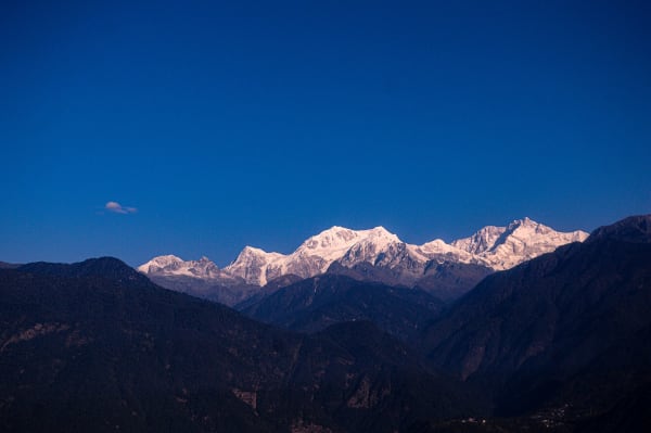
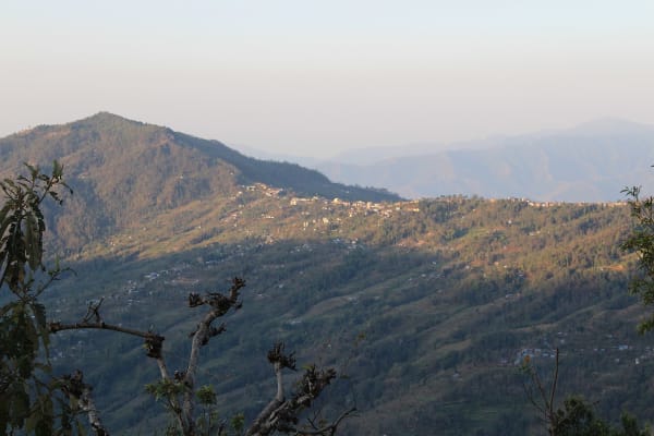
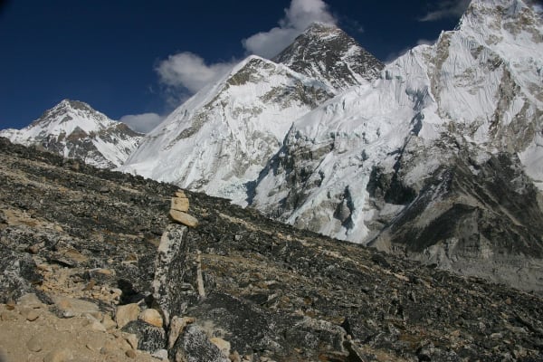
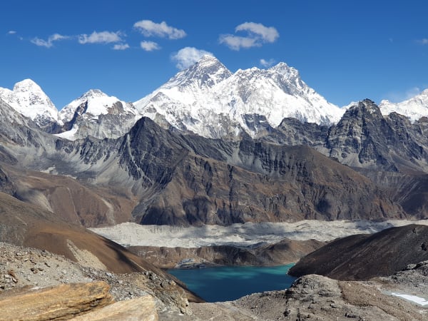
Explore real trekking landscapes, remote villages, high-altitude trails, and the dramatic Makalu Base Camp through our gallery.
Trekking Guides & Articles
Makalu Base Camp Trek: The Barun Valley — A walk up one of the least-visited valleys in the Himalaya to the base camp of the world's fifth-highest mountain.
Makalu Expedition: The Complete Guide — The fifth-highest mountain on earth and the hardest of Nepal's 8,000 m peaks by its normal route.
Sherpani Col Passes Trek: The Complete Guide — The hardest walking route in Nepal: Makalu Base Camp to the Khumbu over three glaciated passes, two of them above 6,000 m, through a closed basin with no exit but forward.
Mundum Trail Trek: Kirat Culture in the Eastern Hills — A new homestay trail through the Khotang and Bhojpur hills, built around Kirat Rai culture and the Mundhum oral tradition.
Off the Beaten Path Treks in Nepal: 15 Routes Almost Nobody Walks — Everest and Annapurna take most of Nepal's trekkers.
Chamlang Expedition: The Complete Guide — The long white wall closing the western side of the Barun, and one of the least-climbed 7,000 m peaks in Nepal.
Fix Departure
This trek runs every week on the selected day(s). Choose custom dates for one-off departures.
Showing fixed departures in Oct 2026
Guest Reviews
Flawless from start to finish
“We picked Makalu Base Camp Trek after a lot of research and it did not disappoint. The pace was just right: challenging enough to feel like an achievement, relaxed enough to actually enjoy it. Thank y...
Jeremiah Peterson
Get in Touch
Tell us the dates you have in mind and roughly what you want out of the trek — one of our guides will reply, usually within 24 hours.
Email Us
info@greencompasstreks.com
Call Us
+977 9864379436
Office
Lakeside, Pokhara, Nepal
Office Hours
Sunday – Friday, 9:00 AM – 9:00 PM
Similar Treks
You might also like these treks
Porter
$578 $525/porter
No payment required yet