

Upper Mustang Trek from Pokhara
The Upper Mustang Trek from Pokhara reaches the former Kingdom of Lo in twelve days, starting and finishing with a mount
Porter
$462 $420/porter
No payment required yet
Trip Overview
The Upper Mustang Trek from Pokhara reaches the former Kingdom of Lo in twelve days, starting and finishing with a mountain flight from Pokhara and skipping the Kathmandu transfers entirely. North of Kagbeni the trail enters a restricted Tibetan Buddhist region closed to outsiders until 1992, where eroded red and ochre cliffs, ancient cave dwellings, and walled mud-brick villages sit on a treeless high plateau.
The route climbs through Chele, Syangboche, Ghami, and Charang to the walled capital of Lo Manthang (3,770 m), with its royal palace, three great fifteenth-century monasteries, and intact city wall. An exploration day takes in the remarkable Chhoser sky caves, a multi-storey dwelling carved into a cliff face. The return follows a different line through Dhakmar and Ghiling before the flight back from Jomsom.
Trip Highlights
Twelve Days from Pokhara: Reach the Kingdom of Lo and return without a single Kathmandu transfer day.
Walled Lo Manthang (3,770 m): Spend an exploration day inside a fifteenth-century capital with its palace, monasteries, and city wall intact.
The Chhoser Sky Caves: Climb through a multi-storey cliff dwelling carved into the rock, one of the Himalaya's most extraordinary sites.
A Restricted Tibetan Region: Trek an area closed to outsiders until 1992 that preserves Tibetan Buddhist life more completely than Tibet itself.
Dhakmar and the Red Cliffs: Return by a different route past the dramatic red cliffs of Dhakmar and Nepal's longest mani wall.
Itinerary
A 12-day Pokhara-to-Pokhara trek into the restricted Kingdom of Lo, with return Jomsom flights, walled Lo Manthang, and the Chhoser sky caves.
1Day 1Fly from Pokhara (822 m) to Jomsom (2,700 m) and Trek to Kagbeni (2,800 m)
Fly from Pokhara (822 m) to Jomsom (2,700 m) and Trek to Kagbeni (2,800 m)
The trek begins with one of the most spectacular short flights in Nepal.
The 20-minute flight from Pokhara to Jomsom (2,700 m) runs straight up the Kali Gandaki gorge, between Annapurna I (8,091 m) and Dhaulagiri (8,167 m) — the deepest valley on earth, measured from the summits either side. Flights go early because the valley wind rises sharply by mid-morning.
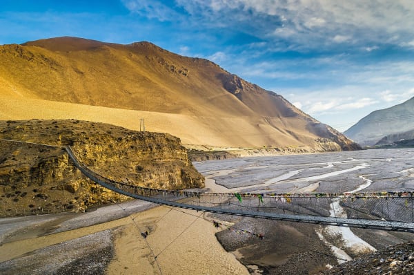
At Jomsom you meet the crew, complete permit formalities and start walking north along the riverbed. The landscape is already unlike the rest of Nepal: this is the rain shadow behind the Annapurnas, and the country is dry, treeless and coloured in ochres and greys.
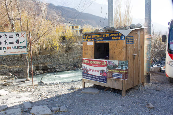
Kagbeni (2,800 m) is a medieval-looking village of mud-brick alleyways, a red gompa and irrigated green fields, sitting at the checkpoint into restricted Upper Mustang. Around 3 hours of walking. Overnight in Kagbeni.
2Day 2Trek from Kagbeni (2,800 m) to Chele (3,050 m)
Trek from Kagbeni (2,800 m) to Chele (3,050 m)
The first day inside the restricted zone, following the Kali Gandaki north.
Your special permit is checked at the Kagbeni post before you set off — Upper Mustang was closed to outsiders entirely until 1992 and still requires a costly restricted-area permit, a licensed guide and a minimum group size.
The trail follows the river north through an increasingly stark landscape of eroded cliffs, wind-carved rock and deep gorges. There is almost no vegetation except where irrigation channels support a village. The route passes through Tangbe, with its whitewashed houses and buckwheat fields, and Chhusang, before crossing the river.
The wind is a constant factor here, blowing hard up the valley from late morning — an early start makes for much easier walking.
Chele (3,050 m) sits above the river where the trail leaves the main gorge. Around 5–6 hours. Overnight in Chele.
3Day 3Trek from Chele (3,050 m) to Syangboche (3,475 m)
Trek from Chele (3,050 m) to Syangboche (3,475 m)
A demanding day crossing several passes on the high desert plateau.
The trail climbs steeply out of Chele and onto the open plateau, and from here the walking is a succession of ascents and descents over ridges rather than a steady climb. The passes today include Taklam La (3,624 m) and Dajori La (3,735 m), each giving wide views over the surrounding badlands.
The landscape is extraordinary — bands of red, grey, ochre and purple rock, deeply eroded into pinnacles and gullies, with the snow peaks of Nilgiri and Damodar Himal on the horizon. There is virtually no shade and no water between villages.
You pass Samar, a small village in a stand of poplars, and a series of chortens and mani walls marking the route. The Buddhist culture here is Tibetan and long-established.
Syangboche (3,475 m) is a tiny settlement on the plateau. Around 6 hours. Overnight in Syangboche.
4Day 4Trek from Syangboche (3,475 m) to Ghami (3,500 m)
Trek from Syangboche (3,475 m) to Ghami (3,500 m)
A day of ridges and passes with little net height change but a great deal of up and down.
The trail crosses the Yamda La (3,850 m) and Nyi La (4,010 m), the highest point of this stage, before descending into the Ghami valley. Between them the route passes through Ghiling, a village set among poplars and barley fields with an old gompa.
The highlight of the day comes on the approach to Ghami: the longest mani wall in Nepal, several hundred metres of stone faced with carved prayer stones, running across the open hillside below the village. By custom it is passed on the left.
The country throughout is high desert — bare, wind-scoured and vividly coloured, with cultivation only where snowmelt can be channelled.
Ghami (3,500 m) is one of the larger settlements of Upper Mustang, a compact village of whitewashed houses surrounded by green fields. Around 5 hours. Overnight in Ghami.
5Day 5Trek from Ghami (3,500 m) to Charang (3,560 m)
Trek from Ghami (3,500 m) to Charang (3,560 m)
A shorter day crossing into the Charang valley, leaving time to explore on arrival.
The trail descends from Ghami, crosses the river and climbs past the long mani wall before ascending to the Chogo La — at around 4,280 m the highest pass of the trek. The views from the top take in the whole tangle of Mustang badlands and the peaks along the Tibetan border.
The descent into the Charang valley is through more of the extraordinary eroded terrain that characterises the region, with cliffs banded in red and grey.
Charang (3,560 m), also spelled Tsarang, was historically the second most important settlement in the Kingdom of Lo. It has a five-storey white dzong (fortress) and a large red gompa perched on the edge of the gorge, holding old thangkas, statues and manuscripts.
The shorter day leaves the afternoon free to visit both. Around 4 hours. Overnight in Charang.
6Day 6Trek from Charang (3,560 m) to Lo Manthang (3,770 m)
Trek from Charang (3,560 m) to Lo Manthang (3,770 m)
The day you reach the walled capital — the destination of the whole trek.
The trail climbs out of Charang and crosses the Lo La (3,950 m), and it is from this pass that you get the first view of Lo Manthang below: a compact walled city on the plain, unchanged in outline for six centuries, with the Tibetan border ranges behind it.
The descent to the city takes around an hour.
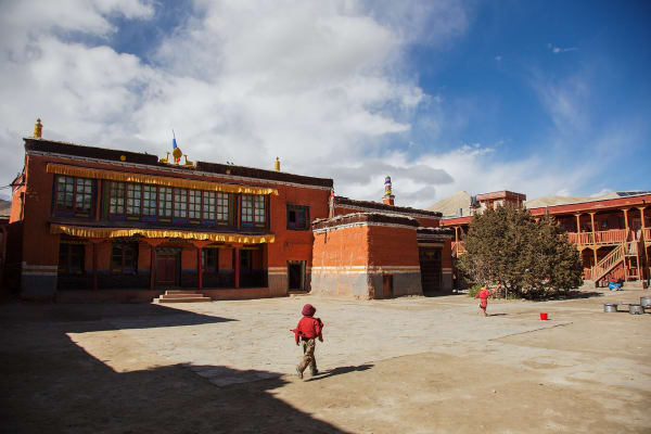
Lo Manthang (3,770 m) was the capital of the Kingdom of Lo, founded in 1380, and its royal line was formally recognised until 2008. The city is entirely enclosed by a wall, with a single main gate, and inside it is a warren of narrow alleys, whitewashed houses and three major monasteries — Jampa, Thubchen and Chodey — holding remarkable 15th-century murals, some of them recently restored.
Around 5 hours. Overnight in Lo Manthang.
7Day 7Exploration Day in Lo Manthang (3,770 m) and Day Trip to Chhoser Cave (3,800 m)
Exploration Day in Lo Manthang (3,770 m) and Day Trip to Chhoser Cave (3,800 m)
A full day in and around the walled city, with an excursion north toward the Tibetan border.
The morning trip goes to Chhoser (3,800 m), around two hours north, where the cliffs are honeycombed with man-made caves. The Jhong cave complex is the most impressive: a five-storey warren of chambers cut into the rock face, connected by ladders and passages, thought to be over 2,000 years old and used variously as dwellings, storage and refuge. Nobody is entirely certain who cut them or why.
Nearby is the Nyphu cave monastery, built into the cliff and still in use.
The afternoon is for Lo Manthang itself. The three great monasteries — Jampa, Thubchen and Chodey — hold 15th-century wall paintings of real art-historical importance, and the royal palace still stands by the main square.
This is as close to Tibet, culturally and geographically, as Nepal gets. Overnight in Lo Manthang.
8Day 8Trek from Lo Manthang (3,770 m) to Dhakmar (3,800 m)
Trek from Lo Manthang (3,770 m) to Dhakmar (3,800 m)
The return journey begins on a different, western route back through the badlands.
Rather than retracing the way in, the trail heads south-west on an alternative line, which makes the return as interesting as the approach. It is a long day over open, exposed country with several passes and no shelter.
The route passes Ghar Gompa, one of the oldest monasteries in Nepal — traditionally dated to the 8th century and associated with Guru Rinpoche (Padmasambhava), who is said to have subdued a demon here on his way to Tibet. It holds old murals and is an important pilgrimage site.
Dhakmar (3,800 m) is the visual highlight of the whole trek: the village sits beneath enormous red cliffs, deeply eroded into fluted columns and caves. Local legend holds that the colour comes from the blood of the demon Guru Rinpoche defeated.
Around 6–7 hours. Overnight in Dhakmar.
9Day 9Trek from Dhakmar (3,800 m) to Ghiling (3,860 m)
Trek from Dhakmar (3,800 m) to Ghiling (3,860 m)
A ridge-and-valley day rejoining the main route south.
The trail leaves Dhakmar and its red cliffs, climbing over open ridges and crossing dry valleys. As with most days in Upper Mustang, the net height change is small but the cumulative ascent and descent is considerable, and the ground is bare and exposed throughout.
The walking is through classic Mustang terrain — banded rock in reds, greys and yellows, eroded into gullies and pinnacles, with barley fields and poplar stands marking each village like green islands in a desert.
The route passes chortens, mani walls and the occasional cave dwelling cut into the cliffs, and the wind is a steady presence from late morning.
Ghiling (3,860 m) is a village set among poplars with an old gompa above it, and it makes a comfortable stop on the way south.
Around 6 hours. Overnight in Ghiling.
10Day 10Trek from Ghiling (3,860 m) to Chhusang (3,050 m)
Trek from Ghiling (3,860 m) to Chhusang (3,050 m)
A long descending day of around 800 m, dropping back toward the Kali Gandaki.
The trail recrosses the Nyi La and Yamda La before beginning the sustained descent south. It is a long day with several climbs still involved, but the overall trend is downhill and the walking gets easier as you lose height.
The landscape gradually shifts from the high, cold desert plateau around Lo Manthang back toward the deep gorge country of the Kali Gandaki. It remains arid throughout, but the villages become larger and greener, with more irrigation and more cultivation.
The route rejoins the main river valley near Chele before continuing south.
Chhusang (3,050 m) sits at the confluence of two rivers, with striking eroded cliffs above it riddled with old cave dwellings and irrigated orchards below.
Around 6 hours. Overnight in Chhusang.
11Day 11Trek from Chhusang (3,050 m) to Jomsom (2,700 m)
Trek from Chhusang (3,050 m) to Jomsom (2,700 m)
The final walking day, following the Kali Gandaki south out of the restricted zone.
The trail heads down the broad, stony riverbed, passing back through Kagbeni (2,800 m) where you check out of Upper Mustang. It is worth a short stop — the red gompa and the mud-brick alleyways are as good on the way out as on the way in.
From Kagbeni the route continues south to Jomsom. This stretch is famous for the valley wind, which blows strongly upriver from late morning, so an early start makes a considerable difference to how pleasant the walk is.
The Kali Gandaki riverbed here is also the place to look for shaligrams — black ammonite fossils, sacred to Hindus as manifestations of Vishnu, and evidence that this whole region was once seabed before the Himalaya rose.
Jomsom (2,700 m) ends the trek. Around 6–7 hours. Overnight in Jomsom.
12Day 12Fly from Jomsom (2,700 m) to Pokhara (822 m)
Fly from Jomsom (2,700 m) to Pokhara (822 m)
The short flight back down the gorge, closing the trip.
Flights from Jomsom leave early in the morning, before the valley wind builds — by mid-morning conditions here are usually too rough for the small aircraft, so departures are almost always at first light. Delays and cancellations do happen, and a spare day in the schedule is always sensible.
The 20-minute flight retraces the Kali Gandaki gorge between Dhaulagiri and Annapurna, and the descent from the arid high valley into the green, subtropical Pokhara basin is abrupt and striking — a whole climatic zone crossed in twenty minutes.
You arrive in Pokhara (822 m) in the morning, where the trek ends.
You leave having walked into the walled city of Lo Manthang, the old Kingdom of Lo, through a restricted region that was closed entirely to outsiders until 1992.
Inclusions & Exclusions
Return Pokhara-Jomsom flights, teahouse lodging, all trekking meals, the Upper Mustang Restricted Area Permit and conservation area permits, a licensed guide, trekking map, first aid, and government taxes are included, while international flights, visa, insurance, personal gear, porter service, city accommodation and meals, personal expenses, and tips are excluded.
What's Included
Domestic flights from Pokhara to Jomsom and Jomsom to Pokhara as per the itinerary.
Accommodation in local teahouses during the trek.
Upper Mustang Restricted Area Permit, Annapurna Conservation Area Permit (ACAP), and required trekking permits.
Professional English-speaking licensed trekking guide.
Three meals a day (breakfast, lunch, and dinner) during the trek.
Group trekking map for route guidance.
First aid kit carried by the guide.
All government taxes, permit fees, and service charges.
What's Excluded
Travel insurance, including emergency helicopter evacuation coverage.
Personal trekking equipment and clothing.
Porter services (available at an additional cost).
Accommodation and meals in Kathmandu or Pokhara unless mentioned in the itinerary.
Snacks, bottled water, hot showers, Wi-Fi, charging fees, and alcoholic or soft drinks.
Personal expenses such as laundry, phone calls, and souvenirs.
Tips for guides, drivers, and support staff.
Any additional accommodation, transportation, or expenses caused by domestic flight delays, bad weather, or other unforeseen circumstances beyond the itinerary.
Route Map
Explore the terrain map showing the trek route.
Loading map...
Altitude Profile
Pricing
Transparent per-person pricing based on group size, covering the services listed in the itinerary with no hidden charges.
Add-ons
Customize your trek with optional services such as porter support and other personalized arrangements at an additional cost.
Best Time to Trek
Upper Mustang's rain shadow position gives it the longest season of any Nepali trekking region. March to November all work, and this is one of the very few routes in the country that is genuinely good during the monsoon (June to August), when the rest of Nepal is under cloud and Mustang remains dry and clear.
The cultural highlight is the Tiji festival at Lo Manthang, usually held in May — a three-day masked dance ritual at the royal palace that requires booking many months in advance. Winter is severe here, with much of the population migrating south for the season and many villages effectively closing, so December to February is not recommended.
For a month-by-month look at weather and trail conditions, see our guide to the best time to trek in Nepal.
Permits & Regulations
Upper Mustang is a restricted area with strict, non-negotiable rules. You need the Upper Mustang Restricted Area Permit, issued only through a registered trekking agency at USD 500 per person for ten days plus USD 50 per additional day, and it is non-refundable and non-transferable. The Annapurna Conservation Area Permit is also required for the approach through Lower Mustang.
A minimum of two trekkers must travel together on a single permit and a licensed guide is mandatory throughout — solo trekking is not permitted under any circumstances. Permits are checked at the Kagbeni police post and again at Lo Manthang. Our team handles the full application, but we need clear passport copies, passport-sized photographs, and your Nepal visa details well in advance, as permits cannot be arranged at short notice.
The fees and conditions for every restricted area are set out in our guide to restricted area permits in Nepal.
Travel Insurance
Travel insurance covering trekking to at least 4,500 m is required, comfortably above the trek's high points near Ghiling and Lo Manthang. Read the altitude clause explicitly and confirm that travel on small domestic aircraft is covered, since the Pokhara-Jomsom sector uses turboprops on a short mountain strip.
Because the restricted-area permit is expensive and non-refundable, trip cancellation and curtailment cover is unusually important on this trek — cancelling for illness or a family emergency after the permit is issued is a substantial loss without it. You also need emergency helicopter evacuation and medical treatment cover, as Upper Mustang has no hospital and evacuation means a helicopter out to Jomsom or Pokhara. Send us your policy number and the insurer's 24-hour emergency line well before departure.
Our guide to travel insurance for trekking in Nepal explains the altitude limits, evacuation terms and common exclusions to check before you buy.
Altitude, Wind & Sun
Upper Mustang rarely exceeds 3,900 m, which is lower than many Nepali treks, and the flight to Jomsom followed by walking days through Kagbeni and Chele gives a reasonable adjustment period. Serious altitude illness is uncommon, though the cumulative effect of eleven consecutive days above 2,800 m in very dry air is more tiring than the numbers suggest.
The greater challenges here are wind and sun rather than altitude. The up-valley wind rises by mid-morning and blows hard and dusty through the afternoon, which is why days start early. The plateau's thin, clear air makes solar radiation intense — sunburn on this trek is common and easily avoided with high-SPF sunscreen, a proper sun hat, and wraparound sunglasses. Drink at least two and a half litres a day; dehydration here is the single most common reason trekkers feel unwell.
Prevention, symptoms and treatment are covered in depth in our guide to altitude sickness in Nepal.
Accommodation, Food & Drinking Water
All eleven nights are spent in village teahouses and guesthouses. Standards in Upper Mustang are simpler than in the Kali Gandaki below — twin rooms with foam mattresses and blankets, mostly shared bathrooms, and dining rooms warmed by a stove in the evening — though Lo Manthang and Charang have several better-equipped guesthouses. Electricity is largely solar and can be intermittent, so hot showers are not guaranteed.
Three meals a day are included on the trek. Menus are shorter than on the main circuits, built around dal bhat, Tibetan bread, thukpa, thenthuk, momos, noodles, potatoes, and eggs, reflecting a high desert where barley, buckwheat, and apples are the only real crops. Butter tea is offered everywhere. Water comes from village supplies and must be treated with tablets, a filter, or a UV pen — carry at least two and a half litres a day, as the dry air is genuinely dehydrating.
What the lodges are really like, from rooms and meals to showers and charging, is covered in our guide to teahouse trekking in Nepal.
Frequently Asked Questions
Find quick answers to common questions about the Upper Mustang Trek from Pokhara.
1How many hours do we walk each day?
Five to seven hours on most days. The route crosses a succession of ridges and dry side valleys rather than following a single river, so nearly every day involves several hundred metres of climbing and descending.
2Why is the permit so expensive?
The USD 500 ten-day fee is set by the Nepali government to cap visitor numbers and protect a culturally fragile region, with part of it directed to local development. It is non-refundable, non-transferable, and cannot be reduced.
3Can I trek Upper Mustang alone?
No. The regulations require at least two trekkers on a permit and a licensed guide at all times. If you are travelling solo we can pair you with another trekker on a fixed departure or issue a two-person permit at the corresponding cost.
4How does this compare with the 16-day Upper Mustang itinerary?
It covers exactly the same route through Lo Manthang and Chhoser, but starts and finishes with the Jomsom flight from Pokhara rather than including the Kathmandu transfers. If you are already in Pokhara, or arranging Kathmandu travel yourself, this is the more efficient option.
5What is the Tiji festival?
A three-day masked dance ritual held at the royal palace in Lo Manthang, usually in May, enacting the defeat of a demon and the restoration of harmony. It is among the most remarkable cultural events in the Himalaya and requires booking many months ahead.
6Can I photograph the monasteries and caves?
Exteriors are generally fine, but many gompas prohibit interior photography of murals and statues, and some charge a fee. Ask your guide first, and never photograph people, monks, or ceremonies without permission.
7What happens if the Jomsom flight is cancelled?
Flights operate early morning only and are frequently grounded by wind or cloud. The alternative is a long jeep journey up or down the Kali Gandaki taking most of a day. Given the fixed permit dates, we strongly recommend a spare day at each end.
8Is mobile network and Wi-Fi available?
Coverage reaches the larger villages including Lo Manthang but is patchy elsewhere and drops out often. Some guesthouses sell Wi-Fi at slow speeds, limited by solar power. Plan on being offline for stretches.
9Where can I withdraw cash and charge devices?
Jomsom has the last reliable ATM before the restricted area and there are none beyond it, so carry all your Nepalese rupees from Pokhara or Jomsom. Charging is solar and limited, usually for a fee, so bring a large power bank.
10Can I leave extra luggage in Pokhara?
Yes, and you should. Your Pokhara hotel stores anything you do not need free of charge until you return, which matters given the roughly 15 kg baggage limit on the Jomsom flight.
Gallery
Explore authentic moments, landscapes, and mountain views from the Upper Mustang Trek from Pokhara.
Trekking Guides & Articles
Walking Meditation: How to Trek Mindfully in Nepal — You are already walking six hours a day.
Upper Mustang Trek: The Walled Kingdom of Lo — A walled medieval capital at 3,840 m in a desert behind the Himalaya, with cave complexes, ochre cliffs and Tibetan Buddhism largely unchanged.
The Tiji Festival at Lo Manthang: Three Days of Masked Dance — Each May, monks at Lo Manthang perform three days of masked dances enacting the defeat of a demon and the driving out of evil for the year.
Fix Departure
This trek runs every week on the selected day. Choose custom dates for one-off departures.
Showing fixed departures in Oct 2026
Guest Reviews
An experience to treasure
“This was my first proper trek and the team made it feel easy and enjoyable. The arrangements were seamless: permits sorted, transport on time, rooms ready when we arrived. The whole team looked after ...
Magdalena Watkins
Get in Touch
Tell us the dates you have in mind and roughly what you want out of the trek — one of our guides will reply, usually within 24 hours.
Email Us
info@greencompasstreks.com
Call Us
+977 9864379436
Office
Lakeside, Pokhara, Nepal
Office Hours
Sunday – Friday, 9:00 AM – 9:00 PM
Similar Treks
You might also like these treks
Porter
$462 $420/porter
No payment required yet