

Mundum Trek
The Mundum Trek is one of Nepal's newest routes, opened in the eastern hills of Khotang and Bhojpur to share the culture
Porter
$424 $385/porter
No payment required yet
Trip Overview
The Mundum Trek is one of Nepal's newest routes, opened in the eastern hills of Khotang and Bhojpur to share the culture of the Kirat Rai people with visitors. Mundum is the oral scripture of the Kirat — an unwritten body of myth, ritual, and law passed down through generations — and the trail is named for it because it passes through the villages and sacred sites at the heart of that tradition.
From Diktel Bazar the route climbs through Chakhewa and Dhotre into rhododendron forest and open ridge country, reaching Rawadhap (3,426 m) and Salpa Bhanjyang (3,348 m) with an exploration day up Silchung Hill (4,200 m), where the panorama takes in Everest, Makalu, Kanchenjunga, and Chamlang at once. Almost no foreign trekkers walk here, and accommodation is in village homestays throughout.
Trip Highlights
Everest, Makalu and Kanchenjunga From One Ridge: Climb Silchung Hill (4,200 m) for a panorama spanning three of the world's five highest mountains.
Kirat Rai Culture and the Mundum: Walk through villages at the heart of the Kirat oral tradition, with sacred sites and living ritual practice.
Village Homestays Throughout: Sleep in Rai family homes rather than commercial lodges, with income going directly to households.
A Route Almost No Foreigners Walk: Trek one of Nepal's newest trails in a region that receives a handful of international visitors a year.
Rhododendron Forest and Open Ridges: Climb through some of eastern Nepal's finest forest into high grazing country above the treeline.
Itinerary
A 13-day homestay trek through the Kirat Rai villages of eastern Nepal, climbing to Salpa Bhanjyang and Silchung Hill (4,200 m) for Everest, Makalu, and Kanchenjunga views.
1Day 1Arrival in Kathmandu (1,400 m)
Arrival in Kathmandu (1,400 m)
Your Mundum Trek begins with arrival at Tribhuvan International Airport in Kathmandu (1,400 m). After immigration and baggage, our representative meets you and transfers you to your hotel.
Your guide runs the pre-trek briefing. The Mundum Trail is a recently developed route through the eastern hills of Khotang and Bhojpur, and it is named after the Mundum — the sacred oral scripture of the Kirat people, passed down by shamans over generations. This is Rai and Limbu country, culturally distinct from the Sherpa and Tamang regions most trekkers visit.
The trek is moderate in altitude, topping out at Silchung Hill (4,200 m), but it is long on ridge walking and the infrastructure is basic — homestays and simple lodges rather than developed teahouses.
Your guide checks your equipment and confirms permits. The rest of the day is free to rest after your flight or walk around Thamel. Overnight in Kathmandu.
2Day 2Drive from Kathmandu (1,400 m) to Diktel Bazar (1,650 m)
Drive from Kathmandu (1,400 m) to Diktel Bazar (1,650 m)
A very long drive east, one of the longest road days on any Nepali trek.
The route leaves Kathmandu on the BP Highway or the Prithvi and Mahendra highways, descending from the valley into the lowlands before turning east and running along the Sun Koshi river system. The journey covers several hundred kilometres and takes the best part of a day and, depending on conditions, sometimes longer.
The scenery changes continuously — river gorges, terraced hillsides, roadside bazaars and long stretches of farmland — and the last few hours climb on rough, unsealed mountain road into the eastern hills.
Diktel Bazar (1,650 m) is the district headquarters of Khotang, a busy hill town serving a wide rural area and the gateway to the Mundum Trail. Very few foreign visitors come through.
After arriving, there is time for a short walk around the bazaar before the walking begins tomorrow. Overnight in Diktel Bazar.
3Day 3Trek from Diktel Bazar (1,650 m) to Chakhewa Village (2,300 m)
Trek from Diktel Bazar (1,650 m) to Chakhewa Village (2,300 m)
The first walking day, a steady climb of around 650 m out of the bazaar onto the ridge system.
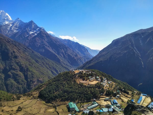
The trail leaves Diktel and begins climbing almost immediately through farmed hillsides. This is inhabited working country rather than wilderness, and the walking is as much cultural as scenic — terraces of millet, maize and rice cut into every usable slope, water mills, livestock, and paths busy with local people moving between villages.
The settlements here are largely Rai, one of the Kirat peoples whose traditions the Mundum records. You will pass small shrines and sacred groves associated with Kirat practice, which is animist and shamanic rather than Hindu or Buddhist, though all three influences are visible.
As you gain height the terraces give way to patches of oak and rhododendron forest, and the views back over the Khotang hills open up.
Chakhewa Village (2,300 m) sits high on the ridge. Around 5–6 hours. Overnight in Chakhewa.
4Day 4Trek from Chakhewa Village (2,300 m) to Dhotre (2,752 m)
Trek from Chakhewa Village (2,300 m) to Dhotre (2,752 m)
A climb of around 450 m along the ridge, with the settlements thinning and forest taking over.
The trail continues north from Chakhewa, following the ridge system that the Mundum Trail uses for most of its length. The farmed terraces of the lower hills become patchier as you gain height, and oak and rhododendron forest closes in around the path.
This is quiet walking. The villages up here are small and widely spaced, and the trail is used mainly by herders moving livestock between grazing grounds. Langur monkeys are common in the canopy and the birdlife is excellent — this part of eastern Nepal sees very few visitors and the forest is largely undisturbed.
There are clearings along the ridge where the trees open out, giving views north toward the Himalayan chain and south over the folded hills of Khotang.
Dhotre (2,752 m) is a small ridge-top settlement. Around 5 hours. Overnight in Dhotre.
5Day 5Trek from Dhotre (2,752 m) to Maiyung (3,122 m)
Trek from Dhotre (2,752 m) to Maiyung (3,122 m)
A steady climb of around 370 m through rhododendron forest toward the 3,000 m mark.
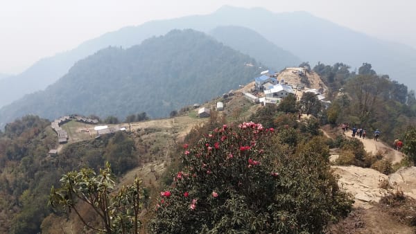
The trail leaves Dhotre and continues along the ridge, climbing gradually. The forest here is dominated by rhododendron, and in spring — roughly late March into April — the whole hillside flowers red and pink, which is the main reason to walk this trail in that season. In autumn the appeal is clearer air and far better mountain visibility.
The walking is a mixture of shaded forest path, open ridgeline and undulating sections across minor saddles. The gradient is manageable, but you are now above 3,000 m and the pace naturally slows.
There are no permanent villages on this stretch. The only structures are herders' shelters used in the summer grazing season.
Maiyung (3,122 m), also written Mayung, is a ridge camp with wide views on a clear day. Around 5 hours. Overnight in Maiyung.
6Day 6Trek from Maiyung (3,122 m) to Rawadhap (3,426 m)
Trek from Maiyung (3,122 m) to Rawadhap (3,426 m)
A climb of around 300 m into the highest and most open section of the trail.
The route continues north along the ridge, and the character of the walking changes as you gain height. The tall rhododendron forest becomes stunted and windblown, and increasingly the trail runs across open grassland and exposed ridgeline rather than under cover.
This is where the Mundum Trail earns its reputation as a viewpoint route. On a clear morning the panorama north takes in a long stretch of the eastern Himalaya — Makalu (8,485 m), the Everest group and, far to the east, Kanchenjunga — with layer after layer of hills falling away to the south.
The exposure means weather matters here. Cloud can close in quickly in the afternoon, so the day starts early to make use of the morning clarity.
Rawadhap (3,426 m) is a high camp on the ridge. Around 5 hours. Overnight in Rawadhap.
7Day 7Trek from Rawadhap (3,426 m) to Salpa Bhanjyang (3,348 m)
Trek from Rawadhap (3,426 m) to Salpa Bhanjyang (3,348 m)
A high traverse with almost no net height change, but a good deal of climbing and descending along the ridge.
The net loss of under 80 m does not reflect the day, which rolls persistently across a series of tops and saddles at around 3,300–3,500 m. The walking is on open ridgeline for most of it, with only intermittent tree cover.
The views are the reason to be here, and in clear weather they are sustained all day — the eastern Himalaya to the north, and the hills of Khotang and Bhojpur spread out below.
Salpa Bhanjyang (3,348 m) is a pass of real significance in this region. It sits on the historic trading and walking route between the eastern hills and the Solu-Khumbu, and nearby is Salpa Pokhari, a lake held sacred by the Kirat Rai people, who make an annual pilgrimage to it. The pass is marked with prayer flags and shrines reflecting both Kirat and Buddhist practice.
Around 5 hours. Overnight at Salpa Bhanjyang.
8Day 8Explore Silchung Hill (4,200 m) and Return to Salpa Bhanjyang (3,348 m)
Explore Silchung Hill (4,200 m) and Return to Salpa Bhanjyang (3,348 m)
The highest point of the trek: a return hike of around 850 m to Silchung Hill (4,200 m).
You start early to make the most of the morning visibility, which on this ridge is usually far better before the cloud builds. The trail climbs steadily from the pass, leaving the last stunted trees behind and continuing over open alpine grass and rock.
It is a sustained climb rather than a technical one, but 850 m at this altitude is real work, and the pace is deliberately slow.
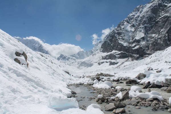
The summit is the payoff. Silchung gives an exceptional panorama of the eastern Himalaya — Everest, Lhotse, Makalu (8,485 m) and Kanchenjunga (8,586 m) can all be seen from a single point on a clear day, which is unusual anywhere in Nepal — with the hills of Khotang, Bhojpur and Solukhumbu below.
You descend by the same route to the pass. Around 6–7 hours in total. Overnight at Salpa Bhanjyang.
9Day 9Trek from Salpa Bhanjyang (3,348 m) to Hyakule (2,962 m)
Trek from Salpa Bhanjyang (3,348 m) to Hyakule (2,962 m)
The trek turns for home, descending around 390 m off the high pass.
The trail drops south-east from Salpa Bhanjyang, leaving the open alpine ridge and re-entering the treeline within a couple of hours. The change is welcome after two nights at over 3,300 m — there is shelter from the wind, the temperature rises, and the walking underfoot becomes softer.
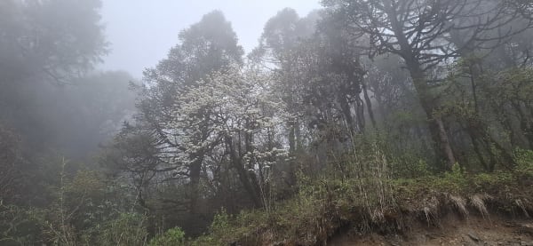
The forest here is rhododendron and oak, thick and mossy, with occasional clearings giving last views back toward Silchung and the high ridge.
As you lose height there are more signs of settlement again: grazing land, herders' huts, and the first terraced fields since Chakhewa. The trail is a working path used by local people rather than a trekking route.
Hyakule (2,962 m) is a small settlement on the ridge, and after the exposure of the pass camps it feels notably more sheltered.
Around 5 hours. Overnight in Hyakule.
10Day 10Trek from Hyakule (2,962 m) to Hanspokhari (2,962 m)
Trek from Hyakule (2,962 m) to Hanspokhari (2,962 m)
A level ridge day with no net height change, but plenty of undulation along the way.
Both ends of today sit at the same altitude, so the profile looks flat on paper. In practice the trail rolls persistently along the ridge, climbing and dropping across a series of tops and saddles, and the cumulative ascent is more than the numbers suggest.
The walking is on open ridgeline for much of the day, through grazing land and patches of rhododendron and oak forest. Because the trail stays high, the views stay with you rather than appearing only in clearings — north to the Himalayan chain, with Makalu and the eastern peaks visible in clear weather, and south over the folded hills of Khotang and Bhojpur.
This section passes seasonal herding shelters and small settlements, and the pace can be relaxed.
Hanspokhari (2,962 m) takes its name from a pond on the ridge. Around 5 hours. Overnight in Hanspokhari.
11Day 11Trek from Hanspokhari (2,962 m) to Bhojpur (1,600 m)
Trek from Hanspokhari (2,962 m) to Bhojpur (1,600 m)
The final walking day, a long descent of around 1,360 m into Bhojpur.
The trail drops steadily off the ridge, and the change over the course of the day is substantial. Cool rhododendron and oak forest gives way to mixed broadleaf, then to terraced farmland, and by the afternoon you are in warm, green, densely cultivated middle-hill country.
Lower down the route passes through a succession of villages, past water mills and irrigation channels, with rice and millet on the terraces. There are more people about, and the trail becomes a busy local path.
Bhojpur (1,600 m) is the district headquarters and a town with a real history of its own — it is known across Nepal for its metalwork, particularly the forging of khukuri knives, a craft still practised in workshops around the bazaar.
Arriving in a town with shops and hot water after nearly two weeks on the ridge is a distinct pleasure. Around 6 hours. Overnight in Bhojpur.
12Day 12Drive from Bhojpur (1,600 m) to Kathmandu (1,400 m)
Drive from Bhojpur (1,600 m) to Kathmandu (1,400 m)
The long drive back west to the capital, and the last day of travel.
The road descends from Bhojpur through the eastern hills toward the lowlands, on rough unsealed surface for the first hours before joining better road further down. The journey runs west along the Sun Koshi river system and then onto the highway network back toward Kathmandu.
It is a long day in the vehicle — comparable to the drive out at the start of the trip — but it is a good final look at the country: river gorges, terraced hillsides, roadside bazaars and the ordinary business of rural eastern Nepal going past the window.
As you approach the Kathmandu valley the road climbs over the rim and the landscape becomes progressively more built up.
You arrive in Kathmandu (1,400 m) in the evening and transfer to your hotel. The evening is free — a hot shower, a good meal, and time for a farewell dinner with your guide and crew. Overnight in Kathmandu.
13Day 13Departure from Kathmandu (1,400 m)
Departure from Kathmandu (1,400 m)
The final day of the Mundum Trek.
Depending on your flight schedule there may be free hours in the morning. Thamel is the obvious place for last-minute shopping — tea, pashmina, or handicrafts — and if you have half a day, Boudhanath, Swayambhunath or Patan Durbar Square are all straightforward visits.
Our representative collects you from your hotel and transfers you to Tribhuvan International Airport approximately three hours before your international departure.
You leave having walked one of the newest and least-visited routes in Nepal: a ridge traverse through the eastern hills of Khotang and Bhojpur, over Salpa Bhanjyang and up Silchung Hill (4,200 m), through the villages of the Kirat Rai people whose oral scripture, the Mundum, gives the trail its name — a trek with very few other foreigners on it and a culture quite distinct from the well-known trekking regions.
Inclusions & Exclusions
Ground transport at both ends, Kathmandu accommodation, village homestays, all trekking meals, trekking permits and municipality fees, a licensed guide, trekking map, first aid, and government taxes are included, while international flights, visa, insurance, personal gear, porter service, city meals, personal expenses, and tips are excluded.
What's Included
Airport pickup and drop-off services in Kathmandu.
Ground transportation from Kathmandu to Diktel Bazar and from Bhojpur back to Kathmandu as per the itinerary.
Accommodation in Kathmandu with breakfast.
Accommodation in local teahouses during the trek.
Required trekking permits and local rural municipality entry fees.
Professional English-speaking licensed trekking guide.
Three meals a day (breakfast, lunch, and dinner) during the trek.
Group trekking map for route guidance.
First aid kit carried by the guide.
Homestay accommodation in the Mundum trail villages as per the itinerary.
All government taxes, permit fees, and service charges.
What's Excluded
International flight tickets to and from Nepal.
Nepal entry visa fees.
Travel insurance, including emergency helicopter evacuation coverage.
Personal trekking equipment and clothing.
Porter services (available at an additional cost).
Lunch and dinner in Kathmandu.
Snacks, bottled water, hot showers, Wi-Fi, charging fees, and alcoholic or soft drinks.
Personal expenses such as laundry, phone calls, and souvenirs.
Tips for guides, drivers, and support staff.
Any additional accommodation, transportation, or expenses caused by unforeseen circumstances beyond the itinerary.
Route Map
Explore the terrain map showing the trek route.
Loading map...
Altitude Profile
Pricing
Transparent per-person pricing based on group size, covering the services listed in the itinerary with no hidden charges.
Add-ons
Customize your trek with optional services such as porter support and other personalized arrangements at an additional cost.
Best Time to Trek
March to May and October to December are the best periods. Spring is exceptional on this route because the eastern hills hold some of the densest rhododendron forest in Nepal, and the ridges above Dhotre are spectacular in April. Autumn and early winter give the clearest air, which matters for the Silchung Hill panorama.
Because most of the trek sits between 1,600 m and 3,400 m, it stays walkable later into the winter than higher routes, though the ridges are cold and exposed from January. The monsoon between June and August brings heavy rain to eastern Nepal, leeches through the forest, and cloud that removes the mountain views entirely, so it is not recommended.
For a month-by-month look at weather and trail conditions, see our guide to the best time to trek in Nepal.
Kirat Rai Culture and Homestays
The Kirat Rai are one of Nepal's oldest indigenous communities, with a religion and social structure centred on the Mundum — an oral scripture covering creation, ancestry, ritual, and law, recited by village priests and never written down. This trail was opened specifically to let visitors encounter that living tradition rather than a museum version of it.
Accommodation is in homestays throughout, meaning you sleep in a family home, eat what the household eats, and pay money that goes directly to that family. Some villages arrange evening cultural programmes with traditional Sakela dance and music. Your guide will explain the customs — remove shoes indoors, ask before photographing people or ritual sites, do not enter sacred groves without permission, and accept food and tea when offered, since refusing is read as impolite.
Travel Insurance
Travel insurance covering trekking to at least 4,500 m is required, comfortably above the Silchung Hill high point of 4,200 m. Standard policies capped at 3,000 m would leave the upper ridge sections uninsured, so read the altitude clause explicitly rather than assuming your existing cover applies.
The policy must include emergency helicopter evacuation and medical treatment. Eastern Khotang and Bhojpur are among the more remote districts in Nepal, with limited road access, no trekking-standard medical facilities, and long distances to the nearest hospital, so evacuation from the ridges means a helicopter, which operators dispatch only against a guarantee of payment. Send us your policy number and the insurer's emergency contact before departure.
Our guide to travel insurance for trekking in Nepal explains the altitude limits, evacuation terms and common exclusions to check before you buy.
Packing List
The village nights are mild but the ridges above Rawadhap are cold and exposed. Bring waterproof trekking boots, three base layers, a fleece, an insulated down jacket, a waterproof and windproof shell, trekking trousers, a warm hat, sun hat, gloves, and wool socks. A sleeping bag rated to -10°C is right for the higher homestays, and a liner is worth having throughout.
Also pack a 30-litre daypack, trekking poles for the long descents, a headlamp with spare batteries, high-SPF sunscreen and lip balm, sunglasses, a reusable bottle with purification tablets or a filter, a personal first aid kit with blister care, insect repellent and leech socks for the forest, a quick-dry towel, toiletries, and a large power bank, since charging in the homestays is limited and often solar.
For the complete kit list, organised by the altitude you will reach, see our Nepal trekking packing list.
Accommodation, Food & Drinking Water
You stay in a tourist-standard hotel in Kathmandu and in village homestays for every night of the trek. There is no commercial teahouse infrastructure here at all — accommodation means a room in a Rai family home, typically with a foam mattress and blankets, a shared or outdoor toilet, and no hot shower. Facilities are basic and the hospitality is exceptional, and your stay is a direct and meaningful contribution to a village economy with very few other visitors.
Three meals a day are included on the trek. You eat what the family cooks: dal bhat with locally grown vegetables, dhido made from millet or maize, gundruk, potatoes, eggs, and chapati, with locally brewed millet drinks sometimes offered. Menus in the western sense do not exist, so tell us about vegetarian, vegan, or allergy requirements well in advance — village shops are minimal and nothing can be substituted at short notice. Water comes from village taps and streams and must be treated with tablets, a filter, or a UV pen.
What the lodges are really like, from rooms and meals to showers and charging, is covered in our guide to teahouse trekking in Nepal.
Frequently Asked Questions
Find quick answers to common questions about the Mundum Trek.
1How many hours do we walk each day?
Five to seven hours on most days. The Silchung Hill exploration day is a demanding six to seven hour round trip from Salpa Bhanjyang, and the descent from Hanspokhari to Bhojpur is a long day dropping over 1,300 m.
2Which permits are required and do you arrange them?
This route lies outside the national park and conservation area system, so you need trekking registration and the local rural municipality entry fees rather than a national park permit. All are included and arranged by our team from passport copies and photographs sent in advance.
3What is the Mundum?
It is the oral scripture of the Kirat Rai people — a body of creation myth, ancestral history, ritual, and customary law recited by village priests and passed down verbally rather than written. The trail is named for it because it passes through the villages and sacred sites where that tradition is still practised.
4How remote is this trek?
Very. Khotang and Bhojpur receive almost no international trekkers, there is no commercial lodging, no ATMs, and limited road access. Your guide's relationships with village households are what make the route possible at all.
5How long is the drive from Kathmandu to Diktel Bazar?
It is a long day, typically twelve to fourteen hours on a mix of highway and rough mountain road through the eastern hills. The return from Bhojpur is comparable. These are the two hardest days of travel on the trip.
6What are the homestays actually like?
You sleep in a room in a family home on a foam mattress with blankets provided, with a shared or outdoor toilet and no hot shower. Facilities are simple, but you eat with the family and get a far closer sense of village life than any lodge offers. A sleeping bag liner is worth bringing.
7Is mobile network and Wi-Fi available?
There is patchy coverage in the larger villages and none on the ridges. Wi-Fi is unavailable anywhere on the route. Plan on being effectively offline for the full trek.
8Where can I withdraw cash and charge devices?
There are no ATMs on the route — the nearest reliable one is in Kathmandu. Carry all your Nepalese rupees from the city. Charging in homestays is limited and often solar, usually for a small fee, so bring a large power bank.
9Will there be cultural performances?
Some villages arrange evening programmes with traditional Sakela dance and Rai music, particularly for groups. These are not scheduled in advance and depend on who is available, so treat them as a bonus rather than a fixture. A contribution to the performers is customary.
10Can I leave extra luggage in Kathmandu?
Yes. Your Kathmandu hotel stores anything you do not need on the trail free of charge until you return, which is worth doing given the basic conditions on this route.
Gallery
Explore authentic moments, landscapes, and mountain views from the Mundum Trek.
Trekking Guides & Articles
Mundum Trail Trek: Kirat Culture in the Eastern Hills — A new homestay trail through the Khotang and Bhojpur hills, built around Kirat Rai culture and the Mundhum oral tradition.
Red Panda Trail Trek: Tea Gardens and Cloud Forest in Ilam — A low-altitude trek through the tea country and cloud forest of Ilam and Panchthar, in some of the best red panda habitat in Nepal.
Responsible Trekking in Nepal: How to Leave the Trail Better — Trekking is one of the few industries that puts money directly into remote Nepali households — and one that leaves plastic, firewood demand and waste behind.
Off the Beaten Path Treks in Nepal: 15 Routes Almost Nobody Walks — Everest and Annapurna take most of Nepal's trekkers.
Fix Departure
This trek runs every week on the selected day. Choose custom dates for one-off departures.
Showing fixed departures in Oct 2026
Guest Reviews
We loved every moment
“Mundum Trek was everything we hoped for and so much more. The itinerary was well paced with proper acclimatisation days built in. I would not hesitate to book with them again and hope to come back for...
Annabelle Parker
Get in Touch
Tell us the dates you have in mind and roughly what you want out of the trek — one of our guides will reply, usually within 24 hours.
Email Us
info@greencompasstreks.com
Call Us
+977 9864379436
Office
Lakeside, Pokhara, Nepal
Office Hours
Sunday – Friday, 9:00 AM – 9:00 PM
Similar Treks
You might also like these treks
Porter
$424 $385/porter
No payment required yet