

Short Annapurna Circuit Trek
The Short Annapurna Circuit Trek strips the classic circuit back to its essential week: a direct drive to Chame (2,710 m
Porter
$270 $245/porter
No payment required yet
Trip Overview
The Short Annapurna Circuit Trek strips the classic circuit back to its essential week: a direct drive to Chame (2,710 m), five days of walking through Upper Pisang and Manang to the foot of the pass, and the crossing of Thorong La (5,416 m) to Muktinath on the far side.
It covers the most spectacular half of the full circuit — the dramatic Marsyangdi upper valley, the Tibetan-influenced villages around Manang, the high pastures at Yak Kharka and Ledar, and the long climb over the pass into the arid Mustang landscape. The trade-off is a fast ascent profile with no rest day, so this itinerary suits fit trekkers who have been at altitude before and want the pass without spending two weeks getting to it.
Trip Highlights
Cross Thorong La Pass (5,416 m): Complete the Annapurna Circuit's legendary crossing, one of the highest walking passes in the world.
The Upper Marsyangdi Valley: Walk from Chame through Upper Pisang and Manang as pine forest gives way to dry Tibetan-influenced high country.
Thorong High Camp (4,925 m): Sleep at the highest lodge on the circuit for a shorter, safer pass day the following morning.
The Sacred Site of Muktinath: Descend from the pass to the temple complex revered by Hindus and Buddhists, with its 108 water spouts.
The Circuit in One Week: Reach the pass and finish in Pokhara in seven days by driving directly to the Chame trailhead.
Itinerary
A 7-day Annapurna Circuit driving straight to Chame, walking through Upper Pisang and Manang, and crossing Thorong La Pass at 5,416 m to Muktinath.
1Day 1Drive from Kathmandu (1,400 m) to Chame (2,670 m)
Drive from Kathmandu (1,400 m) to Chame (2,670 m)
This condensed version of the circuit uses the road as far as it now goes, cutting out the first four days of walking that the classic itinerary spends in the lower Marsyangdi valley.
We leave Kathmandu (1,400 m) early on the Prithvi Highway, turn north at Dumre and reach Besisahar (830 m), where the sealed road ends. From there a local jeep takes over for the rough track up the Marsyangdi — narrow, cut into the gorge wall, with the river far below and waterfalls crossing the road in places.
The track climbs through Jagat, Dharapani and Danakyu, gaining height steadily as the valley walls close in and the vegetation shifts from subtropical to pine. The whole journey takes nine to ten hours.
Chame (2,670 m) is the administrative centre of the Manang district, with shops, a bank and small hot springs beside the river. Overnight in a lodge.
2Day 2Trek from Chame (2,670 m) to Upper Pisang (3,300 m)
Trek from Chame (2,670 m) to Upper Pisang (3,300 m)
The first walking day, and one of the most dramatic on the circuit. The trail leaves Chame through pine forest and enters a steep, narrow section where the valley walls rise almost vertically.
The highlight comes near Dhukur Pokhari: the Paungda Danda, an immense curved slab of rock sweeping more than 1,500 m up from the riverbed in a single unbroken sheet. It is one of the largest rock faces in the Himalaya and dominates the whole afternoon.
Beyond it the valley opens out and the landscape changes character completely — drier, browner and far more Tibetan in feel as you cross into the rain shadow.
The trail climbs to Upper Pisang (3,300 m), a medieval-looking village of stacked stone houses with an old gompa above it. It is worth the extra climb over Lower Pisang for the view across to Annapurna II and Annapurna IV. Overnight in Upper Pisang.
3Day 3Trek from Upper Pisang (3,300 m) to Manang (3,540 m)
Trek from Upper Pisang (3,300 m) to Manang (3,540 m)
There are two routes today and we take the high one — the upper trail via Ghyaru and Ngawal climbs about 400 m more than the valley floor route, but it is far better for both views and acclimatisation.
The climb to Ghyaru is a steep zigzag and hard work at 3,700 m. From the top the reward is an uninterrupted panorama of the Annapurna range across the valley: Annapurna II (7,937 m), Annapurna III, Annapurna IV, Gangapurna and Tilicho Peak, with the Marsyangdi a thin line far below. Ghyaru and Ngawal are old Tibetan settlements with flat roofs stacked with firewood and chortens at every entrance.
The trail descends gradually to rejoin the main route and reaches Manang (3,540 m), the largest village on the circuit. The Himalayan Rescue Association runs a free altitude talk here most afternoons at 3 pm — well worth attending on a fast itinerary like this one. Overnight in Manang.
4Day 4Trek from Manang (3,540 m) through Yak Kharka (4,050 m) to Ledar (4,250 m)
Trek from Manang (3,540 m) through Yak Kharka (4,050 m) to Ledar (4,250 m)
The route now commits to the pass. Because this itinerary has no dedicated acclimatisation day, today's pace matters more than usual — slow and steady is the whole strategy.
The trail climbs gradually out of Manang through Tenki and up the Jarsang Khola valley, leaving the last trees behind within an hour. The landscape becomes open high pasture: juniper scrub, stone-walled corrals and the summer huts of Manang herders.
We pass through Yak Kharka (4,050 m), where most groups stop for lunch. Watch the slopes for blue sheep, which are common here in herds of twenty or more, and for Himalayan griffon vultures riding the thermals.
A further gentle climb brings you to Ledar (4,250 m), a small cluster of lodges on an exposed shelf. There are no trees at this height, the wind picks up in the afternoon and the nights are properly cold. Drink steadily and eat a full dinner. Overnight in Ledar.
5Day 5Trek from Ledar (4,250 m) to Thorong High Camp (4,925 m)
Trek from Ledar (4,250 m) to Thorong High Camp (4,925 m)
A short day by distance but a significant one by altitude — nearly 700 m of gain, sleeping higher than most trekkers on the classic circuit do.
The trail climbs from Ledar along the side of the valley and traverses a steep, slightly exposed section above the Jarsang Khola where the path is cut into loose slope. Your guide will set the pace and pick the line.
After a bridge crossing the route climbs to Thorong Phedi (4,450 m) — 'foot of the hill' — and then, rather than stopping there, continues up the steep wall behind it for a further 450 m to Thorong High Camp (4,925 m). That last climb is short but genuinely hard at this altitude.
Sleeping at High Camp makes tomorrow's pass day considerably shorter, though it is a colder and less comfortable night. Eat as much as you can manage and get into your bag early — the start is around 4:00 am. Overnight at High Camp.
6Day 6Trek from Thorong High Camp (4,925 m) to Muktinath (3,800 m) via Thorong La Pass (5,416 m)
Trek from Thorong High Camp (4,925 m) to Muktinath (3,800 m) via Thorong La Pass (5,416 m)
The big day, and starting from High Camp takes roughly two hours off it. We set out around 4:00 am by head torch, because the wind on the pass rises sharply through the morning and is often unmanageable by midday.
From High Camp the gradient is steadier than the wall below it, but the altitude does the work instead. The trail crosses a series of false summits over snow and frozen scree — each one looks like the top and is not — for three to four hours. Progress is deliberately slow; stopping to breathe is normal. Sunrise on the way up lights the Chulu peaks behind you.
Thorong La (5,416 m) is marked by a cairn buried in prayer flags and a small tea shack, and at 5,416 m it is one of the highest trekking passes in the world.
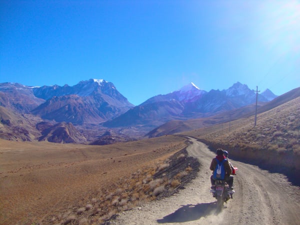
Then comes the descent — 1,600 m of it, long and punishing on the knees, dropping into the Kali Gandaki with the brown hills of Mustang and the wall of Dhaulagiri (8,167 m) ahead. Muktinath (3,800 m) is a major pilgrimage site with 108 water spouts and an eternal natural flame. Overnight in Muktinath.
7Day 7Drive from Muktinath (3,800 m) to Jomsom (2,700 m), Tatopani (1,200 m), and Pokhara (822 m)
Drive from Muktinath (3,800 m) to Jomsom (2,700 m), Tatopani (1,200 m), and Pokhara (822 m)
Before leaving, most trekkers visit the Muktinath Temple complex — Mukti Kshetra to Hindus, the place of liberation; Chumig Gyatsa to Buddhists, the hundred waters. Pilgrims bathe beneath all 108 spouts in the cold morning air, and the Jwala Mai temple nearby shelters a natural gas flame burning above spring water.
We then drive the length of the Kali Gandaki, the deepest gorge in the world, running between the eight-thousand-metre massifs of Dhaulagiri and Annapurna. The road passes Kagbeni (2,800 m) at the gateway to Upper Mustang, then Jomsom (2,700 m) and the apple-growing village of Marpha.
The landscape transforms over the course of the day: from bare high desert, through pine forest, into subtropical green. At Tatopani (1,200 m) there are natural hot springs beside the river, and a stop there is hard to refuse after crossing a 5,416 m pass yesterday.
The road follows the river down through Beni to Pokhara (822 m), arriving in the evening. Overnight in Pokhara.
Inclusions & Exclusions
Jeep and bus transport as per the itinerary, teahouse lodging, all trekking meals, conservation area permits, a licensed guide, trekking map, first aid, and government taxes are included, while international flights, visa, insurance, personal gear, porter service, city accommodation and meals, personal expenses, and tips are excluded.
What's Included
Private jeep transportation from Kathmandu to Chame as per the itinerary.
Shared jeep and tourist bus transportation from Muktinath to Jomsom, Tatopani, and Pokhara.
Accommodation in local teahouses during the trek.
Annapurna Conservation Area Permit (ACAP) and required trekking permits.
Professional English-speaking licensed trekking guide.
Three meals a day (breakfast, lunch, and dinner) during the trek.
Group trekking map for route guidance.
First aid kit carried by the guide.
All government taxes, permit fees, and service charges.
What's Excluded
Travel insurance, including emergency helicopter evacuation coverage.
Personal trekking equipment and clothing.
Porter services (available at an additional cost).
Accommodation and meals in Kathmandu or Pokhara unless mentioned in the itinerary.
Snacks, bottled water, hot showers, Wi-Fi, charging fees, and alcoholic or soft drinks.
Personal expenses such as laundry, phone calls, and souvenirs.
Tips for guides, drivers, and support staff.
Any additional accommodation, transportation, or expenses caused by unforeseen circumstances beyond the itinerary.
Route Map
Explore the terrain map showing the trek route.
Loading map...
Altitude Profile
Pricing
Transparent per-person pricing based on group size, covering the services listed in the itinerary with no hidden charges.
Add-ons
Customize your trek with optional services such as porter support and other personalized arrangements at an additional cost.
Best Time to Trek
Late March to May and late September to November are the only seasons we recommend, and Thorong La is what decides it. Autumn offers the most settled weather and the highest chance of a straightforward crossing. Spring is warmer with longer daylight, which matters on the pass day, though snow can linger at High Camp into April.
Winter closes Thorong La for extended periods and many of the high lodges shut, so December to February carries a substantial risk of not completing the route. The monsoon affects the drive to Chame with landslides and puts cloud over the range, although the Manang valley itself sits partly in the rain shadow and stays drier than most of Nepal.
For a month-by-month look at weather and trail conditions, see our guide to the best time to trek in Nepal.
Altitude, Acclimatization & Who This Suits
This itinerary has no rest day and drives straight to Chame (2,710 m), which makes the acclimatization profile noticeably steeper than the full circuit. You sleep at 3,300 m, 3,540 m, 4,250 m, and 4,925 m on consecutive nights before crossing at 5,416 m. That is a fast build-up by any standard.
For that reason we recommend this route to trekkers who have previously been above 4,000 m and know how their body responds. Your guide monitors the group closely each evening at Manang, Ledar, and High Camp, and will hold the party for an extra night or turn back if anyone is not adapting. Drink three to four litres a day from the first day, walk at a conversational pace, avoid alcohol entirely from Manang upward, and report headache, poor sleep, or appetite loss immediately. If you have not been to altitude before, the 14- or 15-day circuit is the better and safer choice.
Prevention, symptoms and treatment are covered in depth in our guide to altitude sickness in Nepal.
Travel Insurance
Travel insurance covering trekking to at least 6,000 m is mandatory for this trek, since Thorong La stands at 5,416 m and you sleep at 4,925 m the night before. Standard policies commonly cap at 3,000 m or 4,000 m and would leave you uninsured for the entire second half, so verify the altitude clause explicitly before purchase.
Emergency helicopter evacuation and repatriation cover is essential. The compressed profile of this itinerary makes altitude problems more likely than on the full circuit, and between Manang and Muktinath the only way out for a serious case is by helicopter, which operators dispatch against a guarantee of payment. Also check medical treatment and trip cancellation cover, and send us your policy number and the insurer's 24-hour emergency line before departure.
Our guide to travel insurance for trekking in Nepal explains the altitude limits, evacuation terms and common exclusions to check before you buy.
Packing List
The pass day is the coldest few hours of any trek in the Annapurna region, so pack accordingly. Bring broken-in waterproof trekking boots, three or four base layers, a fleece, a proper insulated down jacket, a windproof and waterproof shell jacket and trousers, trekking trousers, a warm hat, sun hat, liner and insulated gloves, and several pairs of wool socks. A sleeping bag rated to -15°C is right for Thorong High Camp.
Also pack a 30-40 litre daypack, trekking poles for the 1,600 m descent to Muktinath, a headlamp with spare batteries for the pre-dawn start, high-SPF sunscreen and lip balm, category 3 or 4 sunglasses, an insulated bottle plus purification tablets or a filter, a personal first aid kit, quick-dry towel, toiletries, and a power bank. Microspikes are worth renting in Manang after recent snow. Keep the porter-carried duffel under 15 kg.
For the complete kit list, organised by the altitude you will reach, see our Nepal trekking packing list.
Accommodation, Food & Drinking Water
All six nights are spent in teahouses. Chame, Upper Pisang, and Manang have comfortable lodges with hot showers, good dining rooms, and in Manang even bakeries and coffee shops. Ledar and Thorong High Camp are basic and cold — small twin rooms or dormitories, shared toilets, and heating only where everyone eats. High Camp has limited beds and no reliable running water, so we arrive early and carry what we need.
Three meals a day are included on the trek. Breakfast is porridge, eggs, Tibetan bread, or pancakes; lunch and dinner come from the lodge menu with dal bhat and free refills the best value, alongside noodles, fried rice, momos, soups, and pasta. Manang offers a surprisingly wide choice for its altitude and is the last place with real variety. Refill your bottle at lodges or the safe drinking water stations and treat it with tablets, a filter, or a UV pen; carry at least two litres on the pass day, insulated so it does not freeze.
What the lodges are really like, from rooms and meals to showers and charging, is covered in our guide to teahouse trekking in Nepal.
Frequently Asked Questions
Find quick answers to common questions about the Short Annapurna Circuit Trek.
1How many hours do we walk each day?
Five to seven hours on most days. The Thorong La crossing is the exception at eight to ten hours from a start around four in the morning, with a 500 m climb to the pass and a 1,600 m descent to Muktinath afterwards.
2Which permits are required and do you arrange them?
The Annapurna Conservation Area Permit and trekking registration are both included and arranged by our team. We need passport copies and passport-sized photographs before departure.
3How is this different from the full Annapurna Circuit?
It drives directly to Chame instead of walking the lower Marsyangdi, drops the acclimatization day in Manang, and skips the Tilicho Lake detour, finishing at Muktinath rather than continuing on foot. You keep the pass and the best scenery but with far less time to adapt.
4What happens if Thorong La is closed by snow?
If the pass is unsafe your guide will hold the group at Manang or Ledar, or retreat and travel round by road. Snow closures are the main reason this route sometimes cannot be completed, and safety takes precedence over reaching Muktinath on foot.
5Where does the trek finish and how do I get back to Kathmandu?
The trek ends in Pokhara after the drive down through Jomsom and Tatopani. From Pokhara you can continue to Kathmandu by tourist bus or by a 25-minute domestic flight, which we are happy to arrange separately.
6Is mobile network and Wi-Fi available?
Coverage is good in Chame, Manang, and Muktinath and patchy in between, with no signal at High Camp or on the pass. Most lodges sell Wi-Fi access at slow speeds, and the connection drops in bad weather.
7Can I charge devices and are ATMs available?
Lodges offer charging for a fee that rises with altitude, and High Camp is solar-only and limited. There are ATMs in Chame and Manang but they run out of cash without warning, so carry enough Nepalese rupees from Kathmandu for the whole trek.
8How cold does it get at Thorong High Camp?
Nights at High Camp typically fall to between -10°C and -20°C, and the pre-dawn hours on the way to the pass are colder still with wind chill. A -15°C sleeping bag plus a liner is the right specification, and water bottles need insulating to stop them freezing.
9How large are the groups and who leads the trek?
Groups are capped at twelve trekkers and led by a licensed English-speaking guide experienced on Thorong La. Given the compressed schedule we keep a close eye on the group and add an assistant guide for larger parties.
10Can I leave extra luggage in Kathmandu?
Yes. Your Kathmandu hotel stores anything you do not need on the trail free of charge until you return, so you can travel with trekking kit only.
Gallery
Explore authentic moments, landscapes, and mountain views from the Short Annapurna Circuit Trek.
Trekking Guides & Articles
Has the Road Ruined the Annapurna Circuit? An Honest Answer — Roads now reach Manang and Muktinath, and the old Annapurna Circuit is not what it was.
Crossing Thorong La: The Biggest Day on the Annapurna Circuit — A 4 a.m.
Annapurna Circuit Trek: The Complete Guide — One of the great walks of the world: a circuit from subtropical valleys over the 5,416 m Thorong La into Tibetan-Buddhist high desert.
Manaslu Circuit vs Annapurna Circuit: Which Is the Better Trek? — Two fifteen-day Himalayan circuits, both over a 5,000 m pass, thirty kilometres apart.
Fix Departure
This trek runs every week on the selected day. Choose custom dates for one-off departures.
Showing fixed departures in Oct 2026
Guest Reviews
The best trekking experience yet
“Short Annapurna Circuit Trek was everything we hoped for and so much more. We learned so much about the villages, monasteries and local life from our guide. The itinerary was well paced with proper ac...
Isabelle Young
Get in Touch
Tell us the dates you have in mind and roughly what you want out of the trek — one of our guides will reply, usually within 24 hours.
Email Us
info@greencompasstreks.com
Call Us
+977 9864379436
Office
Lakeside, Pokhara, Nepal
Office Hours
Sunday – Friday, 9:00 AM – 9:00 PM
Similar Treks
You might also like these treks


Porter
$270 $245/porter
No payment required yet