Thorong La is the highest point most trekkers in Nepal will ever stand on, and the day that crosses it is the single biggest day on any teahouse trek in the country. It is not technical — there is no rope, no crampon, no exposure. It is simply long, high, cold, and unforgiving of poor acclimatisation.
Handled properly it is one of the great days of walking in the Himalaya. Handled badly it is the reason a trek ends in a helicopter.
The Day in Outline
| Time | Where | Altitude | Notes |
|---|---|---|---|
| 3.30–4.00 a.m. | Wake at Thorong Phedi or High Camp | 4,450 / 4,900 m | Tea and a minimal breakfast. Nobody has slept well. |
| 4.00–4.30 a.m. | Leave | — | Headlamp, all layers on, -10 to -20 °C |
| 6.30–7.30 a.m. | False summits begin | 5,000 m + | A long series of rises, each looking like the pass. None of them is. |
| 8.00–10.00 a.m. | Thorong La | 5,416 m | Prayer flags, a sign, a seasonal tea hut. 15–20 minutes, no longer. |
| 10.00 a.m.–2.00 p.m. | Descent to Muktinath | 3,760 m | 1,600 m down on loose scree and dust. Harder than the climb. |
| Early afternoon | Muktinath | 3,760 m | Lodge, food, sleep, relief |
Direction: The Decision Made Ten Days Earlier
This is the most important thing on this page. Walk the circuit anticlockwise — Besisahar to Manang to Thorong La to Muktinath to Jomsom.
| Anticlockwise (correct) | Clockwise (don't) | |
|---|---|---|
| Approach to the pass | Ten days of gradual gain from 760 m | Two or three days from Jomsom at 2,720 m |
| Night before the pass | 4,450–4,900 m, already acclimatised | 3,800 m at best, poorly acclimatised |
| Climb on the day | About 1,000 m | About 1,600 m |
| Acclimatisation days available | Manang, at 3,519 m, with 4,600 m day walks | None of comparable value |
| Altitude risk | Manageable | Substantial |
Anyone offering a clockwise circuit is either inexperienced or cutting corners. The mountain does not care which way the itinerary reads.
Preparing in the Days Before
- Take at least one full acclimatisation day at Manang (3,519 m), two if you can. Climb to Ice Lake at 4,600 m, Gangapurna Lake, or Praken Gompa at 3,950 m, and come back down to sleep.
- Go to the HRA altitude lecture at Manang. It is free, runs most afternoons in season, and is delivered by doctors who spend their season treating exactly the mistakes trekkers are about to make.
- Keep the stages above Manang short. Yak Kharka, then Ledar, then Thorong Phedi — 300 to 400 m a night, which is what our itinerary does.
- Decide Phedi or High Camp the day before. Thorong Phedi at 4,450 m is the safer sleep; High Camp at 4,900 m makes the pass day shorter but is a 450 m jump and a worse night. Your guide will advise based on how the group is coping.
- Drink four litres a day and eat properly, however little you feel like it.
- Pack your daypack the night before and lay out every layer. At 3.30 a.m. at -15 °C, you will not want to be finding gloves.
Our altitude guide covers the symptoms to watch for, and why a headache at Ledar is a conversation with your guide rather than something to push through.
What to Wear and Carry
- Every layer you own for the first two hours — base layer, thermal, fleece, down jacket, shell. You will shed some after sunrise.
- Two glove layers — liners plus insulated gloves or mittens. Fingers are the first thing to suffer.
- Warm hat and a buff over your face. The wind on the pass is the problem, not the temperature.
- Headlamp with fresh batteries. You walk two hours in the dark.
- Category 3 or 4 sunglasses. Snow glare above 5,000 m is serious, and the light arrives suddenly.
- Trekking poles. Non-negotiable for the 1,600 m descent.
- Two litres of water, insulated or inside your jacket — a bladder hose freezes.
- Snacks you will actually eat cold — chocolate, nuts, dried fruit. Appetite at 5,000 m is poor and energy demand is high.
- Microspikes if there has been recent snow. Your guide decides.
What Can Go Wrong
- Altitude sickness. The pass is not the place to develop symptoms. If you have a headache that will not clear at Thorong Phedi, you do not go over — you descend, and rejoin by flying from Jomsom if needed.
- Snow closing the pass. In winter and after storms. Once past Manang the only alternative is turning back, so the decision is taken early with information from lodges on both sides.
- Wind. This is the most common genuine misery. Thorong La funnels wind, and by late morning it can be brutal. It is the reason for the 4 a.m. start.
- Underestimating the descent. More people are injured going down to Muktinath than coming up to the pass. Loose scree, tired legs, and 1,600 m.
- Frostnip on fingers and toes. Rare with proper gloves, common without. Keep moving and tell your guide the moment a digit goes numb.
- Pushing on when the group should wait. The 2014 Annapurna snowstorm, which killed more than 40 people including trekkers on this pass, is the reason a guide who says we wait is the guide you want.
Which Itineraries Cross It
- Annapurna Circuit, 15 days — the standard and best-acclimatised version.
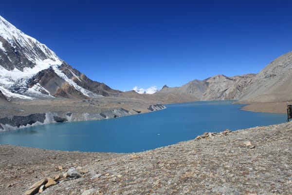
- Circuit with Tilicho Lake, 14 days — the Tilicho detour also doubles as excellent pre-pass acclimatisation.
- Short Annapurna Circuit, 7 days — jeep transfers to Manang, then the pass. Graded challenging, and only for trekkers with previous altitude experience.
- Saribung Pass and other high-pass treks in the region, for trekkers who want more than one 5,000 m crossing.
If you want the Annapurna region without a 5,416 m pass, the Jomsom Muktinath trek covers the western side with no crossing, and the Tilicho Lake trek reaches 4,919 m and returns the way it came.