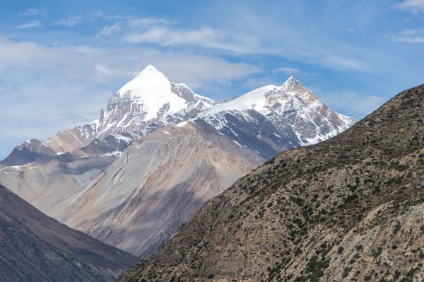
The Annapurna Circuit is the most varied trek in Nepal and, for a long time, was considered the best long-distance trek anywhere. It runs up the Marsyangdi valley from rice paddies at 800 m through pine forest and Tibetan-Buddhist villages to the high pass of Thorong La at 5,416 m, then drops into the arid Kali Gandaki — the deepest gorge in the world, with Dhaulagiri and Annapurna on either side.
In one trek you pass through subtropical farmland, temperate forest, alpine pasture, high desert, and a Hindu-Buddhist pilgrimage site at Muktinath. Roads have changed it, and it is still extraordinary.
The Trek at a Glance
| Duration | 15 days on our standard itinerary; 7 days on the short version |
| Highest point | Thorong La, 5,416 m |
| Highest night | Thorong Phedi or High Camp, 4,450–4,900 m |
| Difficulty | Moderate to challenging — one very big pass day |
| Direction | Anticlockwise, Besisahar to Jomsom — essential for acclimatisation |
| Best seasons | March to May, September to November |
| Permits | Annapurna Conservation Area Permit and trekking registration |
| Accommodation | Teahouse lodges throughout, some very good |
We run it as a 15-day Annapurna Circuit, a 7-day short circuit using jeep transfers, and a 14-day version including Tilicho Lake.
The Route
Besisahar to Manang (760 m to 3,519 m)
Up the Marsyangdi through terraced farmland, waterfalls, and pine forest, past Jagat, Dharapani, Chame, and Pisang. The landscape dries and opens as you climb, and by Upper Pisang the architecture is flat-roofed and Tibetan-Buddhist rather than Nepali. The high route from Pisang through Ghyaru and Ngawal — higher, harder, and with the best views on the circuit — is worth taking over the valley road.
Manang at 3,519 m is the circuit's great staging village: lodges, bakeries, a cinema showing mountain films, and an HRA aid post running free afternoon altitude lectures. You stop here for at least one acclimatisation day, walking up to Ice Lake, Gangapurna Lake, or the Praken Gompa.
Manang to Thorong La (3,519 m to 5,416 m)
Three short stages — Yak Kharka, Ledar, Thorong Phedi — deliberately slow, gaining 300 to 400 m a night. Then the pass day: a 4 a.m. start, 1,000 m of climbing in the cold and dark to Thorong La at 5,416 m, prayer flags and a tea hut at the top, and a punishing 1,600 m descent to Muktinath. Seven to ten hours, and the crux of the trek.
Muktinath to Jomsom (3,760 m to 2,720 m)
Muktinath is one of the most important pilgrimage sites in the Himalaya, sacred to both Hindus and Buddhists, with 108 water spouts and an eternal flame of natural gas. Below it the trail drops into the Kali Gandaki through Kagbeni — a medieval walled village at the gateway to Upper Mustang — and down the windy valley floor to Jomsom, from where most trekkers fly or drive out.
The Road Question
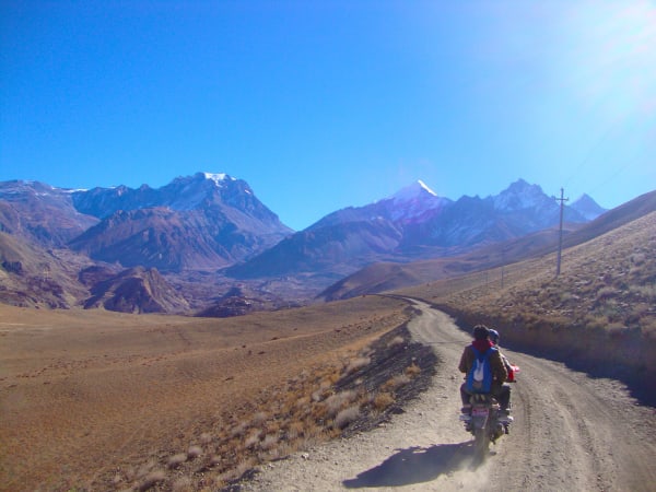
This is the thing people most want to know. Roads now reach Manang on the eastern side and Muktinath on the western, and the old walking route follows the road in places. It has genuinely changed the trek.
What it means in practice:
- NATT trails. Marked alternative walking trails avoid the road for much of the route — the high route through Ghyaru and Ngawal, the old path above the Marsyangdi, the west-bank trail in the Kali Gandaki. A good guide keeps you on these, and it makes most of the difference.
- Jeeps can shorten the trek. A transfer to Chame or Manang cuts the first three or four days, which is how the 7-day circuit works. Useful if your time is short; a loss if you want the full transition of landscape.
- The best part is untouched. From Manang over Thorong La to Muktinath, the highest and most dramatic section, there is no road and will not be one.
- The Kali Gandaki side is the most affected. Below Muktinath the road is busy and dusty, which is why many itineraries fly or drive out from Jomsom rather than walking to Tatopani.
The honest summary: the Annapurna Circuit is no longer a pure wilderness walk, and it remains one of the most varied and rewarding treks in the Himalaya. If the roads bother you, the Manaslu Circuit is the closest thing to what Annapurna was twenty years ago.
Thorong La and Altitude
Thorong La at 5,416 m is the highest point most trekkers in Nepal ever reach, and the pass day is the one that needs respect.
- Direction matters enormously. Walk anticlockwise, Besisahar to Jomsom. The eastern approach gains altitude gradually over ten days; the western side climbs 1,600 m from Muktinath to the pass in a single day, which is a serious altitude risk.
- Acclimatisation days at Manang are not optional. One minimum, two better, with a climb to Ice Lake at 4,600 m or Praken Gompa at 3,950 m.
- Start at 4 a.m. Wind on the pass builds through the morning and can make the crossing genuinely unpleasant by 10 a.m.
- The descent is harder than the climb. 1,600 m down to Muktinath on loose ground, after already walking six hours. This is where poles earn their place.
- Snow can close it. In winter and after storms. There is no alternative once you are past Manang except turning back, so the decision is made before committing.
Read our Thorong La crossing guide before you go. It covers the day in detail.
Tilicho Lake
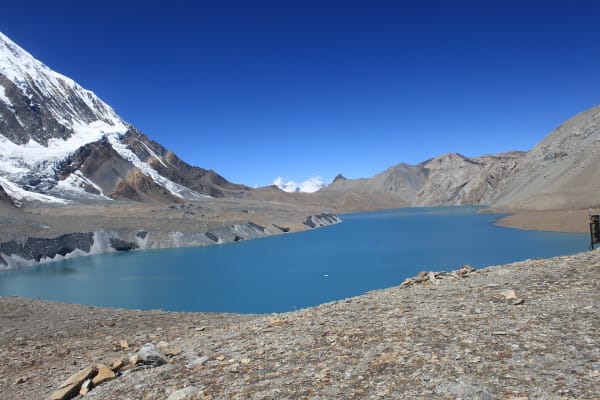
The most popular addition to the circuit is Tilicho Lake at 4,919 m — one of the highest large lakes in the world, held in a bowl of bare rock beneath the Grand Barrier. It adds two to three days from Manang, via Khangsar and the Tilicho Base Camp, on a traverse across a notoriously loose landslide slope.
It is worth it. The lake is turquoise and enormous, ringed by Tilicho Peak and Nilgiri, and the approach is among the most spectacular walking in Nepal. It is also an excellent acclimatisation exercise before Thorong La.
Options: the circuit with Tilicho in 14 days, Tilicho Lake as a 12-day trek in its own right, or a 9-day short version. Note that the landslide traverse needs dry conditions and a guide watching the slope.
Which Version to Book
| Itinerary | Days | Best for |
|---|---|---|
| Annapurna Circuit | 15 | The full transition from subtropics to high desert, with acclimatisation days at Manang |
| Circuit with Tilicho Lake | 14 | Adding the highest lake on the route, and better acclimatisation for the pass |
| Short Annapurna Circuit | 7 | Trekkers with one week who still want Thorong La — harder than it looks |
| Jomsom Muktinath Trek | 9 | The western half only, with no pass and no altitude risk |
| Tilicho Lake Trek | 12 | The lake without the pass crossing |
| Nar Phu Valley | 14 | A restricted-area detour north of Manang into two medieval villages |
A warning about the short circuit: compressing Thorong La into seven days means less acclimatisation, not less effort. It is graded challenging for that reason, and we only recommend it to trekkers with previous altitude experience.