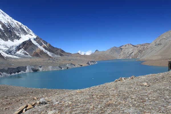
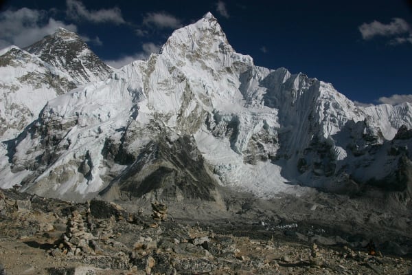
Tilicho is the lake people see a photograph of and immediately want to go to. At 4,919 m it is among the highest large lakes on earth, roughly four kilometres long, held in a bowl of grey and ochre rock behind the Annapurna massif with the Grand Barrier rising on its far side. The colour in clear autumn light is almost implausible.
Getting there involves a traverse across a long, actively eroding scree slope that is the single most exposed trail section on any teahouse route in Nepal. It is not technical and it deserves respect.
The Trek at a Glance
| Duration | 12 days as a standalone trek, 9 days on the short version |
| Highest point | Tilicho Lake, 4,919 m |
| Highest night | Tilicho Base Camp, 4,150 m |
| Difficulty | Challenging — long stages, altitude, and the landslide traverse |
| Best seasons | March to May, September to November |
| Access | Road to Besisahar or Chame, then on foot via Manang |
| Permits | Annapurna Conservation Area Permit and trekking registration |
We run it as a 12-day Tilicho Lake Trek, a 9-day short version using jeep transfers, and as part of the 14-day circuit with Tilicho.
The Route
Up the Marsyangdi to Manang (760 m to 3,519 m)
The same approach as the Annapurna Circuit — Besisahar, Jagat, Chame, Pisang, with the high route through Ghyaru and Ngawal strongly preferred over the valley road. By Manang the landscape is Tibetan-Buddhist high desert: flat-roofed stone houses, barley terraces, and the Gangapurna glacier hanging above the village.
Manang to Tilicho Base Camp (3,519 m to 4,150 m)
West to Khangsar, the last village, then onto the traverse. The trail crosses a kilometre-long slope of loose grey scree that slides continuously — a landslide in slow motion — on a narrow path cut across it. In dry weather it is straightforward walking that demands attention; after rain or fresh snow it can be genuinely hazardous, and groups wait rather than cross. Tilicho Base Camp is two lodges in a bleak, beautiful bowl at 4,150 m.
Base Camp to the lake (4,150 m to 4,919 m)
A pre-dawn start and around 770 m of climbing in zigzags up a bare hillside — three to four hours, slow and breathless. The lake appears all at once over the final rise: four kilometres of turquoise water under the Grand Barrier, with Tilicho Peak and Nilgiri above. Most groups spend an hour there and descend to Base Camp or Shree Kharka the same day.
Out, or over the pass
From Tilicho you either return to Manang and walk out the way you came, or continue over Mesokanto La to Jomsom — a committed high crossing for experienced parties only, with camping and no lodges. Most trekkers return to Manang and either walk out or continue over Thorong La to complete the circuit.
The Landslide Traverse
This is what makes Tilicho challenging rather than moderate, and it is worth being clear-eyed about.
- What it is: a path cut across a continuously eroding scree slope between Khangsar and Tilicho Base Camp, roughly a kilometre long, with a long drop below and loose material above.
- In dry conditions: straightforward walking that requires concentration and no stopping in the exposed sections. Most trekkers find it fine.
- After rain or snow: rockfall risk rises sharply, and the path itself can be partly gone. This is when groups wait or turn back.
- What we do: cross early in the morning before the day warms, ask lodges at Khangsar and Base Camp about current conditions, move one at a time through the worst sections, and hold a day rather than cross a loaded slope.
- If you have a serious fear of exposure, tell us before booking. This is the section to know about.
There are no fatalities here in most seasons, and there have been incidents. It is the clearest example in Nepal of a trail where going with a guide who is reading the ground rather than the itinerary genuinely matters.
Tilicho as Acclimatisation for Thorong La
One of the strongest arguments for adding Tilicho to the Annapurna Circuit is that it is superb preparation for the pass. The detour takes you from Manang at 3,519 m to a night at 4,150 m and a day walk to 4,919 m, then back down — which is textbook climb high, sleep low, at exactly the altitudes that matter before Thorong La.
Trekkers who do Tilicho before the pass generally find Thorong La substantially easier than those who go straight up the Marsyangdi. On the 14-day circuit with Tilicho that is the design rather than a side effect.
The other option — Tilicho on its own, returning to Manang and walking out — gives you the lake at 4,919 m without a pass crossing, which suits trekkers who want the altitude and the landscape without committing to Thorong La. Our Thorong La guide covers that decision.
Practicalities
- Lodges: good through Manang, then two basic lodges at Tilicho Base Camp and a simple one at Shree Kharka. Base Camp fills in peak season and there is no alternative, so booking ahead matters more here than almost anywhere.
- Cold: Base Camp at 4,150 m runs to -10 to -15 °C at night. A -20 °C bag is the right choice.
- Water: treat everything, and carry two litres for the lake climb — there is none on the way up.
- Altitude: this is a genuine high-altitude trek. Manang acclimatisation days are not optional, and a headache at Base Camp means you do not go up the next morning.
- Season: the traverse needs dry conditions. Avoid the monsoon entirely and be cautious in late winter and early spring after snow.
- Insurance: cover to 6,000 m with helicopter evacuation. Base Camp is a long way from a road.
A final note on the lake itself: it is sacred, it freezes in winter, and it is shrinking as the glaciers feeding it retreat. Do not swim, do not leave anything behind, and take your rubbish down — there is no collection at 4,919 m.