The Guerrilla Trek crosses the mid-western hills of Rukum and Rolpa, the districts at the centre of Nepal's ten-year Maoist insurgency between 1996 and 2006. It is named for the routes the insurgency used to move between valleys, and it passes through villages — Thabang most of all — that were the political heart of the movement and are still, in a way that is hard to find anywhere else in Nepal, defined by it.
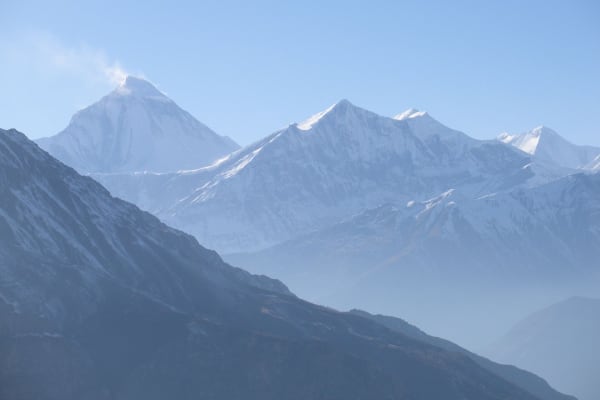
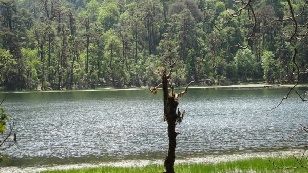
The walking is middle-hill and forest country rather than high mountain. The high point is the Jaljala Pass (3,414 m), and between the wide grasslands of the Dhorpatan Hunting Reserve and the Kham Magar villages beyond it you can walk for days without passing a lodge. Dhaulagiri, Churen Himal and Putha Hiunchuli stand along the northern skyline for much of the route.
This is a trek about people and recent history as much as scenery, in a region that receives virtually no foreign visitors. If that is what you are after, there is nothing else quite like it in the country.

The Trek at a Glance
| Duration | 15 days Kathmandu to Kathmandu |
| Highest point | Jaljala Pass, 3,414 m |
| Difficulty | Moderate — long days, low altitude, rough trails |
| Best seasons | March to May, October to November |
| Accommodation | Tents, village homestays, and teahouses where they exist |
| Access | In by road via Pokhara and Darbang, out by air from Nepalgunj |
| Permits | Dhorpatan Hunting Reserve entry permit and trekking registration |
| Price | From USD 1,750 per person |
We run it as a 15-day trek. It shares its approach over the Jaljala Pass with the Churen Himal Base Camp trek, then turns west into Rolpa where that route turns north.
The Route
Darbang to Dhorpatan (1,110 m to 2,900 m)
Road from Kathmandu via Pokhara to the roadhead at Darbang, then three days up the Myagdi Khola through Dharapani, Muri and Lumsum — Magar villages, terraces and suspension bridges. From Lumsum the trail climbs steadily through rhododendron and fir to the Jaljala Pass (3,414 m), a broad grassy saddle, and drops into the flat-bottomed valley of the Dhorpatan Hunting Reserve.
Dhorpatan to Thabang (2,900 m to 2,200 m)
West out of the grasslands and down into Rolpa, through Pelma and Maikot. This is where the trek changes character: the country is lower, greener and much more populated, but almost nobody here is set up for visitors. Nights are in village households and tents rather than lodges, and the cook crew matters.

Thabang and the exploration day (2,200 m)
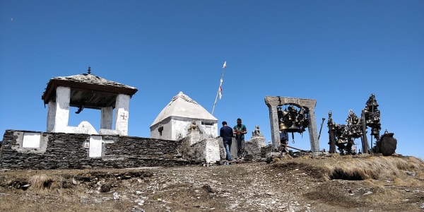
Thabang was the political centre of the insurgency, and a full day there is built into the itinerary for a reason. It is a large Kham Magar village of stone and slate that ran itself largely outside the state for years. The day is spent walking the village with your guide, visiting the memorial and meeting people who lived through the period — and it is best approached with questions rather than opinions.
Thabang to Sulichaur and out (2,200 m to 1,000 m)
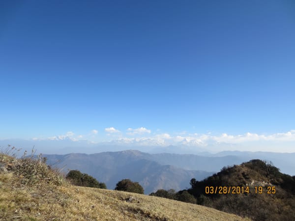
A climb to the Jaljala ridge above Thabang — a different Jaljala from the pass, and a fine viewpoint north to Dhaulagiri — then a long descent to the road at Sulichaur. From there a jeep to Nepalgunj on the Terai plain, and a short flight back to Kathmandu.
Is It Safe, and What Will You Actually See?
It is safe. The insurgency ended in 2006, the Maoists have been a mainstream political party for years, and Rukum and Rolpa are ordinary Nepali hill districts now. The risks on this trek are the normal ones — weather, rough trails, distance from a hospital — not political.
What you see of the history is mostly conversational rather than monumental. There are memorials, a small museum at Thabang, bullet damage on a few buildings, and political murals that have never been painted over. The substance is in what people tell you, which is why a guide who knows the area and can translate properly makes or breaks the trip.
- Thabang — the political heart of the movement, and a full day on the itinerary.
- Memorials and a museum in several villages along the route.
- Kham Magar culture, distinct from the Magar communities further east in language and practice.
- The Dhorpatan grasslands, which are worth the trek on their own.
Difficulty and Conditions
Graded moderate. The altitude is modest — nothing above 3,414 m — but the route is long, the trails are working village paths rather than trekking routes, and the days involve a lot of climbing and descending between valleys.
- Ten walking days, most five to seven hours, with repeated 800 to 1,200 m ascents and descents.
- Low altitude, so altitude sickness is not a significant concern.
- No lodges for much of the route — the trip is supported by tents, a cook crew and village homestays.
- Rough, wet trails through the forest belt, particularly early and late in the season.
- No mobile signal across most of Rolpa, and no ATMs after Pokhara.
Our guide to Nepal's quieter trails puts this route in context against the other genuinely empty options.
What It Costs
The price includes a domestic flight from Nepalgunj, a long jeep transfer out of Rolpa, and a full camp and kitchen crew for the days where there is nowhere to stay.
| Group size | Price per person |
|---|---|
| 1 trekker | USD 1,875 |
| 2 to 4 | USD 1,850 |
| 5 to 7 | USD 1,825 |
| 8 to 10 | USD 1,800 |
| 11 to 14 | USD 1,775 |
| 15 and over | USD 1,750 |
Carry all your cash from Pokhara. There are no ATMs between the roadhead and Nepalgunj, and in villages where nobody runs a lodge, small notes matter.
What Is Included
- Airport pickup and drop-off in Kathmandu.
- Nepalgunj to Kathmandu flight with airport transfers.
- Private transport Kathmandu to Pokhara, and private jeep Pokhara–Darbang and Sulichaur–Nepalgunj.
- Hotel accommodation in Kathmandu, Pokhara and Nepalgunj with breakfast.
- Two-person tents, mess tent, toilet tent and all group camping equipment, plus village homestay arrangements and teahouses where they exist.
- A cook and kitchen crew.
- Three meals a day during the trek.
- Dhorpatan Hunting Reserve entry permit and trekking registration.
- A licensed English-speaking guide, group map, first aid kit, and all government taxes and service charges.
What Is Not Included
- International flights and the Nepal entry visa fee.
- Travel insurance including emergency helicopter evacuation.
- Personal trekking equipment and clothing.
- Porter services, available at additional cost.
- Lunch and dinner in Kathmandu, Pokhara and Nepalgunj.
- Snacks, bottled water, hot showers, Wi-Fi, charging and drinks.
- Laundry, phone calls, souvenirs and personal expenses.
- Tips for guides, drivers and support staff.
- Extra accommodation or transport caused by weather or anything outside the itinerary.
Domestic flights out of Nepalgunj are weather-dependent, so keep a buffer day before an international departure. Our domestic flights guide explains how to plan around them.