The Dhaulagiri Circuit is the only trek in Nepal that circles an 8,000 m mountain entirely on foot, and it is the one classic route where the word expedition is not marketing. There are no lodges above Dobang, no road to bail out to, and no phone signal for a week. Once the group climbs onto the Chhonbardan Glacier the only ways out are forward over two 5,000 m passes or back down the Myagdi valley, and both take days.
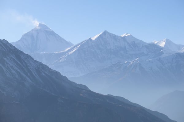
What you get for that commitment is the south face of Dhaulagiri I (8,167 m) — four vertical kilometres of it — from a tent pitched on the ice beneath it, and then a crossing into Hidden Valley, a closed basin at 5,050 m that almost nobody sees. The trek finishes in the apple orchards of Marpha in the Kali Gandaki, which means you walk off a glacier one day and are handed a slice of apple pie the next.

The Trek at a Glance
| Duration | 18 days Kathmandu to Kathmandu, 13 of them walking |
| Highest point | French Pass, 5,360 m |
| Highest night | Hidden Valley, 5,050 m |
| Difficulty | Difficult — a full camping expedition, not a teahouse trek |
| Best seasons | April to May, October to November |
| Accommodation | Teahouses to Dobang, then tents for the rest |
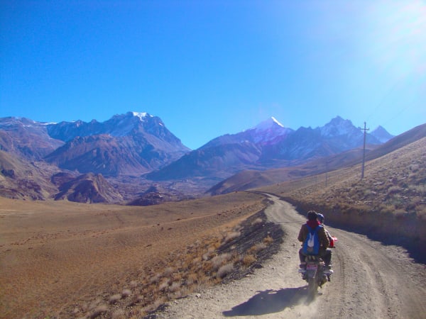
| Access | Road to Darbang, out by road from Jomsom |
| Permits | ACAP and trekking registration — no restricted-area permit |
| Price | From USD 2,250 per person |
We run it as an 18-day camping expedition from Kathmandu. If the full circuit is more than you want, the Churen Himal Base Camp trek reaches comparable remoteness on the western end of the same massif with no glacier travel.
The Route, Stage by Stage
Darbang to Dobang (1,110 m to 2,520 m) — days 3 to 6
Road to the Darbang roadhead via Pokhara and Beni, then four days up the Myagdi Khola through Dharapani, Muri and Boghara. This is settled middle-hill country at first — Magar villages, terraces, suspension bridges — but the valley closes in day by day and the trail gets rougher. Dobang is the last inhabited place; beyond it there are no villages, no lodges and no supplies until Marpha.
Dobang to Dhaulagiri Base Camp (2,520 m to 4,750 m) — days 7 to 11
The biggest single climb of the approach takes you 1,100 m to Italian Base Camp (3,660 m), above the treeline and in full view of the mountain. A full acclimatisation day there — walking to about 4,100 m and coming back down — pays for itself over the pass a week later.
Then the group steps onto the ice. Glacier Camp (4,210 m) and Dhaulagiri Base Camp (4,750 m) are both pitched on the Chhonbardan Glacier's moraine and then the ice itself: loose rock, meltwater channels, and rockfall noise through the night. A second acclimatisation day at Base Camp is the one that decides whether the French Pass goes well or badly.
The French Pass and Hidden Valley (5,360 m / 5,050 m) — day 12
The crux. You leave camp in the dark to be on the pass before the wind gets up. The climb is long rather than steep — a sustained grind on snow and scree — and the French Pass (5,360 m) opens onto Hidden Valley, a flat, closed basin ringed by Sita Chuchura, Tukuche Peak and Thapa Peak. Camp at 5,050 m is the highest and coldest night of the trek, and the wind rarely stops.

Dhampus Pass to Marpha (5,290 m to 2,670 m) — days 13 to 15
A second pass, Dhampus (5,290 m), known locally as Thapa Bhanjyang, and then the longest descent of the trek: roughly 1,600 m to Yak Kharka in an afternoon, on loose ground that punishes tired knees. The following day drops into the Kali Gandaki at Marpha — whitewashed Thakali village, apple orchards, a monastery above the rooftops, and the first hot shower in two weeks. An easy final walk to Jomsom, then out by road.
How Hard Is It, Really?
This is the hardest trek we run that does not involve a rope and a summit. No technical climbing is required, but the grade comes from a combination of things that individually would be manageable and together are not:
- Thirteen consecutive walking days with no road access and no rest day that is not also an acclimatisation day.
- Three nights camped on a glacier at 4,210 m and 4,750 m, plus a night at 5,050 m in Hidden Valley.
- Two passes over 5,250 m in consecutive days, both crossed on snow with crampons and a fixed rope where needed.
- A 1,600 m descent off the Dhampus Pass in a single afternoon, which is where most people's legs give out.
- Cold. Nights at Base Camp and Hidden Valley routinely hit -15 °C and can reach -20 °C, with wind on top of that.
You do not need mountaineering experience, but you should have completed a multi-day trek above 4,000 m before booking this one. Our difficulty grades guide explains how we score routes, and the training plan covers the descent strength this route demands more than most.
Best Time to Go
The usable windows are narrow, and narrower than on a teahouse trek because the passes hold snow and the glacier camps are genuinely cold.
| Season | Conditions |
|---|---|
| April to May | The stronger window. Stable weather, passes generally open, rhododendron through the forest belt on the approach. Warmer nights on the glacier. |
| October to November | Clear air and the best mountain views, but colder. By mid-November Hidden Valley nights are brutal and an early snowfall can close the French Pass. |
| December to March | Not run. The passes are snowbound and the glacier camps are unsurvivable without full winter equipment. |
| June to September | Monsoon. The Myagdi approach is leech country, the trail is unstable, and there is nothing to see. |
Build a spare day into your flights either way. If the French Pass is loaded with new snow your guide will wait at Base Camp rather than cross, and if it stays closed the group retraces the Myagdi valley — which adds three days.
What It Costs
The price is driven by the support crew rather than by lodging. On a fully camped route the team — guide, assistant guide, cook, kitchen crew and porters for tents, food and group equipment — is usually larger than the trekking group itself, and every kilo of food for thirteen days is carried in from the roadhead.
| Group size | Price per person |
|---|---|
| 1 trekker | USD 2,375 |
| 2 to 4 | USD 2,350 |
| 5 to 7 | USD 2,325 |
| 8 to 10 | USD 2,300 |
| 11 to 14 | USD 2,275 |
| 15 and over | USD 2,250 |
Budget on top of that for personal kit, travel insurance that covers helicopter evacuation above 5,000 m, and tips. There is almost nothing to spend money on between Darbang and Marpha — no lodges, no shops, no charging fees — so trail extras are far lower than on a teahouse route. Our cost guide breaks down the wider picture.
What Is Included
Everything below is in the package price:
- Airport pickup and drop-off in Kathmandu.
- Private transport Kathmandu–Pokhara–Kathmandu, and Pokhara–Darbang and Jomsom–Pokhara.
- Hotel accommodation in Kathmandu and Pokhara with breakfast.
- Teahouse accommodation on the lower trail, and two-person tents, mess tent, toilet tent and all group camping equipment above Dobang.
- A cook and full kitchen crew for the camping section.
- Three meals a day throughout the trek.
- Annapurna Conservation Area Permit and trekking registration.
- A licensed English-speaking guide, plus an assistant guide.
- Crampons, ice axe and fixed rope for the French and Dhampus Pass crossings.
- Group trekking map, first aid kit carried by the guide, and all government taxes and service charges.
What Is Not Included
Plan and budget for these separately:
- International flights to and from Nepal, and the Nepal entry visa fee.
- Travel insurance including emergency helicopter evacuation — mandatory on this route, not optional.
- Personal trekking equipment and clothing, including a bag rated to -15 °C or lower.
- Porter services, which are available at additional cost if you would rather not carry a daypack.
- Lunch and dinner in Kathmandu and Pokhara.
- Snacks, bottled water, hot showers, Wi-Fi, charging and drinks.
- Laundry, phone calls, souvenirs and other personal expenses.
- Tips for the guide, crew and drivers.
- Any extra accommodation or transport caused by weather, a closed pass, or anything else outside the itinerary.
That last line matters more here than on other trips. Build the cost of two or three unplanned days into your budget before you go, and see our insurance guide for what a policy actually needs to cover at this altitude.
Life Above Dobang: Kit, Power and Waste
The thirteen days between the roadhead and Marpha are self-contained, and a few practicalities catch people out.
- Power. Patchy NTC signal as far as Boghara, then nothing until Marpha. No mains power between Dobang and Marpha. Bring a large power bank or a small solar panel, and sleep with batteries inside your bag — cold flattens them overnight.
- Washing. A bowl of warm water in the morning. There are no showers between Darbang and Marpha, which is roughly ten days.
- Toilets. The crew pitches a toilet tent at every camp and carries all waste off the glacier.
- Your load. Only a daypack, seven to ten kilos. Porters carry your duffel, capped at 15 kg, along with tents, food and kitchen.
- Sleeping bag. Rated to -15 °C or lower, with an insulated mat. This is a requirement rather than a suggestion.
The packing list covers the general kit; add crampon-compatible boots, proper gaiters and a windproof shell layer for the pass days.