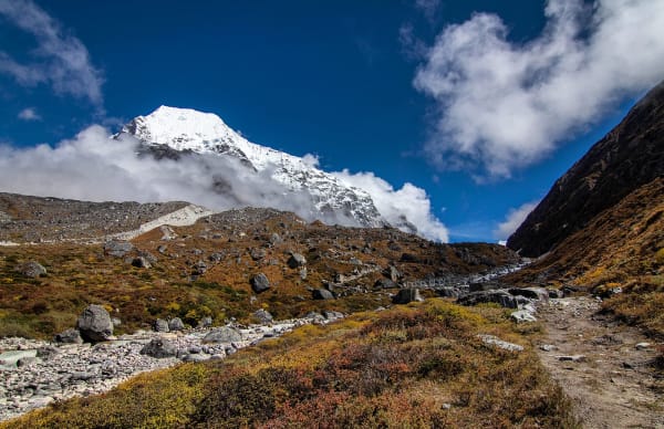
Rolwaling is the valley between the Khumbu and Langtang, running east from the Gaurishankar massif toward the Tibetan border. In Sherpa tradition it is a beyul — a hidden valley, a sacred refuge revealed by Guru Rinpoche — and it feels like one: a long, steep-sided trough with Gaurishankar (7,134 m) at its western end and the Trakarding glacier and Tsho Rolpa at its head.
It also offers one of the great crossings in Nepal. The Tashi Lapcha at 5,755 m links Rolwaling to Thame in the Khumbu, which makes it possible to walk from the road at Dolakha into the Everest region on foot — a serious undertaking that almost nobody does.
The Two Routes
| Rolwaling Valley Trek | Tashi Lapcha Pass Trek | |
|---|---|---|
| Days | 17 | 18 |
| Highest point | About 5,010 m | Tashi Lapcha, about 5,755 m |
| Difficulty | Moderate to difficult | Extreme — glacier travel and rope work |
| Finish | Back out to the road at Dolakha | Thame in the Khumbu, then Lukla |
| Technical ground | None on the standard route | Glacier crossing, fixed rope, crampons |
| Who it suits | Experienced trekkers | Trekkers with mountaineering experience |
There is also a 12-day Tsho Rolpa trek, which reaches the glacial lake and returns — the shortest way into Rolwaling and the right choice if you have under two weeks.
The Valley
In from Dolakha
A road journey from Kathmandu to Chetchet or Gongar in Dolakha district, then up the Bhote Koshi and into the Rolwaling Khola. The lower valley is forested, steep and humid, with a long climb to the Sherpa village of Simigaon and its gompa.
Beding and Na
The valley opens above the forest. Beding at around 3,690 m is the main Sherpa village — a single street of stone houses with a gompa, a population that drops to almost nothing in winter, and a long mountaineering history: many Rolwaling Sherpas work as high-altitude climbers. Na at 4,180 m is a summer settlement of stone huts on a wide yak pasture with the Rolwaling peaks around it.
Tsho Rolpa (4,580 m)
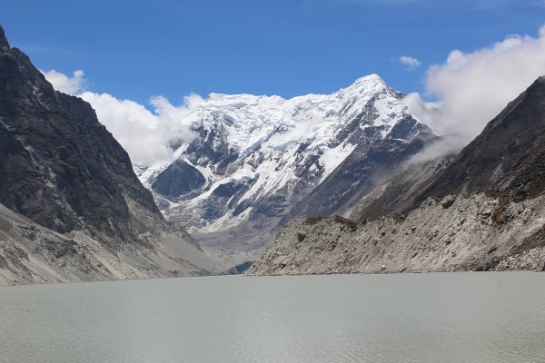
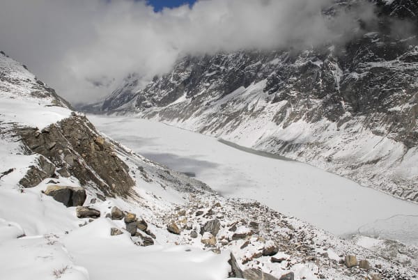
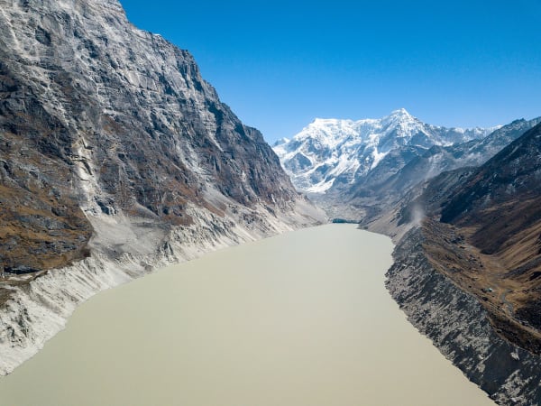
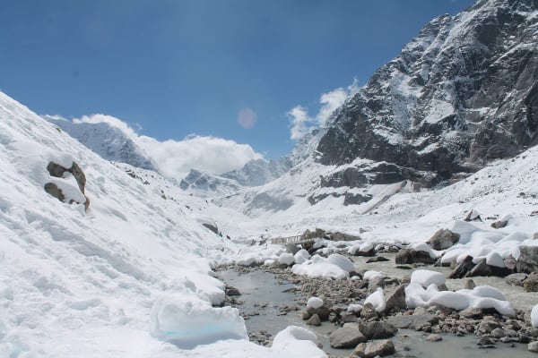
Tsho Rolpa is a glacial lake dammed by moraine at the foot of the Trakarding glacier, around 3.5 km long and one of the largest glacial lakes in Nepal. It has grown dramatically through the last century as the glacier retreated, and it has been the subject of a major engineering programme to lower its level because of the risk of a glacial lake outburst flood. Standing on the moraine dam looking at the ice cliff at the far end is a direct look at what is happening to the Himalaya.
Yalung Ri and the high ground
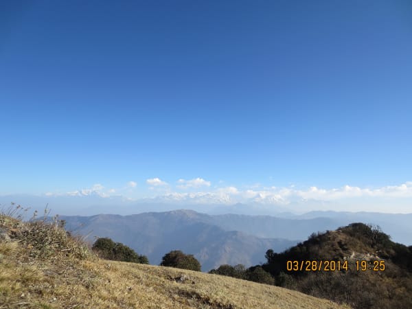
Above Na, Yalung Ri at around 5,630 m is a straightforward snow peak used for acclimatisation and training, and the ridge walks from Na to around 5,010 m give the trek's best views — Gaurishankar, Melungtse across the Tibetan border, and the Rolwaling Himal.
The Tashi Lapcha Crossing
The pass at about 5,755 m links the head of Rolwaling to the Bhote Koshi above Thame in the Khumbu. It is not a trekking pass.
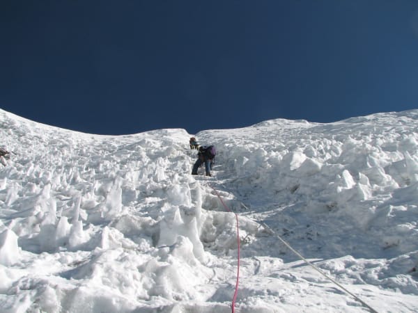
- Glacier travel. The route crosses the Trakarding and Drolambau glaciers, with crevasse risk and roped travel.
- Technical sections. Fixed rope on steep ice and rock, crampons and an ice axe, and a harness.
- High camps. Two or three nights above 5,000 m in tents, with a crew carrying everything.
- No retreat. Once committed to the glacier section, turning back is a multi-day proposition.
- Experience required. We ask for previous glacier and rope experience, or that you take our pre-crossing training days seriously.
Done properly it is one of the finest things you can do in Nepal — a genuine mountaineering traverse from a road-accessible valley into the Khumbu, finishing in Thame with Everest a day away. It is closer to the trekking peak category than to trekking, and it is priced and staffed accordingly.
Practicalities
- Season: April to May and late September to October. The valley is wet in the monsoon and the high ground is snowbound in winter.
- Permits: Gaurishankar Conservation Area entry and trekking registration for the valley; Sagarmatha National Park and the Khumbu municipality fee as well if you cross the Tashi Lapcha.
- Accommodation: basic lodges and homestays at Simigaon, Beding and Na; camping above. Beding and Na both empty out in winter.
- Altitude: Na at 4,180 m and Tsho Rolpa at 4,580 m need proper acclimatisation. Our itineraries build in days at Beding and Na.
- Cold: -15 °C at Na in the main seasons, colder on the pass. A -20 °C bag minimum, and expedition kit for the crossing.
- Insurance: to 6,000 m for the valley, and mountaineering cover to 6,500 m for the Tashi Lapcha.
One note on the road approach: the Dolakha roads are landslide-prone and the drive in can take longer than scheduled. Build in a spare day.
Why Go
- It is genuinely wild. Rolwaling has a handful of villages, no road, and a fraction of the visitors of the valleys on either side of it.
- Gaurishankar and Melungtse. Two of the most striking unclimbed-looking mountains visible from Nepal, neither of which most trekkers ever see.
- Tsho Rolpa. A direct, unmistakable view of Himalayan glacial retreat, on a scale that photographs do not convey.
- The beyul tradition. Rolwaling's status as a hidden valley shapes how the Sherpa community there relates to the place, and it is worth asking about.
- The crossing. If you have the skills, walking from Dolakha to Thame over the Tashi Lapcha is one of the great Himalayan traverses.
Who should not go: first-time trekkers in Nepal, anyone who needs lodge comfort, and — for the Tashi Lapcha specifically — anyone without rope and crampon experience. For a first high trek in central Nepal, Langtang or Everest Base Camp are the better introductions.