Panch Pokhari means five lakes, and they sit in a rock basin at around 4,620 m in the Jugal Himal, the range east of Langtang and north-east of Kathmandu. The lakes are a Hindu pilgrimage site, visited in numbers at Janai Purnima in August and otherwise almost empty.
This is the highest trek in Nepal that is still within six hours' drive of Kathmandu, and it sees perhaps a couple of hundred foreign trekkers a year. The trade-off for that solitude is real: the lodge network is thin, some nights are basic shelters or camping, and the altitude gain is fast.
The Trek at a Glance
| Duration | 11 days from Kathmandu |
| Highest point | Panch Pokhari, about 4,620 m |
| Difficulty | Moderate to challenging — fast altitude gain, basic accommodation |
| Access | Road from Kathmandu to Chautara or Melamchi, about 6 hours |
| Permits | Trekking registration; conservation area fee on some variants |
| Best seasons | March to May, October to November; August for the pilgrimage |
| Accommodation | Basic lodges, homestays and simple shelters |
We run it as an 11-day Panch Pokhari trek.
The Route
The trail climbs a long ridge from the Sindhupalchok hills to the lakes, gaining over 3,000 m with almost no traverse — it is essentially one very long ascent and the same descent.
- Chautara or Melamchi to Bhotang and Kami Kharka — terraced farmland and Tamang villages, with homestay accommodation and the Jugal Himal appearing on the skyline.
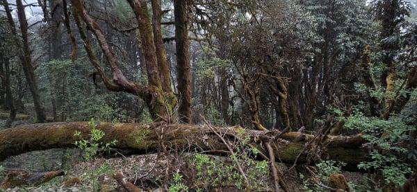
- Kami Kharka to Pauwa Bas and Hile Bhanjyang — into oak and rhododendron forest, then out onto open ridge pasture used by summer herders. Accommodation becomes simple huts and shelters.
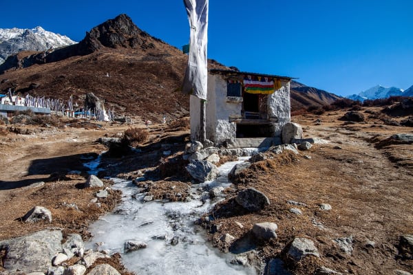
- To Panch Pokhari (4,620 m) — a long final climb to the lake basin, with a small Shiva temple, pilgrim shelters, and the five lakes scattered across bare rock beneath Dorje Lakpa (6,966 m).
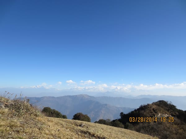
- The viewpoint above the lakes — a short climb for the full Jugal Himal panorama, taking in Dorje Lakpa, Madiya, Phurbi Ghyachu, and on clear days across to Langtang Lirung and the Rolwaling peaks.
- Down the same ridge, with variant descents toward Melamchi or the Indrawati valley.
Difficulty and the Honest Caveats
This is a more demanding trek than its modest profile suggests, for three specific reasons.
- Fast altitude gain. From roughly 1,000 m to 4,620 m with no natural rest stop and a thin lodge network, which limits how the itinerary can be staged. Our schedule builds in a ridge night to break it, and the altitude still needs respect.
- Basic accommodation. Homestays low down, then herders' huts and pilgrim shelters higher. Expect no showers, shared sleeping space, and on some nights a tent. Bring a -20 °C bag.
- Water and supplies. Thin on the upper ridge. Our crew carries food and treats water on the high sections.
- Weather exposure. The ridge is long and open, with no shelter between stops, so a storm means walking in it.
- Remoteness. Despite being close to Kathmandu in kilometres, the upper ridge is a long way from a road or a health post. Insurance with helicopter cover matters here.
What you get for that: a 4,620 m lake basin under a 6,966 m peak, a Hindu pilgrimage site almost nobody photographs, and a trek where you are genuinely unlikely to meet another foreign group.
The Pilgrimage, and the Earthquake
At Janai Purnima in August, pilgrims walk up to the lakes to bathe and have their sacred thread renewed — the same festival that fills Gosaikunda, on a much smaller scale. Shelters at the lakes exist for this rather than for trekkers, and the trail is briefly busy. If you want to see it, the same caveats apply as at Gosaikunda: monsoon weather, no views, and crowded shelters.
Sindhupalchok was the district with the highest death toll in the 2015 earthquake, and the villages on the lower part of this trek — Bhotang among them — were very badly hit. Rebuilding has happened, and homestay income on this trail goes to households that lost a great deal. Our earthquake recovery guide covers the wider picture in this part of Nepal.
Who Should Go
- Experienced trekkers who have slept above 4,000 m and want somewhere genuinely unvisited.
- Trekkers comfortable with basic accommodation and the possibility of a tent.
- Anyone avoiding flights who still wants to get above 4,500 m.
- Photographers — the Jugal Himal from the lake basin is as good as anything in central Nepal and essentially unphotographed.
One more practical point in favour of it: because the whole route is one long ridge, the escape plan is simple. There is no pass to commit to and no point at which going back is harder than going on, so a trekker who is struggling with the altitude can descend to thicker air within a few hours at any stage. That is a meaningful safety margin on a trek this high, and it is why we are comfortable running it despite the thin infrastructure.
Who should not: first-time trekkers in Nepal, and anyone who needs lodge comfort or a reliable hot shower. For a first high trek in this part of the country, Langtang Valley or Gosaikunda are the better choices, and Ama Yangri is the better short option.