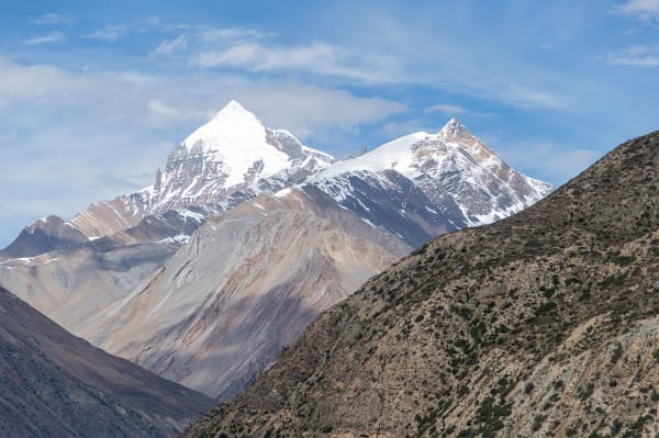
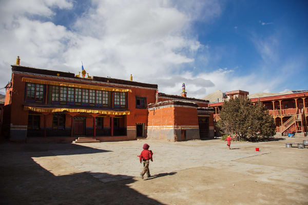
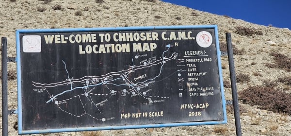
Nar and Phu are two villages at around 4,000 m in a side valley north of Manang, closed to outsiders until 2002 and still seeing a tiny fraction of the trekkers who walk the Annapurna Circuit a day's walk away. Getting in means a long climb through a narrow gorge; getting out, for most itineraries, means crossing the Kang La at 5,320 m back into Manang.
The draw is the villages themselves: flat-roofed stone houses, ancient gompas, yak herds, and a Tibetan-dialect culture that has been largely undisturbed because almost nobody went there. It feels closer to Upper Mustang than to the Annapurna Circuit, for a fraction of the permit cost.
The Trek at a Glance
| Duration | 14 days from Kathmandu |
| Highest point | Kang La, 5,320 m |
| Villages | Phu (about 4,080 m) and Nar (about 4,110 m) |
| Difficulty | Challenging — a 5,320 m pass, long remote stages, basic lodges |
| Permit | Restricted-area permit, USD 100 per week Sep–Nov, USD 75 Dec–Aug, plus ACAP |
| Minimum group | Two trekkers with a registered agency and licensed guide |
| Best seasons | March to May, September to November |
| Accommodation | Basic lodges and homestays, some camping on variants |
We run it as a 14-day Nar Phu Valley Trek, usually combined with Manang and sometimes with Thorong La to complete the Annapurna Circuit.
The Route
Besisahar to Koto (760 m to 2,600 m)
The standard Annapurna Circuit approach up the Marsyangdi — Jagat, Dharapani, and Chame — as far as Koto, where the Nar Phu valley joins from the north and the restricted-area checkpoint sits.
Koto to Phu (2,600 m to 4,080 m)
The best walking on the trek. The trail enters a narrow gorge on the Phu Khola, crossing and recrossing the river on bridges wedged between rock walls, past Dharmasala and Kyang, through a genuine slot canyon section where the sky narrows to a strip. Then it opens abruptly and Phu appears on a bluff — a fortified village of stacked stone houses with three gompas and yak pastures beyond, at the foot of glaciers running down from the Tibetan border.
Spend a day here. The Tashi Lhakhang Gompa above the village is one of the oldest in the region, and the walk up the valley toward the Himlung Himal base camp is superb.
Phu to Nar (4,080 m to 4,110 m)
Back down the valley and up a side branch to Nar, the larger of the two villages — four gompas, a chorten row on the approach that is among the most photographed in Nepal, and a working agricultural community at 4,110 m.
Nar to Manang over the Kang La (5,320 m)
The crux. A long pass day with around 1,200 m of ascent to the Kang La at 5,320 m, then a steep descent to Ngawal on the Annapurna Circuit high route. The view from the pass takes in the whole Annapurna range from the north — Annapurna II, III, IV, Gangapurna, Tilicho Peak — which is an angle almost no trekkers ever see.
From Ngawal you are back on the circuit. Many itineraries then continue to Manang and over Thorong La; ours can do either.
Permits and the Group Rule
Nar Phu is a restricted area, which has three practical consequences:
- You cannot trek it independently. A licensed guide and a registered agency are conditions of the permit itself.
- Minimum two trekkers. A solo traveller cannot be issued a permit alone, though we can often pair you with another booking — ask early.
- The permit is time-limited and priced by the week. USD 100 per week from September to November, USD 75 from December to August, plus the ACAP at NPR 3,000. Extra days cost more, so the itinerary length is set when the permit is issued.
Permits are processed through the Department of Immigration in Kathmandu on a working day and need your original passport, so plan at least one full day in the city before departure. Our restricted-area permits guide covers the whole system.
Difficulty and Conditions
- The Kang La at 5,320 m is a genuine high pass — long, cold, and with around 1,200 m of ascent followed by a steep descent. Nights at Nar at 4,110 m acclimatise you for it, which is why the pass comes at the end.
- Lodges are basic. Simple lodges and homestays in Phu and Nar, and a teahouse at Kyang and Dharmasala on the way in. Expect shared rooms, outside toilets, and no showers at altitude.
- Stages are long and remote. The gorge day to Phu is seven to eight hours, and there is nothing in between.
- Cold. Nights at Phu and Nar run to -10 to -15 °C in the main seasons. A -20 °C bag is right.
- Partial rain shadow. Nar Phu sits behind the Annapurnas and stays relatively dry, which makes it one of the better monsoon-season options — though the approach up the Marsyangdi is wet.
- Insurance to 6,000 m with helicopter evacuation. This is remote country.
Why Go Here Rather Than Upper Mustang
Both are restricted Tibetan-Buddhist regions behind the main Himalayan chain. The differences:
| Nar Phu | Upper Mustang | |
|---|---|---|
| Permit cost | USD 100 per week | USD 500 for ten days |
| Days | 14 | 16 |
| Highest point | Kang La, 5,320 m | About 3,860 m |
| Difficulty | Challenging — a high pass | Moderate — long days, no pass |
| Landscape | Glacial side valley, slot canyon, yak pasture | Ochre desert, eroded cliffs, walled towns |
| Culture | Two isolated villages, four gompas at Nar | Lo Manthang, the former capital, monasteries and cave complexes |
| Accessibility | On foot from the Annapurna Circuit | Flight to Jomsom, or road |
Nar Phu is the better choice if you want a high pass and a fraction of the permit cost; Upper Mustang if you want the cultural depth of a former kingdom and lower altitude. Both are genuinely remote in a way the Annapurna Circuit no longer is.