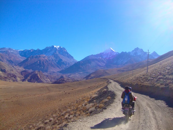
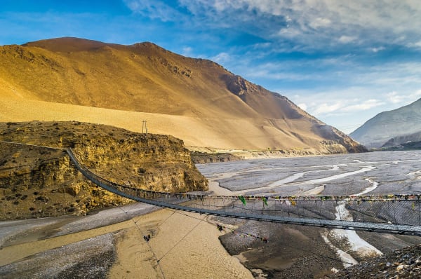
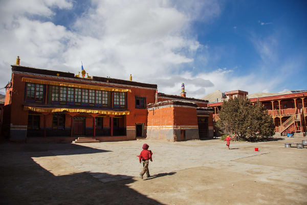
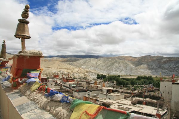
The Kali Gandaki cuts between Dhaulagiri (8,167 m) and Annapurna I (8,091 m), making it the deepest gorge on earth by some measures, and north of that gap the landscape changes completely. The monsoon cannot cross the barrier, so Lower Mustang is dry, wind-scoured, ochre-coloured desert with walled Tibetan-Buddhist villages and barley terraces irrigated from snowmelt.
At the top of the valley sits Muktinath at 3,760 m, one of the most important pilgrimage sites in the Himalaya, sacred to Hindus and Buddhists alike. The trek there has no pass, almost no altitude risk, and weather that works when most of Nepal is under cloud.
The Trek at a Glance
| Duration | 9 days from Kathmandu, 5 days from Pokhara |
| Highest point | Muktinath, 3,760–3,800 m |
| Difficulty | Moderate — long valley stages, strong afternoon wind |
| Best seasons | March to May, September to November; also viable in monsoon |
| Access | Flight or road to Jomsom from Pokhara |
| Permits | Annapurna Conservation Area Permit and trekking registration |
| Altitude risk | Low — no pass, gradual gain |
We run it as a 9-day trek from Kathmandu and a 5-day version from Pokhara, with the Lower Mustang trek as the longer 10-day exploration of the same valley.
The Route
Into the valley
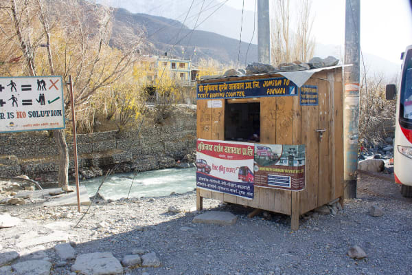
Either a 20-minute flight from Pokhara to Jomsom (2,720 m) — spectacular, flying between Dhaulagiri and Annapurna — or a long road journey up the Kali Gandaki. Jomsom is the administrative centre of Mustang, a strip of a town on a windy riverbed with an airstrip and a good mountaineering museum.
Marpha and the Thak Khola
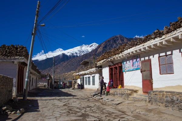
South of Jomsom lies Marpha, the most attractive village in the valley — whitewashed flat-roofed houses, paved alleys, a hillside gompa, and apple orchards that supply Nepal's best apple brandy and dried fruit. Several itineraries include it, and it is worth the detour.
Kagbeni
North of Jomsom, Kagbeni at 2,810 m is a medieval walled village at the confluence of the Kali Gandaki and the Jhong Khola, and the gateway to restricted Upper Mustang. Red-ochre gompa, mud-brick alleys you can barely walk two abreast in, a 15th-century monastery, and a checkpoint beyond which you need a USD 500 permit. It is one of the most atmospheric villages in Nepal.
Muktinath (3,760 m)
Up the Jhong Khola through Jharkot and Khinga to Muktinath. The temple complex holds the Vishnu shrine with its 108 water spouts, which pilgrims bathe under in sequence, and the adjacent Jwala Mai gompa with an eternal flame of natural gas burning over water — which is why the site is sacred to both Hindus and Buddhists. It is one of the 108 Divya Desams of Vaishnavism and a Buddhist place of power associated with Guru Rinpoche.
The walk down from Muktinath to Kagbeni or Jomsom is straightforward, and most trekkers fly or drive out of Jomsom.
Why It Works When Other Treks Do Not
- The rain shadow. Lower Mustang sits behind the Himalayan barrier and gets a fraction of Nepal's monsoon rainfall, so this is one of the few treks that works in July and August.
- No pass. The route gains altitude gradually to 3,760 m and stops. Altitude sickness is uncommon.
- Good in winter. Cold but dry and clear, and the valley is low enough to stay comfortable.
- Culturally dense. Kagbeni, Marpha, Jharkot and Muktinath in five days is more built heritage than most Nepali treks offer in two weeks.
- Short and flexible. Five days from Pokhara, with flights or jeeps in and out.
The one thing to plan around is wind. The Kali Gandaki funnels a ferocious valley wind from about 11 a.m. every day, carrying dust. Walking stages are scheduled to finish early for exactly this reason, and a buff and sunglasses are not optional.
The Road, and What It Changed
A jeep road now runs up the Kali Gandaki to Jomsom and on to Muktinath, which has changed this trek more than any other in Nepal. Walking the valley floor means sharing it with vehicles and dust.
What we do about it: use the west-bank and high trails wherever they exist, which avoid the road for most of the route and give better views in the process. Some stages use a jeep deliberately — there is no merit in walking a dusty road for four hours — and the saved time goes into Kagbeni, Marpha and the side valleys instead.
If you want the Mustang landscape without any road at all, the answer is Upper Mustang beyond Kagbeni, or the Nar Phu valley on the other side of the range. Both are restricted areas with the permit costs that implies.
Muktinath as a Pilgrimage
For a large share of visitors, Muktinath is not a trek at all — it is a pilgrimage, and Nepali and Indian pilgrims come in numbers, particularly in autumn.
- The 108 spouts — bathing under all of them in sequence, in freezing snowmelt, is the central act. Watch rather than participate unless you intend it seriously.
- The eternal flame — natural gas burning above a spring inside the Jwala Mai temple, representing the union of fire and water.
- Shaligram fossils — ammonites from the Tethys Sea found in the Kali Gandaki riverbed, held sacred as manifestations of Vishnu. Collecting them is restricted; buy from a licensed seller rather than taking from the river.
- Etiquette — remove shoes in the temple complex, walk clockwise, dress modestly, and ask before photographing pilgrims.
If pilgrimage is the purpose rather than the walking, we also run a 6-day Muktinath pilgrimage tour by road and a helicopter day tour from Pokhara, both of which avoid the trekking entirely.