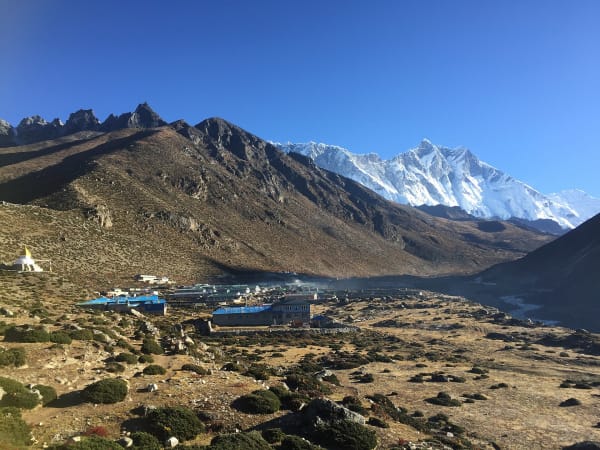
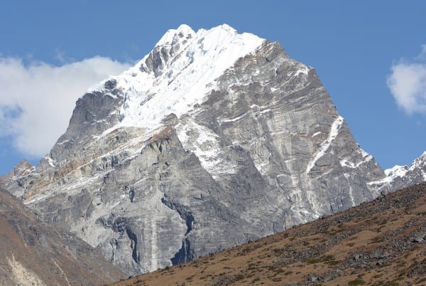
Island Peak — Imja Tse in Nepali — stands at 6,189 m at the head of the Imja valley in the Khumbu, named by Eric Shipton's party in 1952 because from Dingboche it looks like an island in a sea of ice. It was first climbed in 1953 as training for the Everest expedition, and it is now the most climbed trekking peak in Nepal.
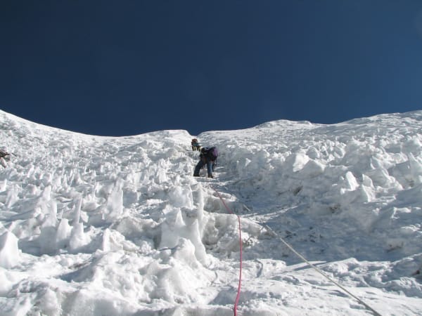
It earns that position. It is a genuine mountaineering route with a glacier, a steep fixed-rope headwall and an exposed summit ridge, and it is accessible to a fit trekker with no prior climbing experience. The summit looks directly at the Lhotse south face, one of the great walls in the Himalaya.
The Climb at a Glance
| Summit | 6,189 m |
| Duration | 18 days from Kathmandu on the standard itinerary |
| High camp | About 5,200 m |
| Summit day | 12–15 hours round trip |
| Technical grade | Alpine PD+ — glacier travel, a 45–50° fixed-rope headwall, exposed ridge |
| Skills needed | Crampons, ice axe, jumar, abseil, roped glacier travel — taught on the trip |
| Permits | NMA Group B (USD 250 spring, 125 autumn, 70 winter/summer), Sagarmatha National Park, Khumbu fee |
| Best seasons | April to mid May, October to November |
We run it as an 18-day standard itinerary following the Everest Base Camp acclimatisation profile, a 14-day version from Chhukung for climbers who are already acclimatised, and a 15-day version with a helicopter return.
The Route
Acclimatisation through the Khumbu
The standard itinerary walks the Everest Base Camp route — Lukla, Phakding, Namche with a rest day, Tengboche, Dingboche with a second rest day — and most trips include Everest Base Camp and Kala Patthar before turning to the peak. That is not padding: it is the acclimatisation that makes a 6,189 m summit realistic.
Chhukung and base camp
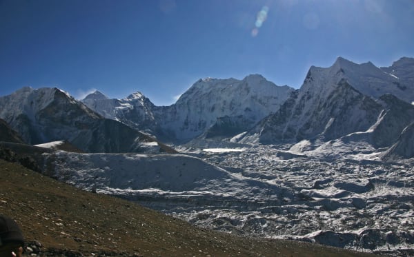
From Dingboche east into the Imja valley to Chhukung (4,730 m), then up to Island Peak Base Camp at about 5,100 m on a sandy flat beside the Imja glacier. The valley here is enclosed by Lhotse, Nuptse, Baruntse and Ama Dablam, and the Imja Tsho glacial lake is below — one of the most closely monitored lakes in Nepal because of outburst flood risk.
Training day
A full day at base camp or on the glacier with the climbing guides: crampons, ice axe, harness, jumar on a fixed rope, abseiling, and rope team procedure. Take it seriously. Climbers who can jumar efficiently summit; climbers who cannot spend four hours on a headwall that should take ninety minutes.
High camp
Most itineraries move to high camp at around 5,200 m the afternoon before the summit, which shortens summit day by two hours at the cost of a cold night in a tent. Some groups climb from base camp instead, which is a longer day and a better sleep.
Summit Day
| Stage | Ground | Time |
|---|---|---|
| High camp to the crampon point | Steep rock, scree and a gully, in the dark | 2–3 hours |
| Crampon point | Harness, crampons, rope up, one last layer | 20 min |
| Glacier | Roped travel, crevasses, occasionally a ladder | 1.5–2 hours |
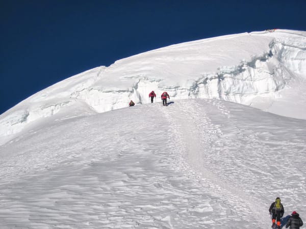
| The headwall | 100–150 m of 45–50° snow and ice on fixed rope, jumar | 1–3 hours |
| Summit ridge | Narrow and exposed, with drops both sides | 30–45 min |
| Summit, 6,189 m | Lhotse south face, Makalu, Baruntse, Ama Dablam | 15 min |
| Descent | Abseil the headwall, reverse the glacier and the gully | 4–5 hours |
Two things decide the day. The first is speed on the headwall — it is the bottleneck, and in peak season there can be a queue. The second is the turnaround time your guide sets, usually around 10 a.m.: if you are not at the ridge by then, you go down, because the afternoon weather and the long descent do not negotiate.
What Goes Wrong
- Altitude. The most common reason people do not summit. A 6,189 m push from 5,200 m after two weeks at altitude is demanding, and a poor night at high camp is normal rather than a warning — but a headache that will not clear is.
- Slow jumar technique. The single most fixable problem. Practise before you come.
- Cold. -20 °C with wind at the crampon point. Thin gloves and inadequate boots end more attempts than technique does.
- Queues on the headwall in peak season, which cost hours and push groups past the turnaround.
- Crevasses. The glacier changes year to year and the crossing points move. This is why a guide who has been up recently matters.
- Weather window. A summit push needs a clear, low-wind morning. Our itineraries carry a spare day for a second attempt.
It is also worth saying plainly: this is a mountain, and people have died on it. The exposure on the ridge is real, the glacier is a glacier, and the decision to turn around belongs to your guide. That is what you are hiring.
Island Peak or Mera Peak?
| Island Peak | Mera Peak | |
|---|---|---|
| Summit | 6,189 m | 6,476 m |
| Technical difficulty | Higher — headwall and exposed ridge | Lower — a long glacier with a short summit step |
| Summit day length | 12–15 hours | 8–12 hours |
| Acclimatisation | Excellent, via the Everest Base Camp route | Good, via the Hinku valley |
| Crowds | The busiest trekking peak in Nepal | Quieter |
| The view | Lhotse south face from close range | Five 8,000 m peaks — Everest, Lhotse, Makalu, Cho Oyu, Kanchenjunga |
| Best for | Climbers who want a technical summit day | Climbers who want altitude with less technical ground |
Many climbers do both — a 25-day combination climbs Mera first as acclimatisation and Island Peak second, which is the most effective way to summit both. Our full comparison goes into the decision.