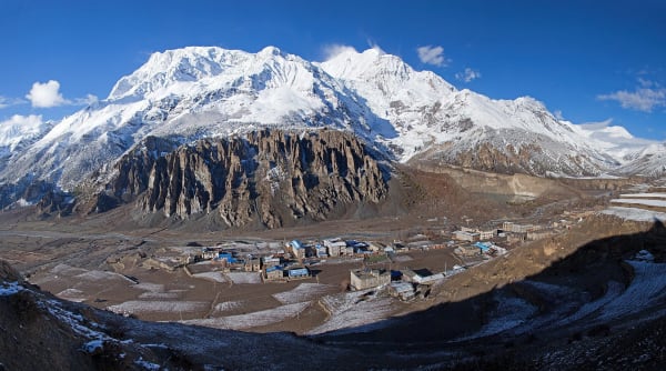
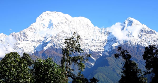
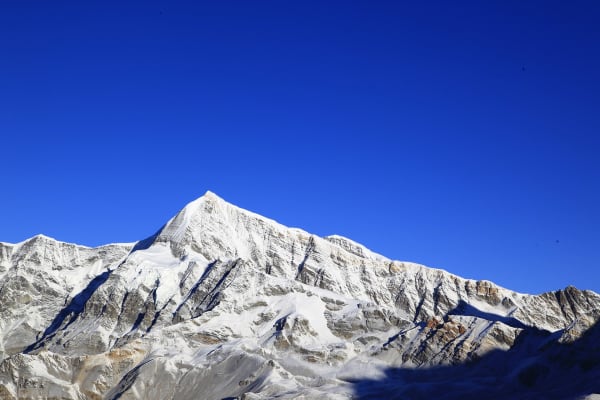
Gangapurna (7,455 m) is the mountain everyone in Manang looks at. Its north face and the icefall beneath it fill the entire southern skyline of the village, and the glacier lake at its foot is the standard afternoon walk for trekkers on the Annapurna Circuit.
Almost none of them realise it is climbable, and very few teams try — it was first climbed in 1965 by a German expedition under Günther Hauser, and successful ascents since can be counted in dozens rather than hundreds.
The route is graded D and it is a serious one: a heavily crevassed glacier, sustained ice at 50 to 55 degrees, a long corniced ridge, and objective hazard from seracs on the lower face that has to be timed rather than avoided. It is one of the hardest 7,000 m peaks in Nepal that is guided at all, and we run it for experienced alpinists with a previous 7,000 m summit behind them.

The Expedition at a Glance
| Summit | 7,455 m |
| Grade | D — crevassed glacier, 50–55° ice, long corniced ridge |
| Duration | 29 days Kathmandu to Kathmandu — no flight |
| Camps | Base camp 4,600 m, Camp 1 5,600 m, Camp 2 6,300 m, high camp 6,800 m |
| Main hazard | Serac fall on the lower face |
| Summit success rate | Under half of attempts |
| Who we take | Alpinists with a previous 7,000 m summit |
| Price | From USD 22,500 per person |
We run it as a 29-day expedition, with one or two fixed departures a season. Tilicho Peak is the AD+ alternative in the same region.
The Hazard
Serac fall on the lower face is the main hazard. The icefall that makes the mountain photogenic from Manang is directly above part of the route, and it cannot be avoided entirely — only timed, crossed in the cold hours, and never lingered in.
That is why conditions on the lower face account for more abandoned attempts than the climbing above it does, and why we are willing to cancel a departure if conditions are wrong or if the party that assembles is not strong enough. On a grade D route with serac hazard and no other team on the mountain, an under-strength party is a safety problem rather than a commercial one.
Under half of the expeditions that attempt it summit, and there are years when none do.
The Route
Dharapani to Manang (1,860 m to 3,540 m)
The Annapurna Circuit approach: Chame, Upper Pisang and the Ghyaru high route to Ngawal with an acclimatisation day, then Manang (3,540 m) with another. It is the best-acclimatised approach to any hard peak in Nepal, and it is also an excellent trek in its own right.
Base camp (4,600 m)
Half a day's walk south of Manang above the glacier lake to base camp at 4,600 m — which makes this an unusually accessible base camp for a peak this hard, with a village that has bakeries and an airstrip within a few hours.
A puja, a technical assessment and training day, an acclimatisation day, and a full rotation to Camp 1 (5,600 m) and back with two rest days.
The summit push (5,600 m to 7,455 m)
Base camp to Camp 1, Camp 1 to Camp 2 (6,300 m), Camp 2 to a high camp at 6,800 m, and the summit day on the sustained ice and the corniced crest, with the Sherpas fixing in stages ahead of the team.

What It Costs
| Group size | Price per person |
|---|---|
| 1 climber | USD 27,450 |
| 2 to 4 | USD 25,420 |
| 5 to 7 | USD 24,080 |
| 8 to 10 | USD 23,400 |
| 11 to 14 | USD 22,840 |
| 15 and over | USD 22,500 |
What Is Included
- Airport transfers, a climbing briefing, permits and an equipment check in Kathmandu.
- Private transport Kathmandu to Dharapani and back — no flight.
- Hotel accommodation in Kathmandu with breakfast, and teahouses on the Circuit approach.
- Base camp (4,600 m), Camp 1, Camp 2 and a high camp, with mess, kitchen, storage and toilet tents.
- A cook and kitchen crew, and all meals throughout the expedition.
- Gangapurna royalty permit, the Annapurna Conservation Area Permit, TIMS and liaison arrangements.
- An expedition leader, climbing Sherpas and high-altitude staff.
- Progressive rope fixing of the whole route by our own Sherpa team.
- A puja, a technical assessment and training day, an acclimatisation rotation and reserve days.
- Emergency oxygen with masks and regulators at the high camps and base camp, garbage deposit, summit certificate and all taxes.
What Is Not Included
- International flights and the Nepal entry visa fee.
- Expedition insurance valid to 7,500 m with helicopter evacuation and repatriation.
- Personal climbing equipment, double boots and a bag rated to -30 °C.
- Personal porter services.
- Meals in Kathmandu beyond breakfast.
- Snacks, bottled water, hot showers, Wi-Fi, charging and drinks.
- Laundry, phone calls, souvenirs and personal expenses.
- Summit bonus and tips for the climbing Sherpas and high-altitude staff.
- Extra costs arising from a cancelled departure, an attempt abandoned for serac conditions, weather or an early descent.