Api (7,132 m) is the highest mountain in far-western Nepal and the most remote 7,000 m peak in the country. It stands in the Yoka Pahar section of the Gurans Himal, a few kilometres from both the Indian and Tibetan borders, in a corner of Nepal that has no trekking industry, no lodges and effectively no visitors.
It was first climbed in 1960 by a Japanese expedition and has seen a handful of ascents since.
The approach is the defining feature: a flight to Dhangadhi on the Indian border, a day's drive north into the hills, and four days of walking through Chhetri and Bhotiya villages on trails used by nobody but the people who live on them. The route is graded D — a crevassed glacier, sustained ice and a corniced ridge — and your team fixes every metre. It is the least-visited expedition in this catalogue.

The Expedition at a Glance
| Summit | 7,132 m |
| Grade | D — crevassed glacier, sustained ice, corniced ridge |
| Duration | 32 days Kathmandu to Kathmandu |
| Camps | Base camp 3,900 m, Camp 1 4,800 m, Camp 2 5,700 m, high camp above |
| Vertical gain from base | Over 3,200 m — the largest of any peak we run |
| Departures | At most one a season, cancelled readily |
| Evacuation | The most difficult of any expedition we run |
| Price | From USD 18,500 per person |
We run it as a 32-day expedition. The Api Himal Base Camp trek reaches the same country without the climb.
The Far West
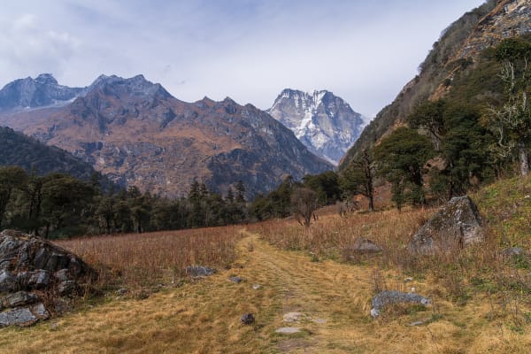
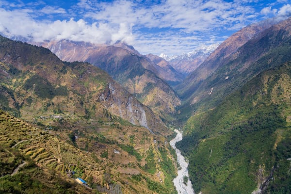
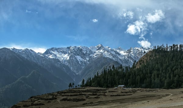
Poor, beautiful and almost entirely unvisited. Chhetri and Bhotiya villages, terraced farming, forest and steep valleys, with no trekking lodges, no menus in English and no other foreigners. The trails are used by the people who live on them and by nobody else.
The approach runs: a one-hour flight to Dhangadhi on the Indian border, a full day's drive north into the hills to Gokuleshwar, and four days of walking through Makarigad, Dhuli and the Upper Seti camp to base camp at 3,900 m.
Base camp is low — 3,900 m — because the approach valleys are deep and the mountain rises straight out of them. That means the route gains over three thousand metres to the summit, which is a large part of why the expedition is thirty-two days and why the rotation matters.

Evacuation, and Why We Cancel Readily
The evacuation situation is the most difficult of any expedition we run. A helicopter would come from Nepalgunj or Dhangadhi across a great deal of empty country, it is expensive, and it can only fly in clear weather. Below base camp, evacuation means being carried.
That shapes the whole trip. We run at most one departure a season and cancel readily — the far west has no infrastructure to fall back on, and running a marginal expedition there transfers the risk to our staff as much as to the climbers.
The summit success rate is low and impossible to quote precisely given how few attempts there are. Weather, the length of the summit ridge and the sheer vertical gain all contribute. Climbers book this for the place as much as the summit, which is the right reason.
What It Costs
| Group size | Price per person |
|---|---|
| 1 climber | USD 22,570 |
| 2 to 4 | USD 20,900 |
| 5 to 7 | USD 19,800 |
| 8 to 10 | USD 19,240 |
| 11 to 14 | USD 18,780 |
| 15 and over | USD 18,500 |
What Is Included
- Airport transfers, a briefing, permits, a Ministry briefing and cargo dispatch in Kathmandu.
- Kathmandu–Dhangadhi return flights and private transport to Gokuleshwar and back.
- Hotel accommodation in Kathmandu and Dhangadhi with breakfast, and village accommodation on the lower approach.
- Full camping support from Gokuleshwar onward, with base camp (3,900 m), Camp 1, Camp 2 and a high camp.
- A cook and kitchen crew, and all meals throughout the expedition.
- Api royalty permit and the Api Nampa Conservation Area permit, plus liaison arrangements.
- An expedition leader, climbing Sherpas and high-altitude staff.
- Progressive rope fixing of the entire route by our own Sherpa team.
- A puja, a technical assessment and training day, an acclimatisation carry and a full rotation, and reserve days.
- Emergency oxygen with masks and regulators, garbage deposit, summit certificate and all taxes.
What Is Not Included
- International flights and the Nepal entry visa fee.
- Expedition insurance valid to 7,200 m with helicopter evacuation and repatriation — and note that evacuation here is expensive, slow and weather-dependent.
- Personal climbing equipment, double boots and a bag rated to -30 °C.
- Personal porter services.
- Meals in Kathmandu and Dhangadhi beyond breakfast.
- Snacks, bottled water, hot showers, Wi-Fi, charging and drinks.
- Laundry, phone calls, souvenirs and personal expenses.
- Summit bonus and tips for the climbing Sherpas and high-altitude staff.
- Extra costs arising from a cancelled departure, flight delays at Dhangadhi, weather or an early descent.