Api (7,132 m) is the highest mountain in far-western Nepal, standing in Darchula district where the borders of Nepal, India and Tibet meet. It sits inside the Api Nampa Conservation Area, gazetted in 2010, and it receives a number of foreign trekkers each year that can be counted in dozens.
This is the most remote trek in this catalogue in terms of simple inaccessibility: a flight to Dhangadhi in the far-western Terai, a very long road journey north, and then a week of walking into a valley with no trekking infrastructure at all. What you get is a Himalayan base camp at around 4,100 m beneath an unclimbed-looking wall of ice, in country that feels entirely outside the Nepali tourist economy.
The Trek at a Glance
| Duration | 15 days from Kathmandu |
| Highest point | Api Base Camp area, about 4,100 m |
| The mountain | Api, 7,132 m — highest in far-western Nepal |
| Difficulty | Challenging — very long approach, no infrastructure, camping |
| Access | Flight to Dhangadhi, then a long road journey to Darchula |
| Permits | Api Nampa Conservation Area entry and trekking registration |
| Best seasons | April to June, September to October |
| Accommodation | Homestays low down, camping above |
We run it as a 15-day Api Himal Base Camp trek, and the mountain itself as a 32-day expedition for climbing teams.
The Route
Getting there
A flight to Dhangadhi in the far-western Terai, then a long road journey north through Dadeldhura and Baitadi to Darchula on the Mahakali river, which forms the border with India. The drive is the single biggest commitment on this trek — a full day and a half on mountain roads — and it is worth understanding before booking.
Up the Chamaliya to Ghusa
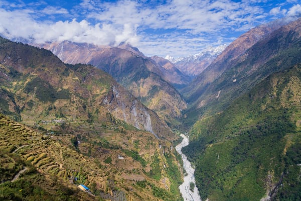
From the roadhead near Khalanga, the trail follows the Chamaliya valley north through villages of slate-roofed houses — Makarighat, Seti, Dhaulakot, Ghusa — in farming country that grows barley, buckwheat, apples and walnuts. The culture here is Khas and Hindu rather than Tibetan-Buddhist, which makes it quite unlike the rest of the high Himalaya in Nepal.
Into the Api Nampa Conservation Area
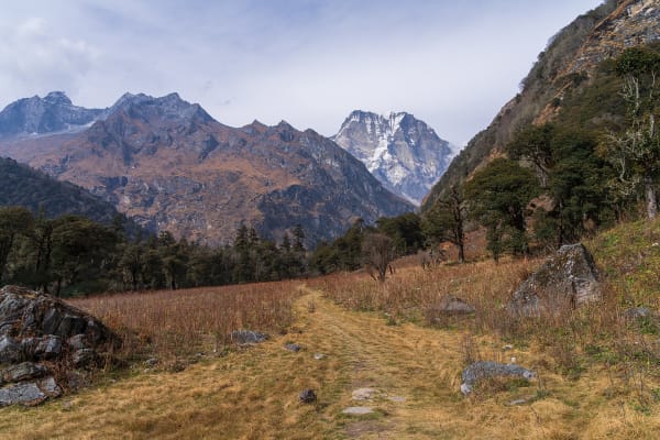
Above Ghusa the valley narrows into forest — fir, birch, rhododendron — and then opens into high pasture used by summer herders. Kalidhunga and the Nampa Valley give the first full views of Api and Nampa (6,755 m), and the approach to base camp crosses glacial moraine.
Api Base Camp
The base camp area at around 4,100 m sits beneath Api's south face, a complex wall of ice and rock with Nampa alongside. The peak was first climbed in 1960 by a Japanese team and has seen very few ascents since. There is nothing here but moraine, a glacial stream, and the mountain.
Out
Back down the same valley. There is no loop and no alternative exit, which is a characteristic of far-western trekking generally.
What Makes It Different
- No tourist economy. There are no lodges built for trekkers, no menus in English, and no gear shops. You are travelling with a crew and staying in homestays and tents.
- Khas Hindu culture. Unlike every other high trek in this catalogue, the villages here are Hindu Khas rather than Tibetan-Buddhist — different architecture, different food, different festivals. Jumla and Darchula are the heartland of the old Khas kingdom and the origin of the Nepali language.
- Genuine remoteness. A day and a half of road from the nearest airport, then a week on foot. Evacuation is difficult and weather-dependent.
- Wildlife. The Api Nampa Conservation Area protects snow leopard, Himalayan black bear, musk deer and the Himalayan griffon, with very low human pressure.
- Very few foreigners. In many of these villages you will be the first foreign trekker of the season, and possibly of the year.
That last point cuts both ways. The welcome is extraordinary, and it also means behaving with particular care: ask before photographing, do not hand out money or sweets, and accept that facilities are what the village has rather than what a trekker expects.
Practicalities
- Season: April to June and September to October. The far west gets less monsoon than central Nepal but the approach roads are still vulnerable to landslides in July and August, and winter closes the high pasture.
- Accommodation: homestays in the lower villages, camping above Ghusa. Our crew carries tents, food and fuel.
- Permits: Api Nampa Conservation Area entry and trekking registration. No restricted permit, which keeps the cost down relative to Dolpo or Humla.
- Altitude: 4,100 m maximum with a gradual approach, so risk is low.
- Cold: nights at base camp to -10 °C. A -20 °C bag for comfort.
- Insurance: to 5,000 m with helicopter evacuation and a search-and-rescue clause. Read the wording.
- Time: build in two spare days for the Dhangadhi flight and the road.
Other Far-Western Treks
| Trek | Days | Highest point | The draw |
|---|---|---|---|
| Api Himal Base Camp | 15 | About 4,100 m | A 7,132 m peak from close range in Nepal's remotest district |
| Rara Lake | 11 | About 3,450 m | Nepal's largest lake, monsoon-viable, superb birdlife |
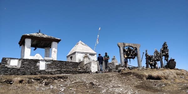
| Badimalika | 13 | 4,214 m | A major Hindu pilgrimage temple on an open ridge, thronged each August |
| Ramaroshan Lakes | 11 | About 3,200 m | Twelve lakes and eighteen meadows in Achham, almost unknown |
| Khaptad plateau (on request) | — | — | A rolling grassland plateau with a hermitage, unlike anywhere else in Nepal |
The far west is where Nepali trekking is heading next, and at present it is the closest thing to walking in the Himalaya before trekking existed. Our off-the-beaten-path guide compares the quietest routes across the whole country.